A series of cold fronts are setting their sights on southern WA in the next 10 days, bringing fierce winds, showers, thunderstorms and cooler temperatures.
The stubborn high-pressure system that has sat over the Bight for weeks, preventing cold fronts from making it to WA, will finally move east this week. This will cause an increase in frontal activity, with 5 fronts or troughs expected to march across the state between Friday, May 24 and Sunday, June 2 and more in the following week.
The video below shows the series of cold fronts and the rain forecast in the next 10 days.
Video: Forecast wind and precipitation from Friday, May 24 to 8pm AWST on Sunday, June 2, according to Access-G
The video above shows several rain-bearing systems moving over southwestern WA during this period, meanwhile a tropical depression could bring rainfall to the Pilbara region.
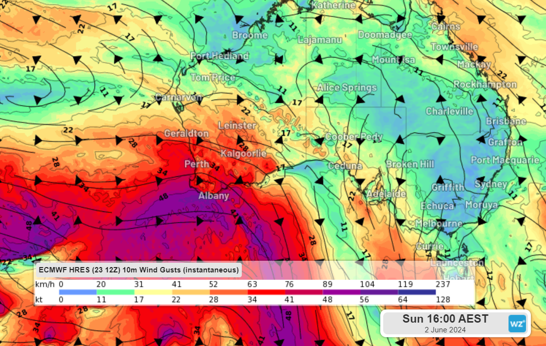
A fortnight of high wind power
The succession of cold fronts will also bring a few weeks of elevated wind power, especially for the wind farms located in the southwest. The cold front forecast next Saturday, June 1 looks very strong and has the potential of bringing damaging winds to southern parts of the state, with the potential for wind farm cut outs.
Temperatures
As of 9am Friday, Perth has broken the May record with 17 days above 24C, beating the previous record of 16 days set in May 2018. Friday and Saturday’s maximum is forecast to reach 25 to 26C meaning this streak is likely to reach 19 days above 24C.
The late autumn warmth is set to end early next week, with temperatures set to drop below 20C for at least one day mid next week. This will be the first time the mercury has dropped below 20C in seven months.
The map below shows forecast air temperatures around 1.5km above sea level on Wednesday morning moving over southern WA.
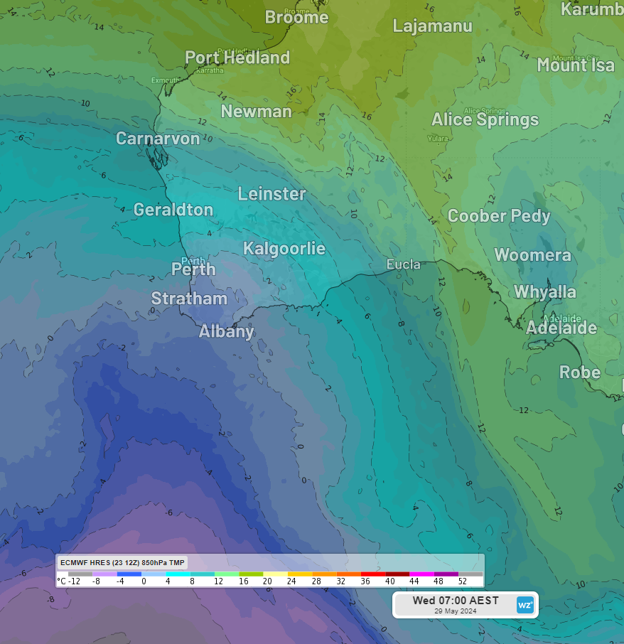
Image: 850hpa temperature at 5am AWST on Wednesday, May 29.
Temperatures are set to warm up again by the end of the working week before another strong cold front and associated cool air arrives on the weekend. This cold front has the potential to bring severe weather to the state, so keep an eye out for the latest warnings here.
Weatherzone Business has grown to become the outright leader within the Australian energy market, serving wind, solar, hydro, trading, utilities and network companies.
You can’t control the weather, but you can gain precision insights to optimise your response. What lights us up is providing your energy business with tailored weather information to reduce your risk and keep you moving ahead of the curve.
Our services cover all aspects – from wind and solar generation to demand forecasts, wholesale markets to retail so, no matter where your company sits, we have solutions for you. We have worked closely with market participants to create products that meet the evolving needs of the sector, aiming to increase safety and profitability for our customers.
Benefit from the timely delivery of accurate weather information, allowing informed and effective decision-making. For more information, please contact us at apac.sales@dtn.com.


