The NSW coast can expect another week of rain as eastern Australia remains stuck in a stagnant pattern of wet and stormy weather.
A stubborn high pressure system centred to the south of Australia has been driving moisture-laden winds into eastern Australia over the past week. This wet weather pattern is expected to linger for at least another week, causing rain and thunderstorms to continue over already sodden parts of NSW.
The map below shows how much rain fell over NSW during the seven days ending at 9am on Sunday, May 5.

Image: Observed accumulated rain during the 7 days ending at 9am on May 5. Source, Bureau of Meteorology
In addition to the rain shown above, heavy falls continued in parts of central eastern NSW on Sunday into Monday morning, with some places picking up more than 160 mm in 24 hours.
This latest deluge has caused minor flooding to develop at Tuggerah Lake around Long Jetty. Some of the standout totals during the 24 hours to 9am on Monday included:
- 165 mm at Hamlyn Terrace
- 140 mm at Mardie Dam
- 130 mm at Erina Heights
- 80 mm at Belrose
- 67 mm at Ulladulla
Sydney has already registered 124 mm of rain in the opening 6 days of May, which is more than the city’s long-term May average of 117 mm.
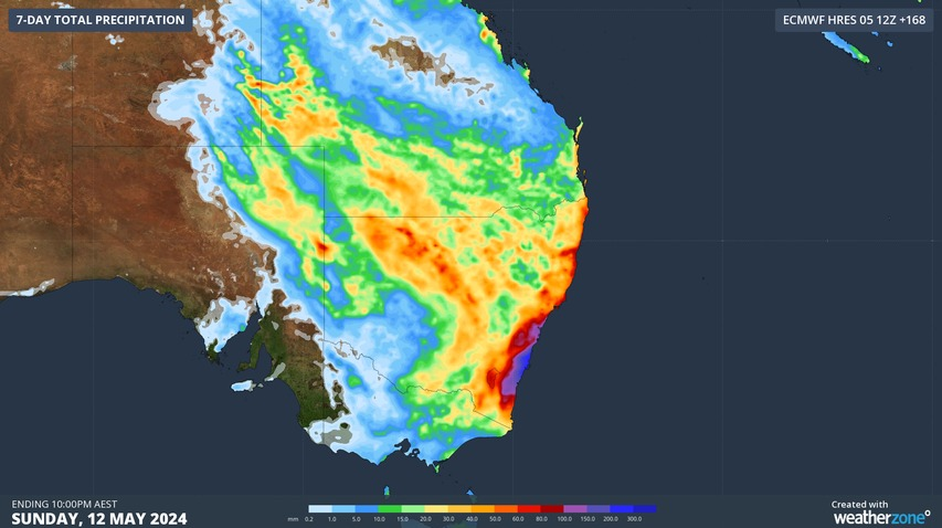
Looking ahead, persistent onshore winds will continue to produce showers along the NSW coast every day this week. Rain and thunderstorms will also become heavier and more widespread over eastern Australia in the second half of the week under the influence an upper-level low. The maps below show how much rain one computer model is predicting on each day this week.
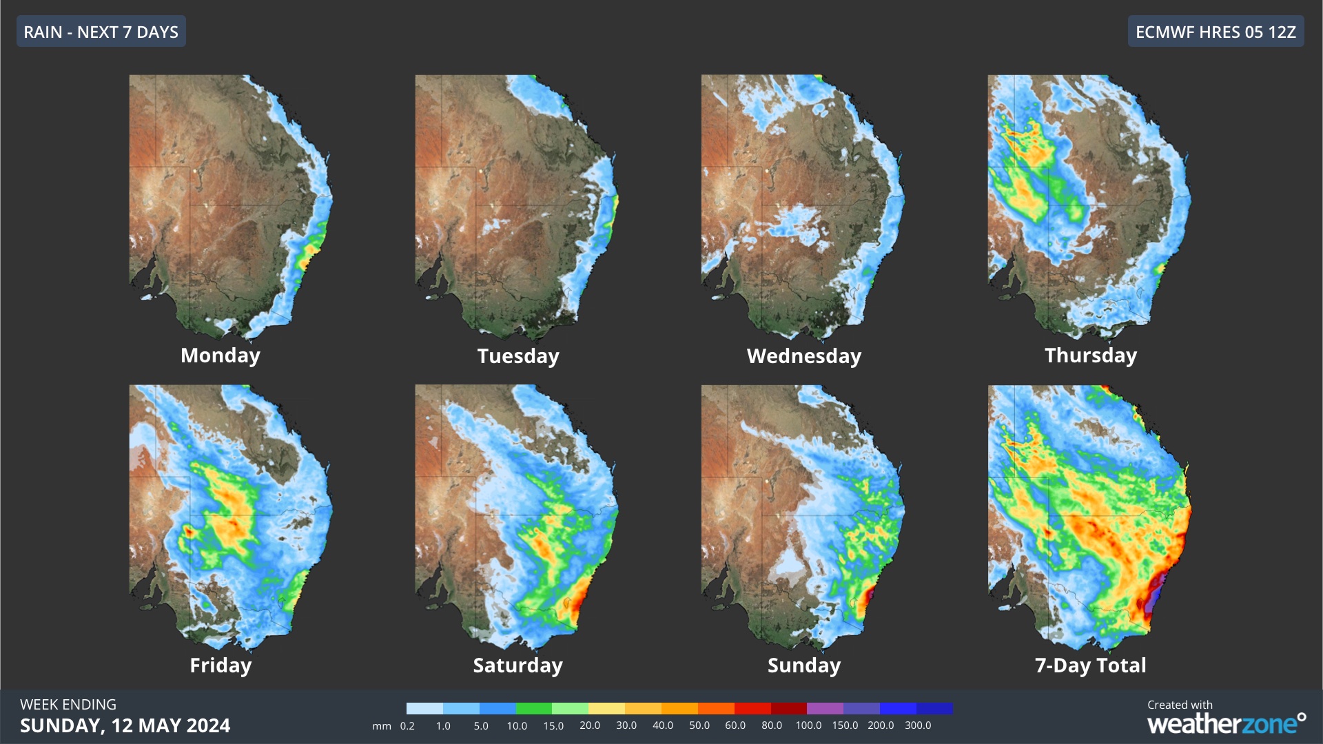
Image: Forecast accumulated rainfall over the next seven days, according to the ECMWF-HRES model.
The impending rain will be falling onto already saturated ground in some areas, which increases the likelihood of flooding in parts of NSW and southern Qld. Stay up to date with the latest forecasts and warnings for the most accurate information over the coming week.
Rail and transport networks are exposed to severe weather risk, every day. Our services significantly improve efficiency, safety, and planning. DTN APAC, a DTN company, specialises in building customised weather monitoring and alerting solutions. These guide transport operators to plan and respond effectively. We tailor our data and
analytics to your exact requirements. For more information, please contact us at apac.sales@dtn.com.


