Prosper in a dynamic world
Search

Nine metre waves and 100 km/h winds hit NSW

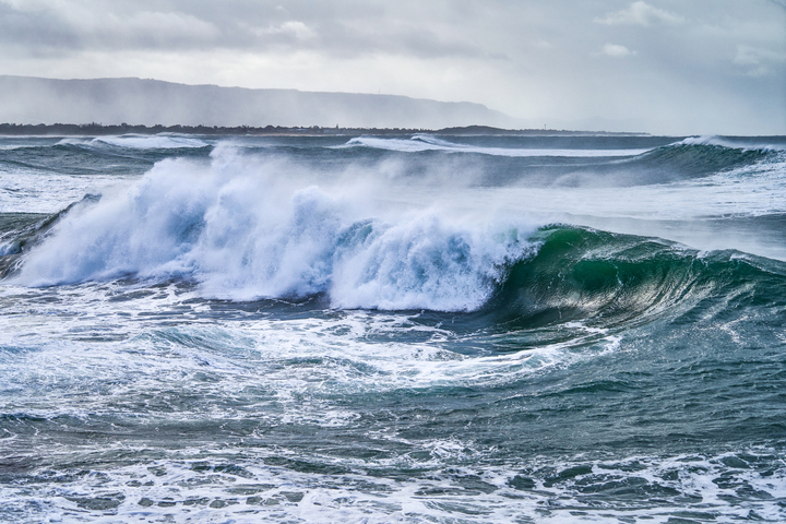
A powerful burst of southerly winds is causing massive waves to batter NSW beaches today, with warnings in place for damaging surf in some areas.

A deepening low pressure system over the Tasman Sea caused a blustery southerly change to move up the NSW coast on Tuesday. These cool southerly winds have strengthened further on Wednesday morning, causing damaging gusts and huge waves on the NSW coast, as we warned you about yesterday.

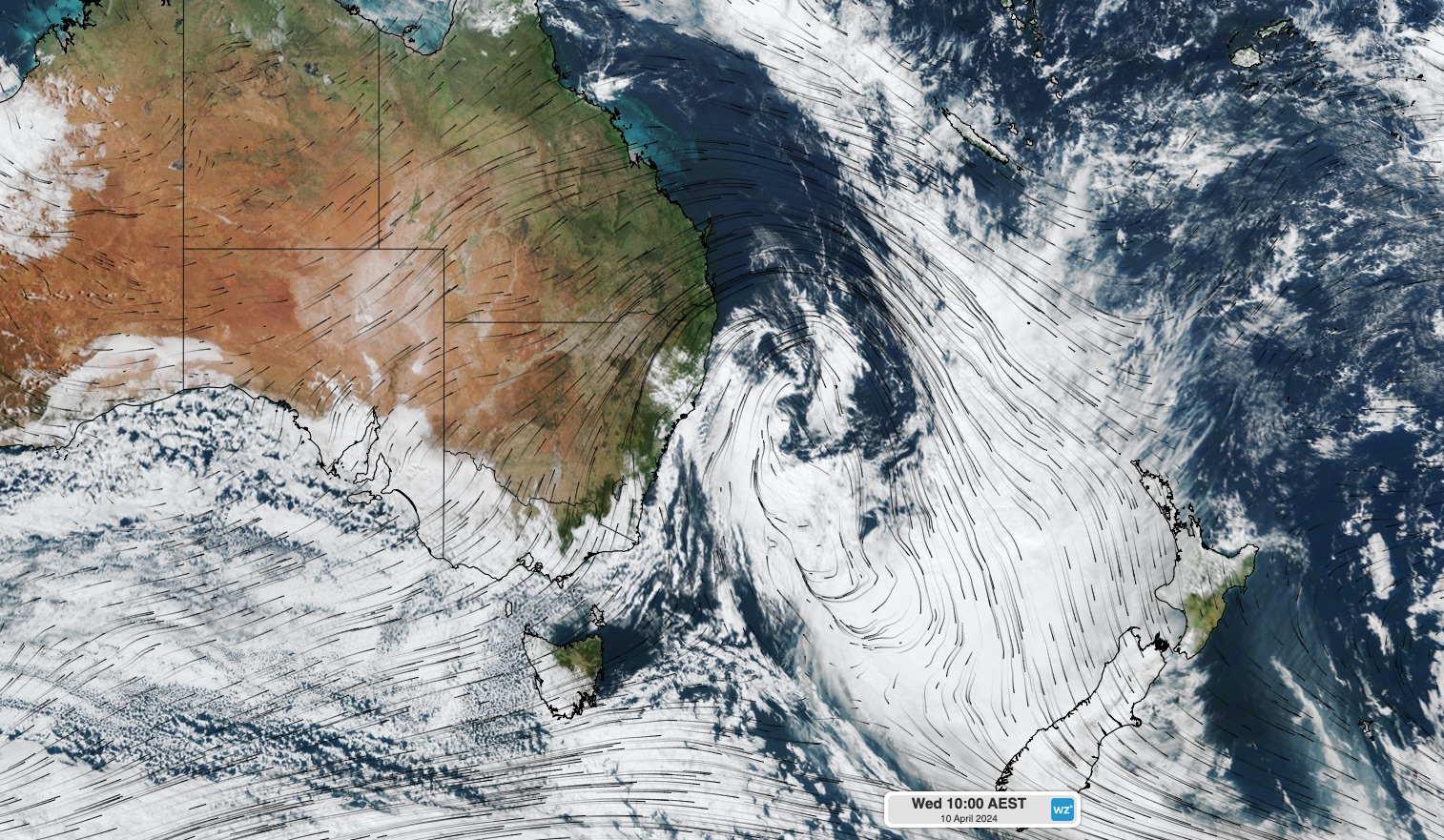
Image: Composite satellite and modelled wind at 10am AEST on Wednesday.

A wave rider buoy located off the coast of Sydney’s Northern Beaches recorded maximum wave height of around nine metres on Wednesday morning. This is the second time in five days waves have reached this high near Sydney, following a similar surge of swell on the weekend.

Image: Wave height observations off the coast of Sydney’s Northern Beaches over the last few days. Source: Manly Hydraulics

On land, wind gusts reached 102 km/h at Wattamolla and 78 km/h on Sydney Harbour in the early hours of Wednesday morning.

Blustery winds and large waves will continue to affect some central and northern parts of the NSW coast on Wednesday, although wind will gradually ease into the afternoon and evening.

As of 11am AEST, a severe weather warning was in place for damaging surf along the coast between Seal Rocks and Broken Bay.

DTN APAC offers a comprehensive suite of services, refined through years of collaboration with the marine, ports and offshore industries, to optimise the safety and efficiency of your operations.

We work with you to understand your intrinsic operational challenges and customise high-precision forecasting, metocean and aviation services to your exact location and operational scope. For more information, please contact us at apac.sales@dtn.com.

Latest news

Satisfy your weather obsession with these news headlines from around the nation, and the world.

Possible negative IOD developing this winter

Warm sea surface temperatures near Indonesia are expected to heat up further over winter, possibly triggering a negative Indian Ocean Dipole (IOD) event. What is the Indian Ocean Dipole (IOD)? The IOD is an index that measures the difference in sea surface temperatures across the equatorial Indian Ocean. A negative IOD occurs when cooler-than-average water […]

Hydropower season wimpers to a start

Snow has fallen across Australia’s alpine region, and while it’s only a moderate amount, it’s a start for the peak hydropower season. Australia’s largest resort Perisher was claiming 15cm of settled snow on its snow stake, with slightly lower totals reported at other resorts, after a polar airmass briefly whipped through southeastern Australia on Tuesday […]

Record May rain soaks NT and WA transport and mining – Queensland next in line

Unseasonably heavy rain has drenched parts of northern WA and the NT, with Queensland next in line for soaking rain in the next few days. A deep stream of tropical moisture originating over the Indian Ocean is fuelling a massive northwest cloud band across Australia this week. This thick cloud band has been producing exceptionally […]

Back-to-back large south swells to smash NSW ports

A powerful Tasman low and vigorous cold front are generating two strong south swells that will bring large waves to coastal NSW in the coming days. The satellite loop below shows a deep Tasman low spinning halfway between NSW and New Zealand. The satellite imagery also shows a powerful cold front crossing well to the […]