Ex-Tropical Cyclone Olga is edging ever so slightly closer to the Pilbara on Wednesday, bringing damaging winds and rain to the far western Pilbara and its islands.
Ex-Tropical Cyclone Olga is currently about 200kmh northwest of Karratha on Wednesday morning, with the satellite image below showing thick cloud and lightning offshore.
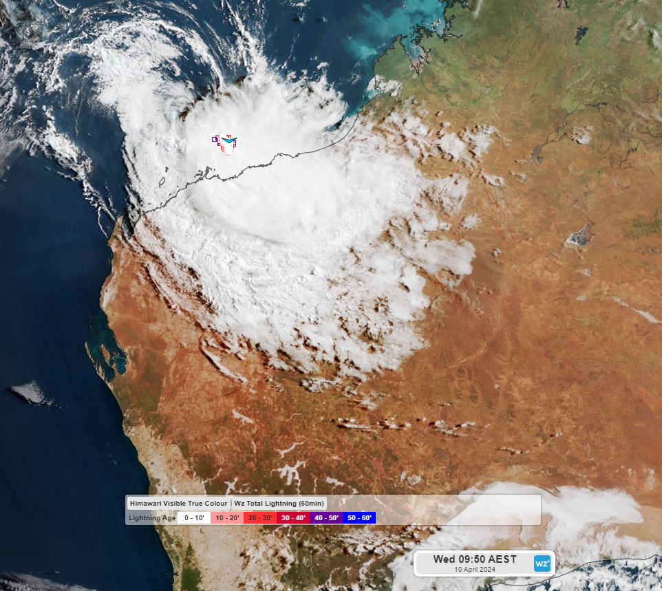
Image: Himawari- 9 satellite image at 7:50am AWST on Wednesday, April 10.
The Islands off the Burrup Peninsula have seen gale force winds early Wednesday morning, with Varanus Island recording sustained winds of 72km/h and an 87km/h wind gust at 2am. Legendre Island’s sustained winds reached 83km/h at around 5:30am, with gusts reaching 102km/h.
The Bureau’s track map below shows ex-Tropical Cyclone Olga moving to the southwest and coming close to the Peninsula in the next 48 hours, but not crossing it.
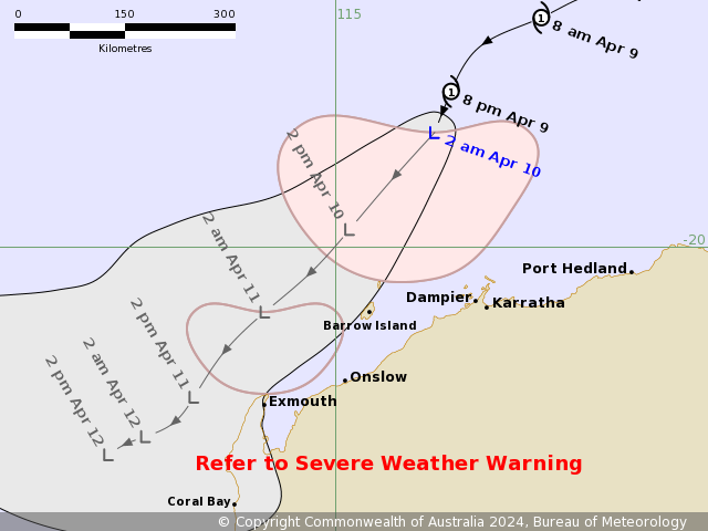
Image: Ex- Tropical Cyclone Olga track map issued at 2:39am AWST on Wednesday, April 10.
While ex-Tropical Cyclone Olga will continue to weaken and is unlikely to directly hit the Pilbara coast, damaging winds could continue over the Burrup Peninsula and adjacent Islands, extending to Dampier and Karratha during Wednesday morning.
Damaging winds averaging 60 to 70km/h, with gusts peaking at around 100km/h are possible in this region in the morning before easing below damaging strength in the afternoon.
The map below shows one model forecast wind gusts early and late Wednesday morning, with the strongest winds over the ocean and over the islands.
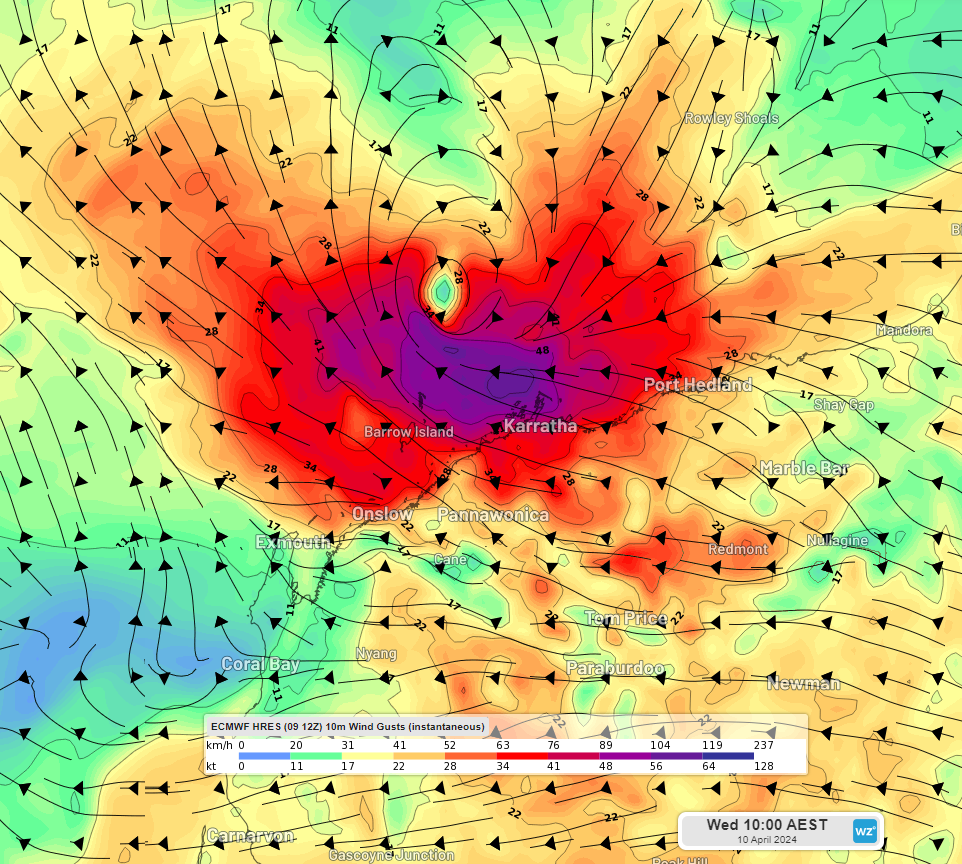
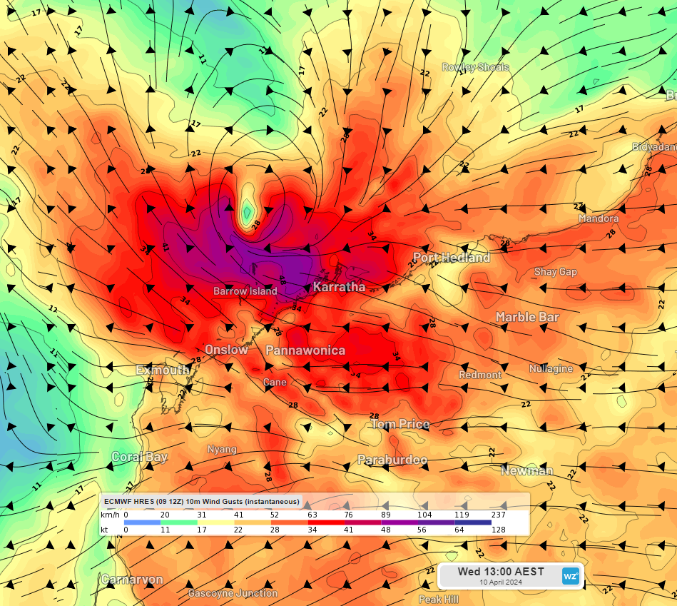
Image: Instantaneous wind gusts at 8am (top) and 11am (bottom) AWST on Wednesday, April 10, according to the ECMWF model
Thick cloud and rain is streaming into the region on Wednesday morning and will continue in the next 48 hours.
Heavy rainfall is possible along the coastal fringe but is dependent on the movement of remnants of Olga.
The map below shows the accumulated rainfall forecast by two different computer models to late Friday, April 12.
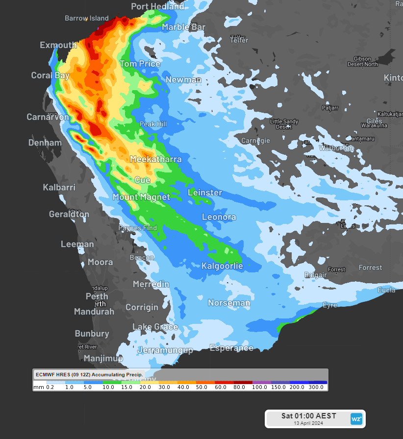
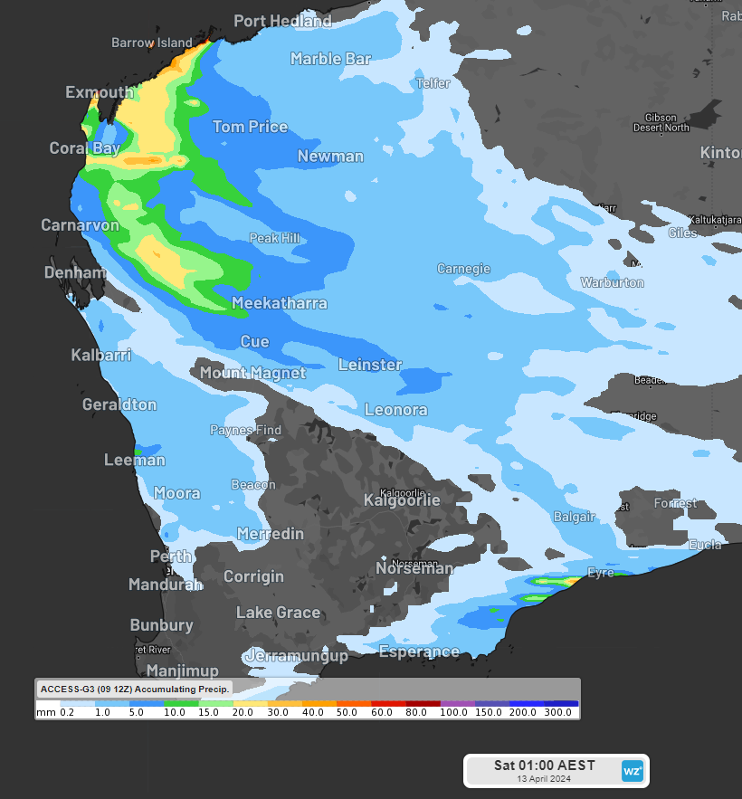
Image: Accumulated rainfall forecast to 11am AWST on Friday, April 12, according to ECMWF (top) and Access-G (bottom).
You can see in the graphics above that there is still some uncertainty with regards to how much rain will fall in the Pilbara and Gascoyne districts in the coming days, due to the two different models’ positions of ex- Tropical Cyclone Olga. Thunderstorms near the coast may further increase wind gusts and bring heavy rainfall in the next few days.
The rainfall will then extend towards Esperance later in the week, missing the dry southwest, including Perth. We will be watching ex-Tropical Cyclone Olga’s track closely in the coming days, and you can keep an eye out for the latest warnings here.
Miningzone is the proven and trusted turnkey solution –deployed at over 400 mines globally – offering you tailored forecasting and alerting systems to protect your valuable staff and assets.
Weatherzone’s integrated services are intuitive and user-friendly, providing you with the specific weather and blast data needed to gain a complete environmental picture.
You will have access to our lightning and severe weather tracking and alerts, EPA-approved blast dispersion modelling, thunderstorm tracking and high precision and site-specific forecasting, along with comprehensive reporting capacity.
Precise, market-leading data is delivered via multiple platforms including Weatherguard – our easy-to-use app – and can be fully integrated into your operational control or SCADA systems. For more information, please contact us at apac.sales@dtn.com.


