Damaging winds are forecast to impact the central NSW coastline in the next 24 hours, impacting port operations across the state.
A strong southerly change is expected to arrive in Sydney around 11:30am-1:30pm local time, with sustained winds exceeding 46 km/h (25 knots) during and after the change.
The video below shows the forecast southerly change moving its way up the NSW coastline, with the winds intensifying in the early hours of Wednesday morning.
Image:10m wind forecast for Tuesday and Wednesday, according to Access-C
Damaging southerly winds will develop in the early hours of Wednesday morning across the Sydney, Hunter and Mid North coastal fringes, as a low-pressure system deepens off the NSW coast.
Average or sustained wind speeds will peak at around 45-50km/h (25 knots) gusting up to 100km/h (54 knots) in the early hours of Wednesday morning before easing below 37km/h (20 knots) later Wednesday afternoon.
This wind will be coupled with large waves on Wednesday and Thursday, adding to the complex weather the NSW ports will endure in the next 48 hours.
So how will this weather impact port operations?
High winds are one of the highest impact weather elements on port operations. Unloading all the containers from a ship can take up to 3 days, especially when the ports are unloading bulk carriers and container ships with up to 10,000 containers.
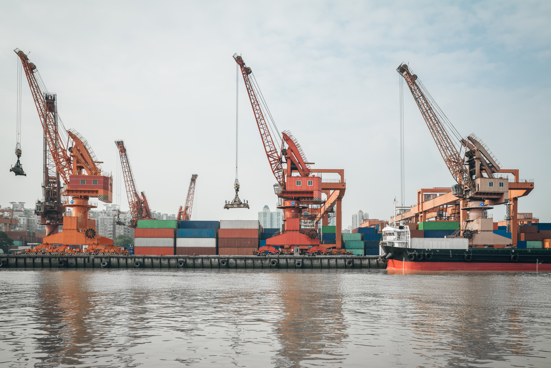
The cranes that lift the containers off the ship and stack them can be over 73 metres high, with a boom that reaches 105 metres in the air at full height. Winds speeds are stronger the higher you are above the surface.
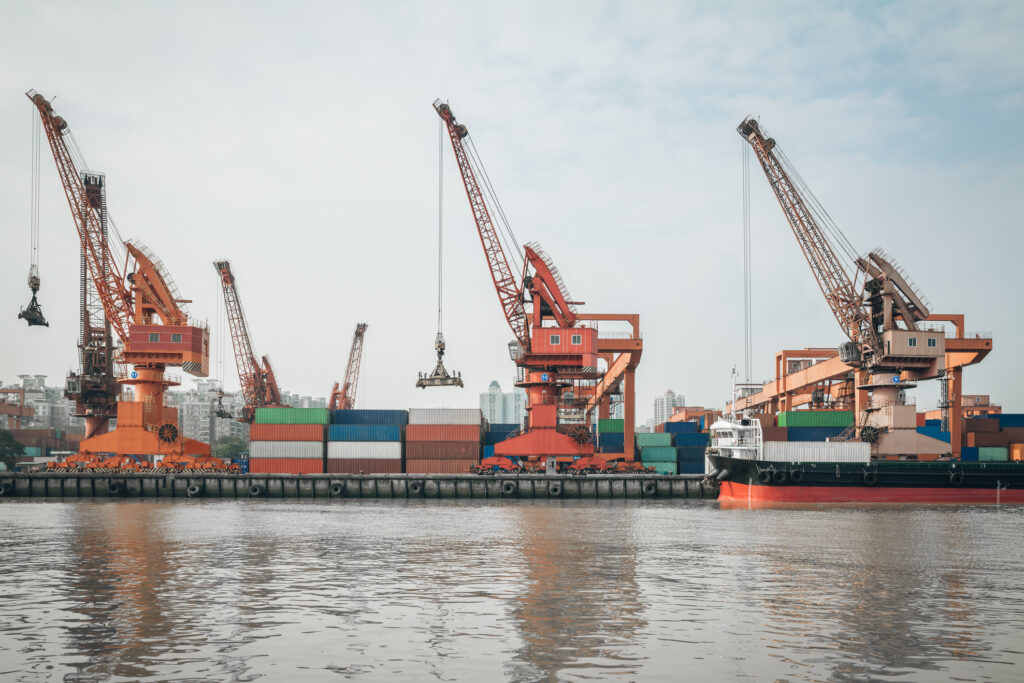
Image: Cranes taking off containers from a carrier docked at a port
The strong winds forecast in the next 24-36 hours could mean that crane operations need to be suspended. During periods of extreme winds, the crane often needs to be taken down and there is also a chance that the ship could move off the platform.
The waves and volatile waters forecast could also make the process of navigating a ship through a small port challenging. However, the ships and the cargo are in good hands with a trained pilot jumping onboard outside the port or harbour maneuvering the vessel through the challenging waters.
The pilot’s job is to jump onboard the large vessel from a much smaller ship via a ladder on the vessel which can be very dangerous during periods of large swell.
There is also a chance of thunderstorms and lightning today as the change moves up the coast which is hazardous for port staff and crane operators that are out in the elements. If lightning is within 20km of the port, the managers will plan for this lightning. The showers forecast could also be gusty this afternoon which can slow efficiency due to the unpredictable wind and reduced visibility.
How can Weatherzone help?
DTN APAC offers a comprehensive suite of services, refined through years of collaboration with the marine, ports and offshore industries, to optimise the safety and efficiency of your operations.
We work with you to understand your intrinsic operational challenges and customise high-precision forecasting, metocean and aviation services to your exact location and operational scope.
When working offshore, our solutions can underpin planning and safe execution for offshore oil and gas enterprises and wind farms. Our data can support your exploration, development, rig moving, shuttle tanker operations, and production and decommissioning phases. Whether your crews are on-site, being transported to shore, or diving to perform maintenance, we deliver tailored weather risk briefings to ensure you choose the optimal time to proceed.
Weatherzone’s trusted nowcasting and forecasting system, OpticastTM, allows you to rapidly respond to changing conditions offshore, en route and in port. We take your port topography and berth orientation into account, ensuring site-specific forecasts. For offshore oil & gas, wind farms, ports and logistics, we have your weather situational awareness covered, no matter where you are. We deliver real-time severe weather and lightning alerts to your team via your integrated dashboard: Portzone, and our Weatherguard app.
Weatherzone’s Total Lightning Network (TLN) ensures you avoid hours of unnecessary downtime by providing the most accurate technology in lightning detection and alerting. Safeguard your teams and assets with lighting and Dangerous Thunderstorm Alerts (DTAs), customised to your existing parameters and delivered in real-time across all devices in your network. You gain full spatial awareness of developing severe weather systems, allowing you to plan ahead and, where needed, execute your shutdown and evacuation procedures.
With extreme conditions slowing production and affecting infrastructure, safety and transport, trust us to deliver Australia’s most precise weather data and tailored insight, giving you decisive confidence when it’s most needed. For more information, please contact us at apac.sales@dtn.com.


