
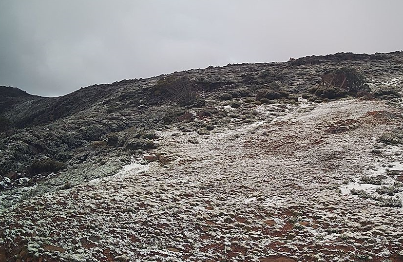
The first significant snowfall of autumn 2024 has fallen across higher elevations of Tasmania as a cold front whipped through southeastern Australia overnight, while tropical lows continue to dominate the pattern in northern Australia.
This was the Wednesday morning scene at Mt Mawson, a tiny club-operated ski field about two hours northwest of Hobart.
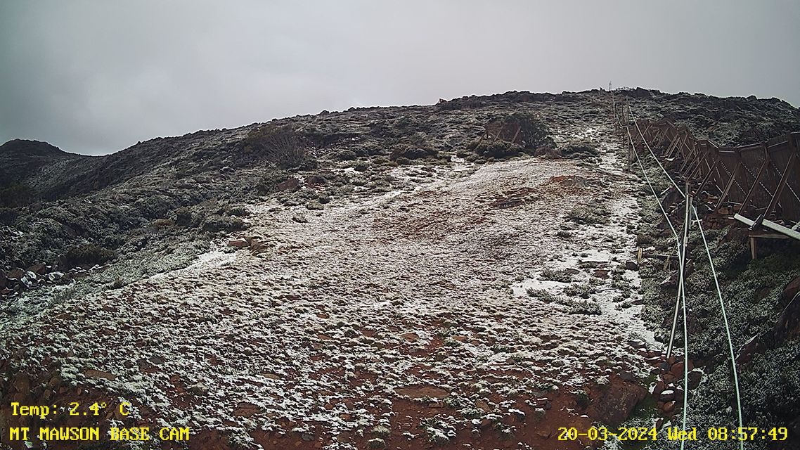
Image: Just a dusting. Source: Mt Mawson.
Interestingly, the snow was heavier in the state’s northwest at Ben Lomond, Tasmania’s only commercial ski resort, about an hour east of Launceston.
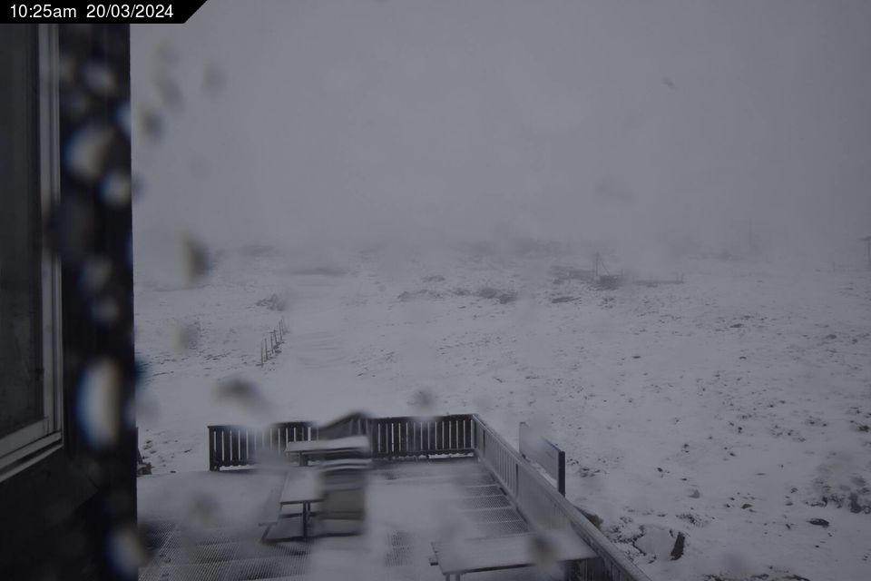
Image: The snow cam image is a bit blurry and foggy, but locals are reporting a good 5 cm with snow still falling on Wednesday morning. Source: ski.com.au.
You can see the heavy band of rain and snow showers that passed through northwestern Tasmania in the loop below. The loop covers the three hours from 3 am up to 6 am as temperatures started to drop and became cold enough for snow to settle.
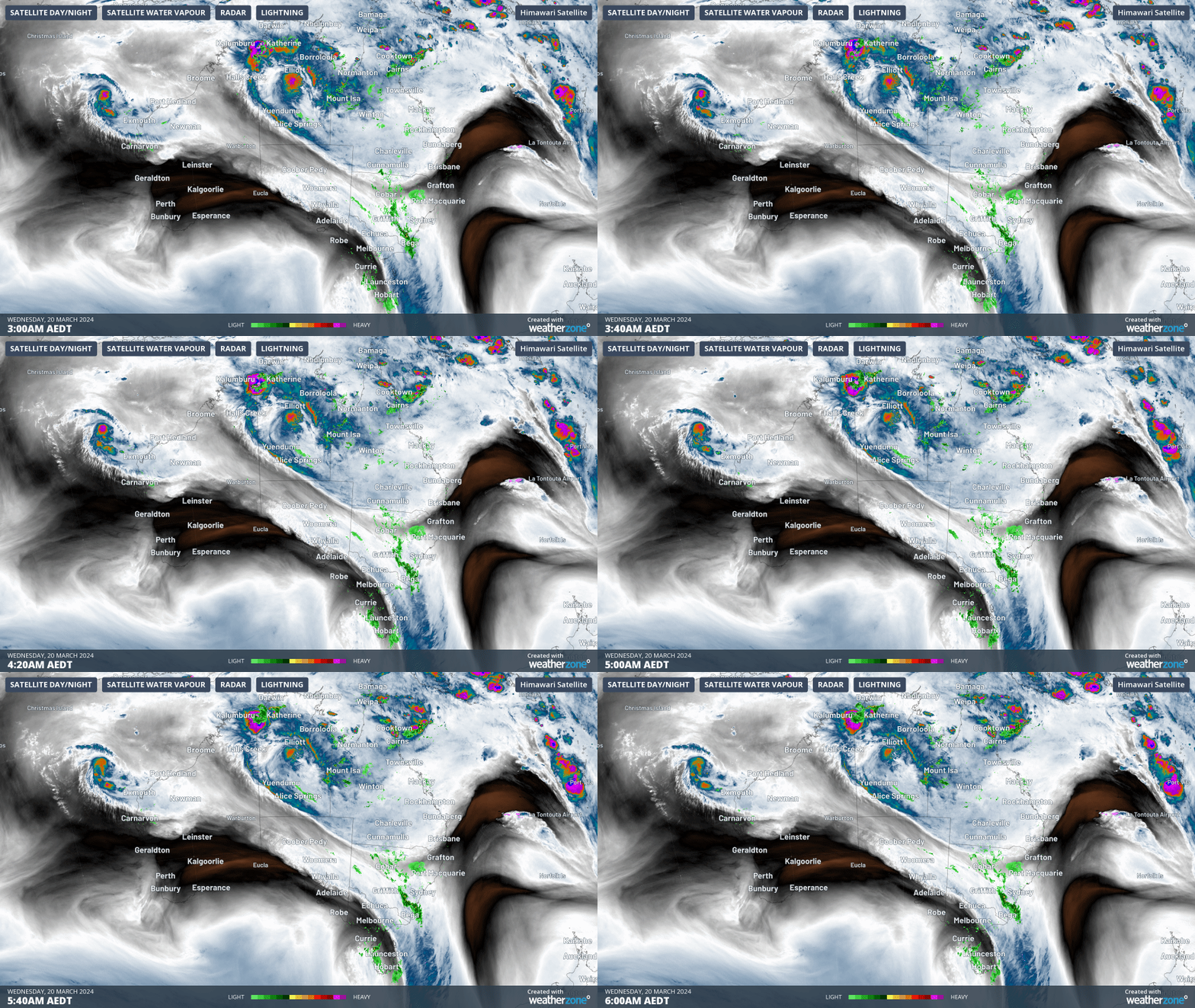
The loop also shows the remnants of ex-Tropical Cyclone Megan which is expected to continue delivering showers and potentially flooding rain through parts of the inland Northern Territory as it tracks southwards before dissipating.
Also visible is the low off the northwest Western Australian coastline, which is expected to become Tropical Cyclone Neville by Thursday morning. We’ll keep you posted on that one.
The broad-scale picture adds up to a classic autumn mix for Australia, with weather associated with summer up north and weather associated with winter down south. That seems pretty appropriate as the autumn equinox falls today, March 20.
For those interested in the capital city weather, the cold front has already moved through Adelaide, Melbourne, and Hobart, dropping temps significantly in those cities and most places in between. Sydney will cop a cold blast later on Wednesday afternoon, as detailed in this story, while Canberra can expect almost a week of nights with single-digit minimums in the cool, dry air in the wake of the front.
Weatherzone Business has grown to become the outright leader within the Australian energy market, serving wind, solar, hydro, trading, utilities and network companies.
You can’t control the weather, but you can gain precision insights to optimise your response. What lights us up is providing your energy business with tailored weather information to reduce your risk and keep you moving ahead of the curve.
Our services cover all aspects – from wind and solar generation to demand forecasts, wholesale markets to retail so, no matter where your company sits, we have solutions for you. We have worked closely with market participants to create products that meet the evolving needs of the sector, aiming to increase safety and profitability for our customers.
Benefit from the timely delivery of accurate weather information, allowing informed and effective decision-making. For more information, please contact us at apac.sales@dtn.com.




