
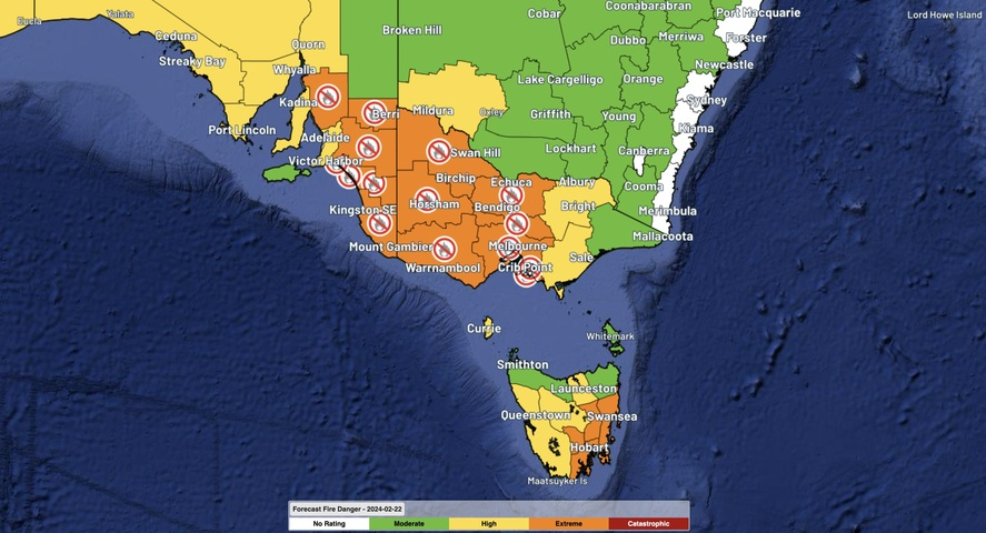
A burst of very hot, dry and windy weather will cause extreme fire danger across parts of Vic, SA and Tas today, with temperatures predicted to reach the mid to high 30s in Melbourne and Hobart.
A surge of northwesterly winds ahead of an approaching cold front will drive hot and dry air into southeastern Australia on Thursday. This is a typical summertime weather pattern that is notorious for creating dangerous fire weather.
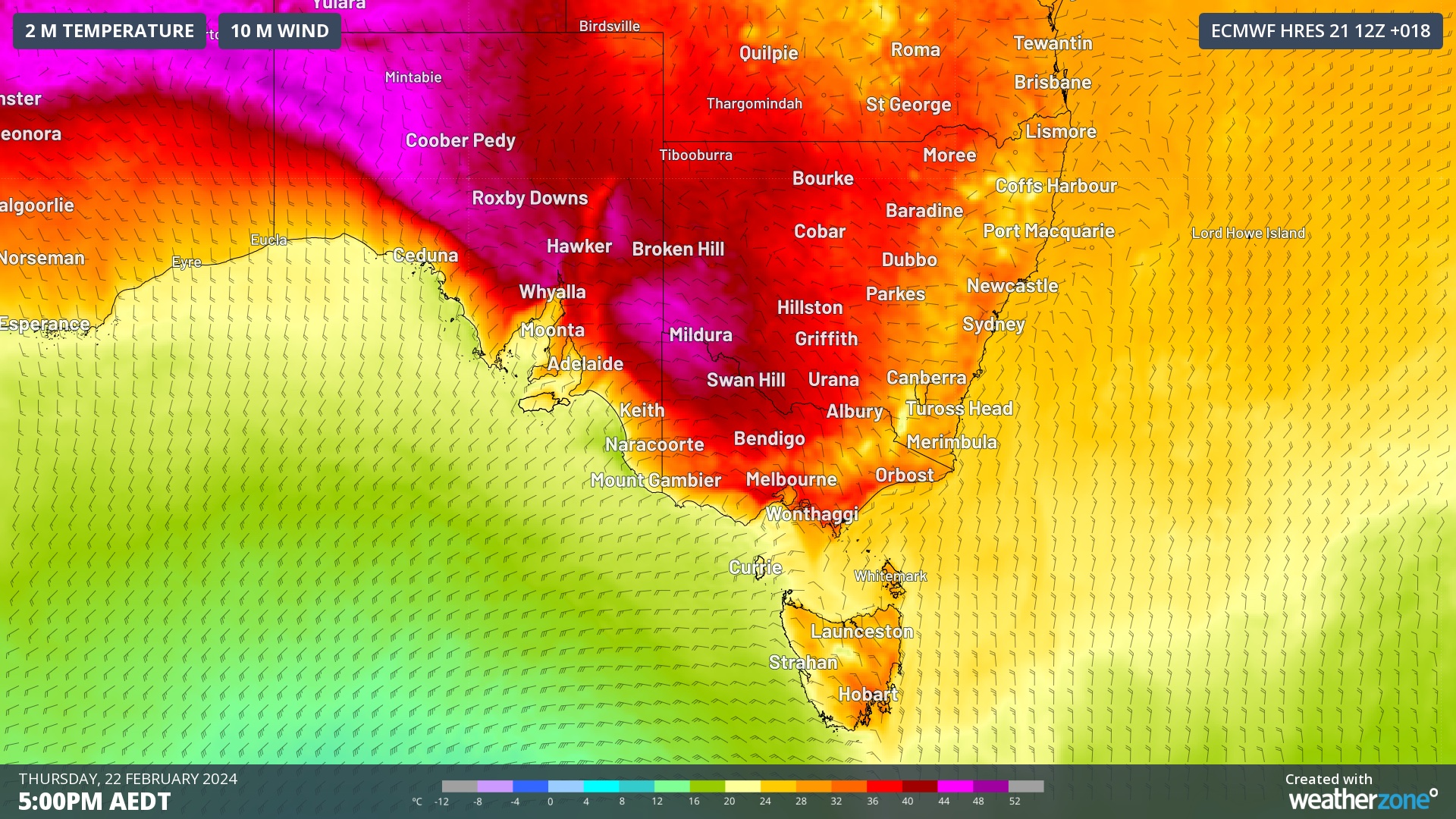
Image: Forecast temperature and wind at 5pm AEDT on Thursday, according to the ECMWF-HRES model.
The heat being drawn into SA, Vic and Tas on Thursday should allow temperatures to reach around 38ºC in Melbourne, 36ºC in Hobart and 33ºC in Adelaide. Even more intense heat will be felt in the Vic-NSW-SA border region, with temperatures forecast to reach 42 to 44ºC at Renmark, Mildura and Menindee.
The combination of heat, blustery winds and dry air will cause high to extreme fire danger over a broad area stretching from SA across most of Vic and Tas. This includes extreme fire danger in the Melbourne and Hobart regions.
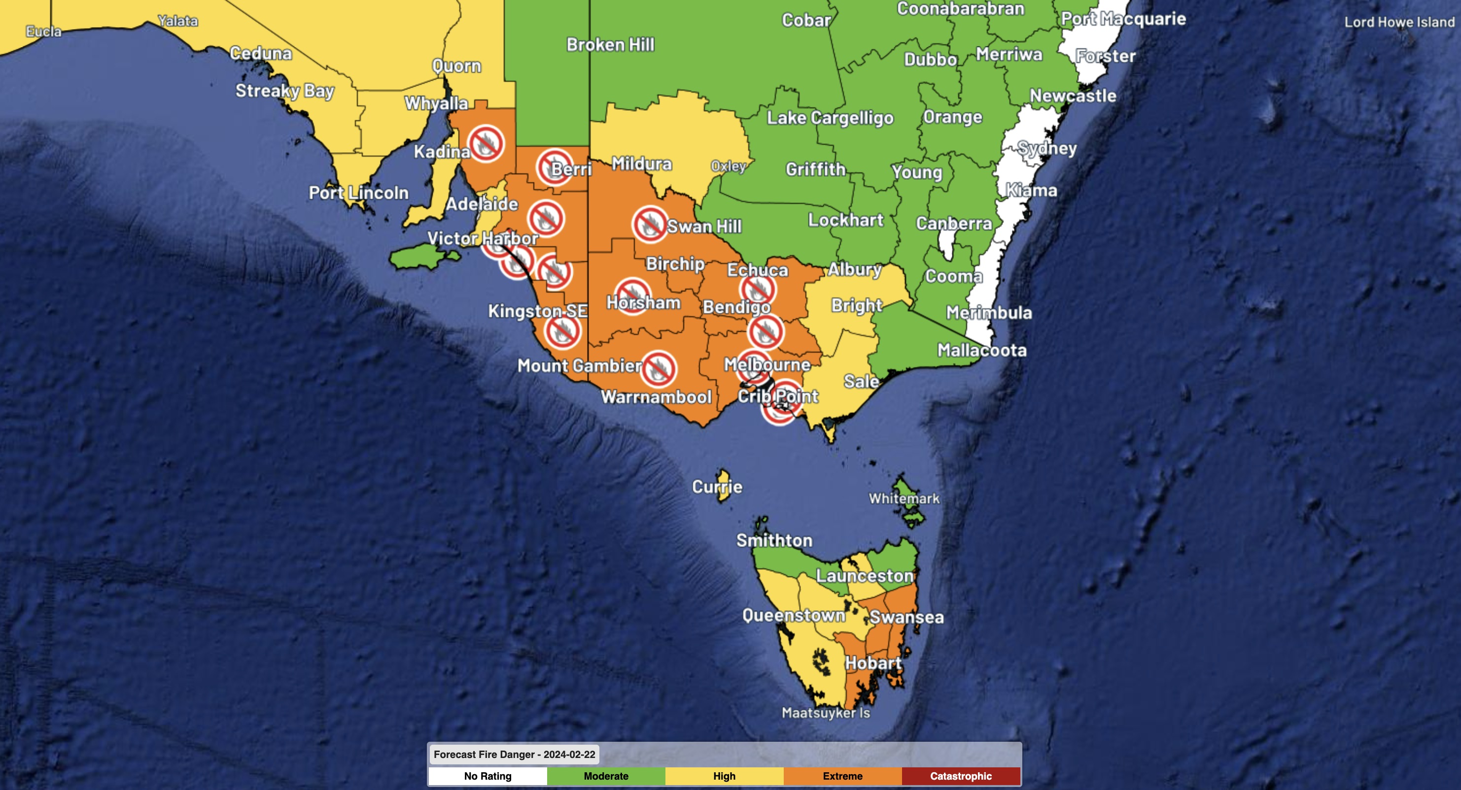
Image: Predicted fire danger ratings and total fire bans on Thursday.
A cool southwesterly change will flush the heat out of southeastern Australia, reaching Adelaide in the early afternoon and Melbourne and Hobart in the evening.
A few thunderstorms could develop near the cool change as it sweeps through Vic and eastern Tas in the late afternoon and evening, most likely in central and northern parts of the state. These storms will produce little if any rain in some areas, which increases the risk of lightning starting new fires into the evening.
While Thursday’s weather system has some similarities to the one that pummelled Victoria last Tuesday, it’s worth noting that this week’s weather will not be as severe and there will be far less thunderstorm activity.
However, anyone living in Vic, Tas and SA should closely monitor the latest fire and weather warnings throughout Thursday.
Working in often severe conditions in the high-risk fields of forestry and emergency, our consolidated weather services can ensure full situational awareness for you and your team.
DTN APAC serves the forestry and emergency sectors, delivering trusted weather data and severe weather alerting to maintain safety, protect your assets and underpin your planning.
Weatherzone’s trusted nowcasting and forecasting system, OpticastTM, is independently proven to outperform other industry models, allowing you to respond rapidly to changing conditions. Opticast can ingest data from your on-site weather observation equipment, ensuring your forecast is customised to your local microclimate. From nowcasting and 14 day forecasting to seasonal outlooks, you have powerful, hyper-local weather alerting and intelligence, giving you decisive confidence when it’s most needed.
With lightning a prominent cause of forest fires throughout Australia, Weatherzone’s Total Lightning Network offers real-time detection and unsurpassed accuracy of lightning strikes to <200m. Based on a vast sensor network, both intra-cloud and cloud-to-ground strikes are located, ensuring you are alerted when severe weather is building and threatening your teams, assets and infrastructure. When volatile conditions increase the ferocity of fire it’s imperative you have lead-time to enact safety plans, keeping your people out of harm’s way.
Your weather intelligence is accessible across all devices in your network via our Weatherguard App, and your customisable interface. For more information, please contact us at apac.sales@dtn.com.




