
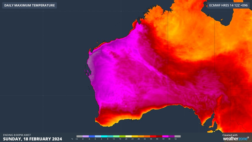
A searing air mass will send temperatures soaring in northwestern Australia this Sunday, with several forecast models predicting temperatures over 50ºC in the Gascoyne region.
Easterly winds feeding into a west coast trough will draw very hot continental air towards western parts of the Gascoyne and Pilbara districts this weekend. While the heat will stick around for several days, the highest temperatures are likely to occur on Sunday as the trough drifts far enough west to carry intense inland heat into low-lying land close to the coast.
The maps below show the forecast maximum temperature this Sunday according to the European and Australian global forecast models. Both models are predicting temperatures above 50ºC just inland from the Gascoyne coast.
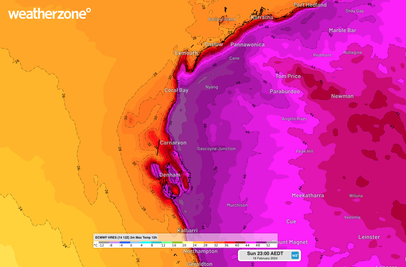
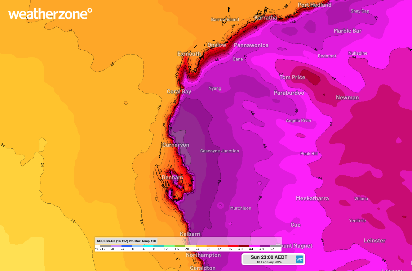
Images: Forecast maximum temperature on Sunday, February 18, according to the ECMWF (top) and ACCESS-G (bottom) models.
Other forecast sources are also hinting at the prospect of 50ºC heat in the Western Gascoyne this Sunday, including the Bureau of Meteorology’s Met Eye tool, which is based on gridded data from the Australian Digital Forecast Database (ADFD).
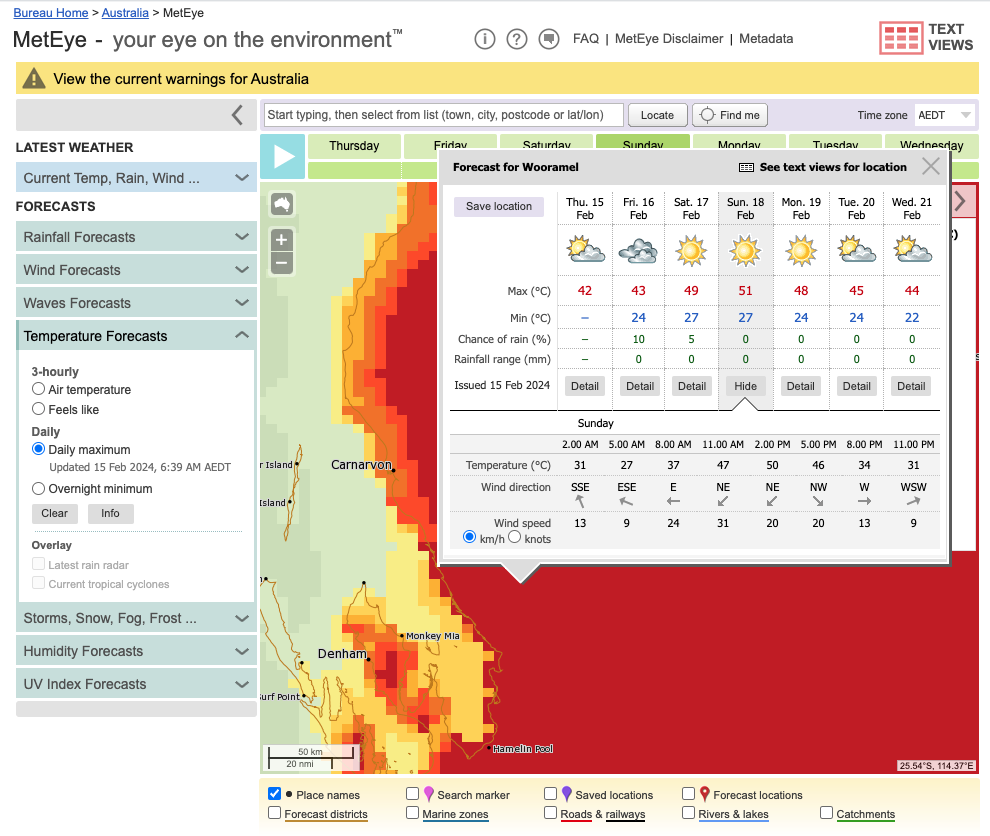
Image: Point location maximum temperature forecast in the Western Gascoyne District on Sunday, February 18, according to the Bureau of Meteorology’s ADFD grid. Source: Bureau of Meteorology.
The consensus between forecast models suggests there is a decent chance that some parts of northwestern Australia will be pushing close to 50ºC this Sunday. However, the sparse network of automatic weather stations in the region will mean the day’s peak heat is unlikely to be officially recorded.
Carnarvon’s weather station is located too close to the coast to be exposed to the intense heat that will be felt a few kilometers further inland this Sunday. Gascoyne Junction’s weather station is much further inland, but at 144 m elevation, it will be too high to experience the day’s hottest weather.
The vast low-lying area just inland from the Gascoyne coast will see the highest maximum temperatures on Sunday, with some areas possibly exceeding 50ºC under the sweltering afternoon sunshine.
For those interested in tracking the heat this weekend, Australia’s highest official temperature on record is 50.7ºC from Onslow on January 13, 2022, and Oodnadatta on January 2, 1960. Australia’s highest February temperature on record was 50.5ºC at Roebourne on January 13, 2022. For more information on our extreme temperature forecasts, please contact us at apac.sales@dtn.com.




