
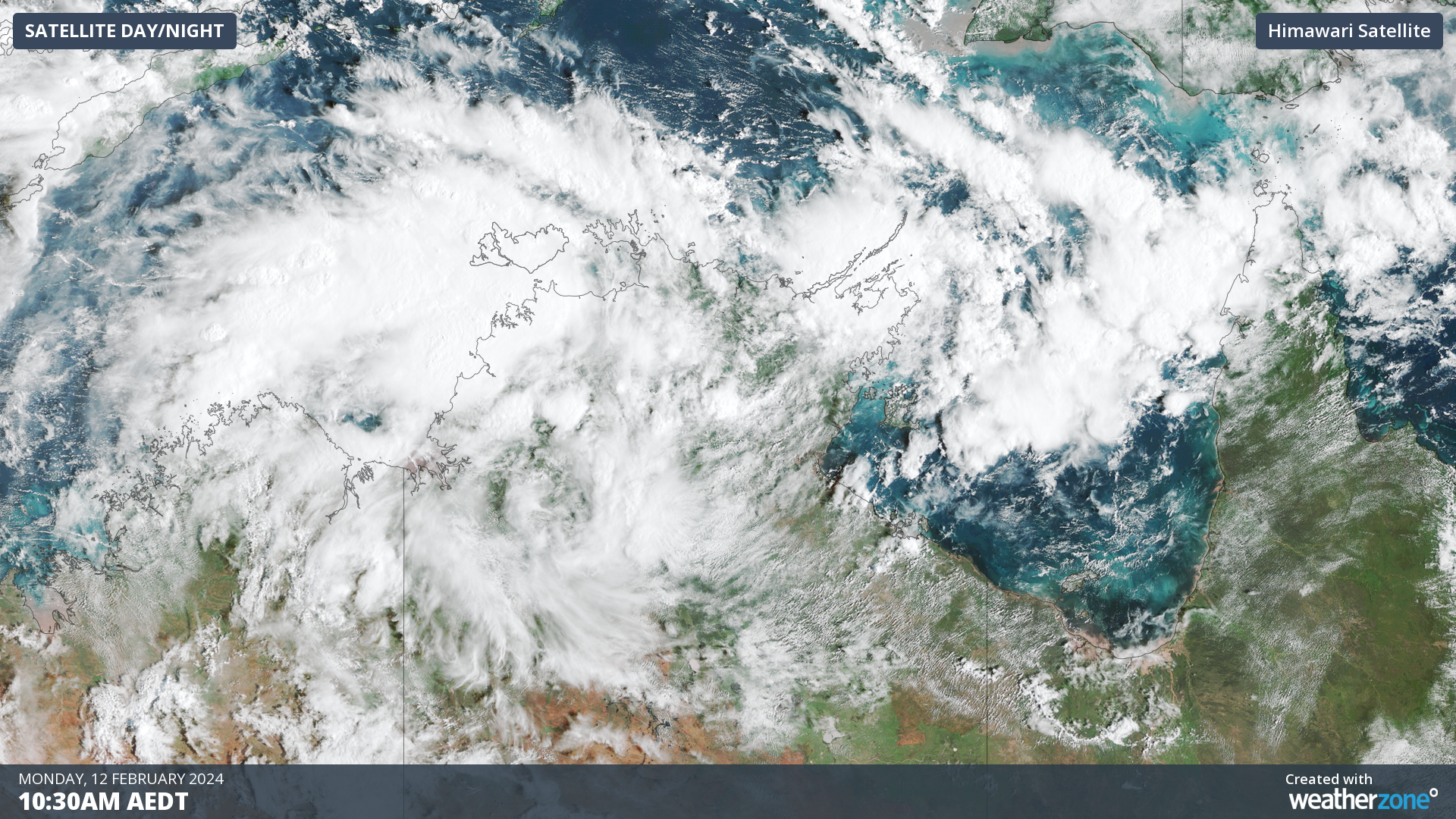
Darwin has had its wettest day in 7 years as a tropical low builds strength in the Top End and could become a tropical cyclone later this week.
Over the last 36 hours, a tropical low has been building over the western Top End. Last night, the low strengthened enough to incorporate cross-equatorial winds from further north, developing an active monsoon again after last month’s onset.
This tropical low is causing heavy rain and frequent thunderstorms to build in the Timor Sea, and pushing them directly toward the Territory’s capital, Darwin.
In the 24 hours to 9am Monday, Darwin recorded 164.6mm in the gauge, its wettest day in 7 years. Rain squalls have been on-and-off over the city since about 2am last night, leading to periods of heavy rain followed by calmer conditions and even some blue sky.
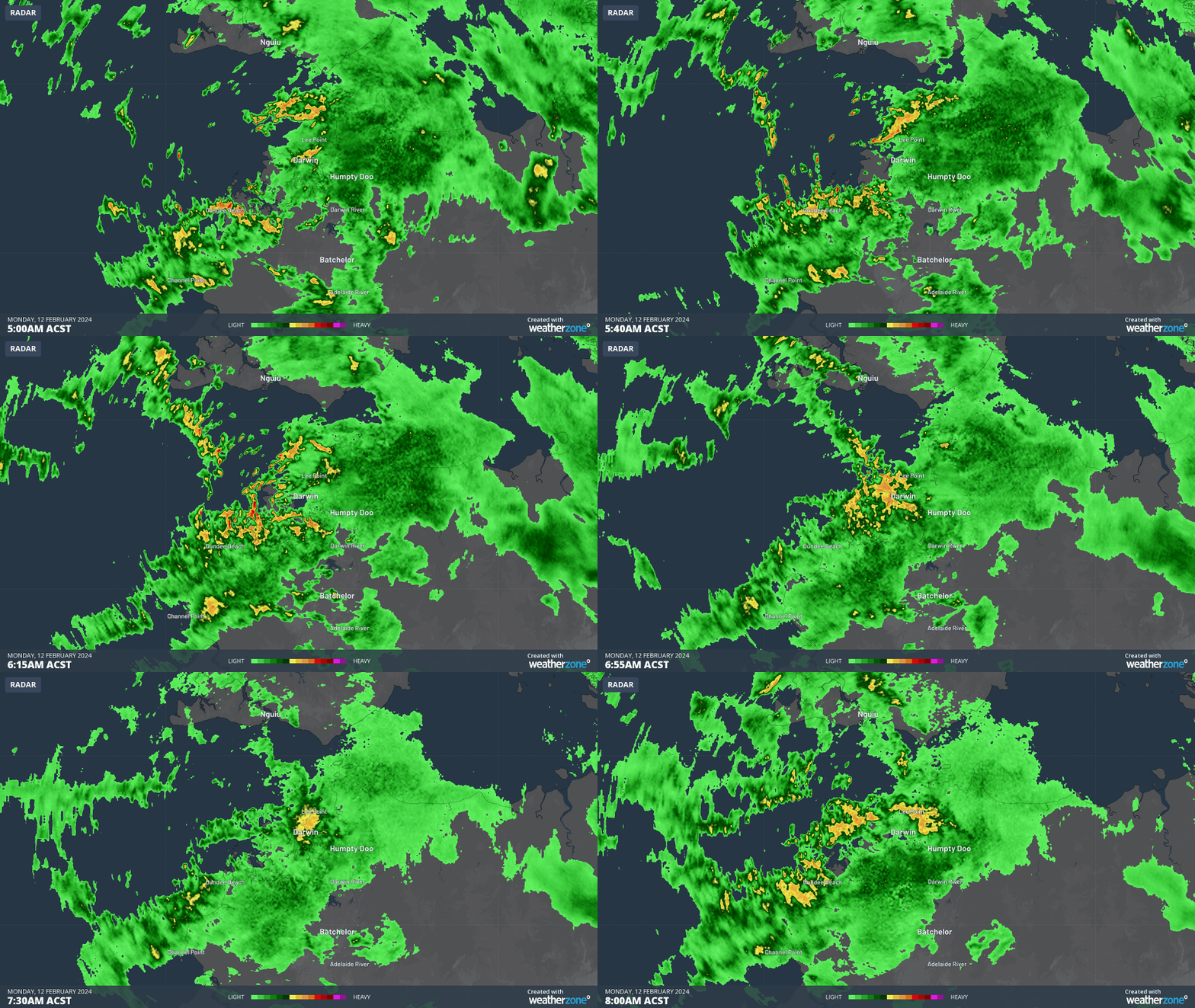
Image: Heavy rain in yellow and red can be seen coming in waves from the Darwin radar on Monday morning.
This surge of tropical activity brings Darwin’s wet season rainfall much closer to average for this time of year, with 1063mm accumulated since September 1st 2023. The graph below shows how this wet season compares to the climate average.
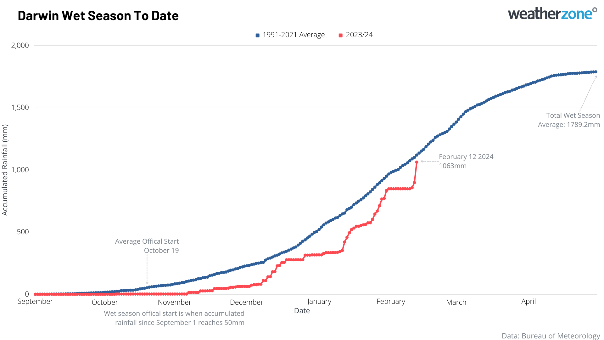
Darwin will likely be in for some more heavy falls during Monday and Tuesday as the tropical low and monsoonal winds build further, potentially pushing this season’s rainfall line above the average climate line for the first time this season.
Over the coming days, the tropical low will start to track east towards the Gulf of Carpentaria, spreading the heavy rain around the northern coast of Queensland.
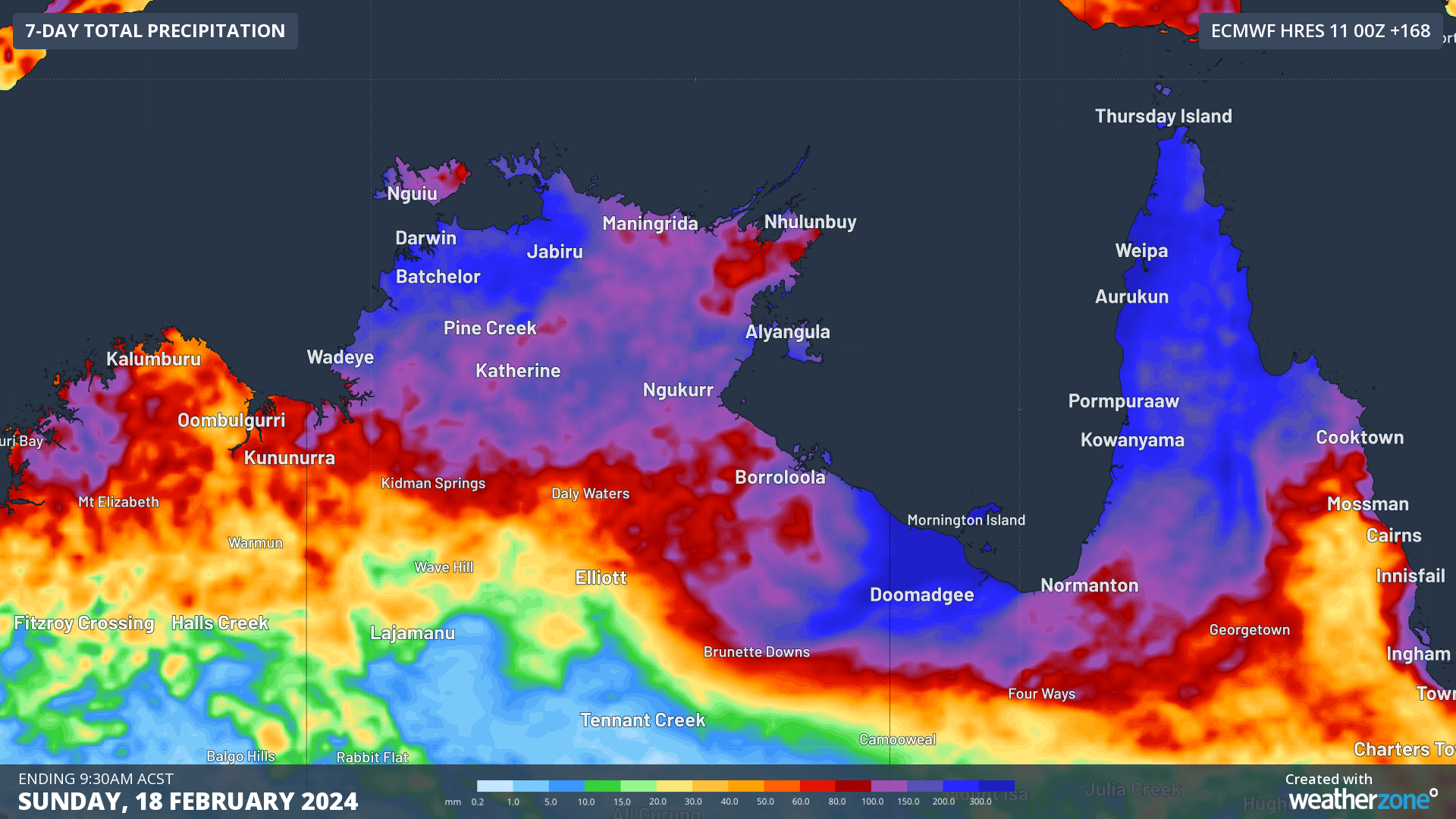
Image: Forecast 7-day rainfall from ECMWF, showing widespread falls of 100-200mm, and isolated falls of 300-500mm possible.
Once in the Gulf of Carpentaria, the system will start to strengthen further. With ocean temperatures averaging about 30°C, well above the required 26.5°C necessary for tropical cyclone development. Along with favourable atmospheric conditions, development will come down to whether this system has enough time over water to become a tropical cyclone before it makes landfall on the south side of the Gulf on Friday or Saturday.
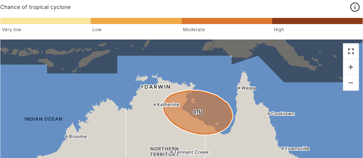
Image: Tropical Low 07U is rated as a moderate chance of becoming a tropical cyclone by Friday evening. Source: BoM
Overall, this system is currently rated as a moderate chance of developing into a tropical cyclone and would most likely make landfall as a category 1 system if it develops. The next tropical cyclone to be declared in Australian Waters will be named Lincoln.
Over the weekend and into next week, this system is expected to track back towards the west into the central NT, bringing further heavy rainfall with it. These areas were recently flood affected by tropical low 03U in January that took a similar path.
We will monitor this system over the coming days for possible cyclogenesis, and for further heavy rain and flooding that this system brings along. Stay up to date with the latest warnings and news at Weatherzone.com.au.
DTN APAC has a suite of tropical cyclones services we provide to deliver our clients with as much forewarning of tropical cyclones as we can. We have 4 levels of forecasts timeframes:
- Tropical cyclone seasonal outlooks
- Weekly tropical update
- Daily 7-day tropical cyclone forecast
- Detailed tropical cyclone impacts (issued every 1-6 hours aligning with offical advisories)
Through these products you can have as much preparation as possible for tropical cyclones and their impacts. To find out more, please visit our website or email us at apac.sales@dtn.com.




