Despite the unexpectedly sluggish development of a tropical low over the Coral Sea, a tropical cyclone named Kirrily is still expected to hit the east coast of Qld tomorrow night.
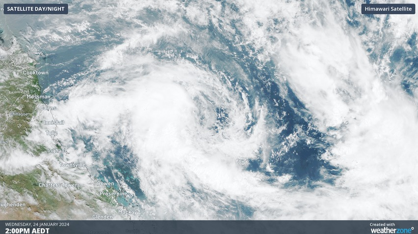
A tropical low has been spinning over the central and eastern Coral Sea over the last few days, threatening to become a tropical cyclone. However, despite clear indications from multiple numerical weather prediction models that a tropical cyclone was likely, the tropical low hasn’t yet managed to reach tropical cyclone strength, according to the Bureau of Meteorology.
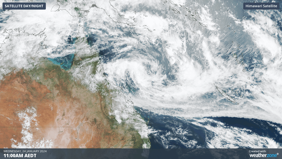
The large size and elongated shape of the tropical low, combined with an unfavourable environment, are responsible for the system’s slow development over the last couple of days.
However, the system is about to move into a more favourable environment that should help it strengthen over the next 24 to 36 hours. These improving conditions are giving forecasters at the Bureau of Meteorology and the Joint Typhoon Warning Center enough confidence to predict a category two landfall in eastern Queensland tomorrow night.
At 10 am AEST, the tropical low was located roughly 580 km northeast of Mackay and 670 km east northeast of Townsville. Based on current forecast guidance, this low should become tropical cyclone Kirrily by tonight, before approaching the Qld coast and making landfall as a category two system somewhere near Townsville on Thursday night.
The large size of Kirrily means that gale force winds with damaging gusts could start to impact parts of the Qld coast from Wednesday night and become more widespread and persistent on Thursday. Destructive wind gusts reaching around 140 km/h could develop near Kirrily’s core later on Thursday, most likely about coastal and island communities between Cardwell and Proserpine, including Townsville and the Whitsunday Islands.
Heavy rain and flooding are also a risk along the coast and adjacent inland between Innisfail and St Lawrence on Thursday and into Friday as the system crosses the coast. As with wind, Kirrily’s large size could allow heavy rain to extend a long way from the centre of the tropical cyclone.
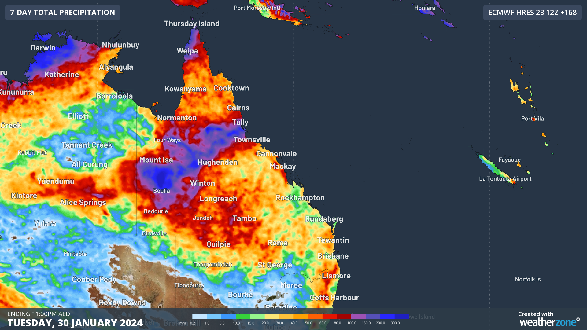
Image: Forecast accumulated rain during the 7 days ending at 11pm AEDT on Tuesday, January 30.
A storm tide will also impact parts of Qld’s coast as Kirrily makes landfall, most near and south of the system’s core, over an area extending from Townsville to Mackay.
After making landfall on Thursday, Kirrily will rapidly weaken below tropical cyclone strength as it moves over land. This remnant low pressure system is expected to carry lots of tropical moisture into central and western Qld from Friday into the weekend, where it could cause rain and thunderstorms to continue for several days.
A flood watch has been issued for coastal and adjacent inland catchments between Tully and St Lawrence, and the upper Flinders catchment. Be sure to check the latest tropical cyclone advisories, severe weather warnings, and flood watches and warnings for the most up-to-date information on Tropical Cyclone Kirrily. For more information on our tropical cyclone briefings and services, please contact us at apac.sales@dtn.com.


