
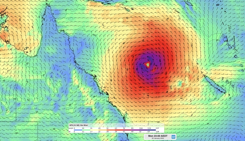
A developing tropical low over the Coral Sea could become a tropical cyclone by the start of next week, continuing the region’s active start to the 2023-24 tropical cyclone season.
It’s been just over a month since Tropical Cyclone Jasper made landfall along Queensland’s North Tropical Coast, bringing torrential rain and major flooding across the state’s northern tropics.
Now, forecast models suggest that another tropical low will strengthen into a tropical cyclone by Monday, with growing signs that it could impact eastern Qld next week.
The animation below shows cloud and rain starting to circulate around a developing tropical low located roughly 600 km off the northeast coast of Qld on Wednesday afternoon.
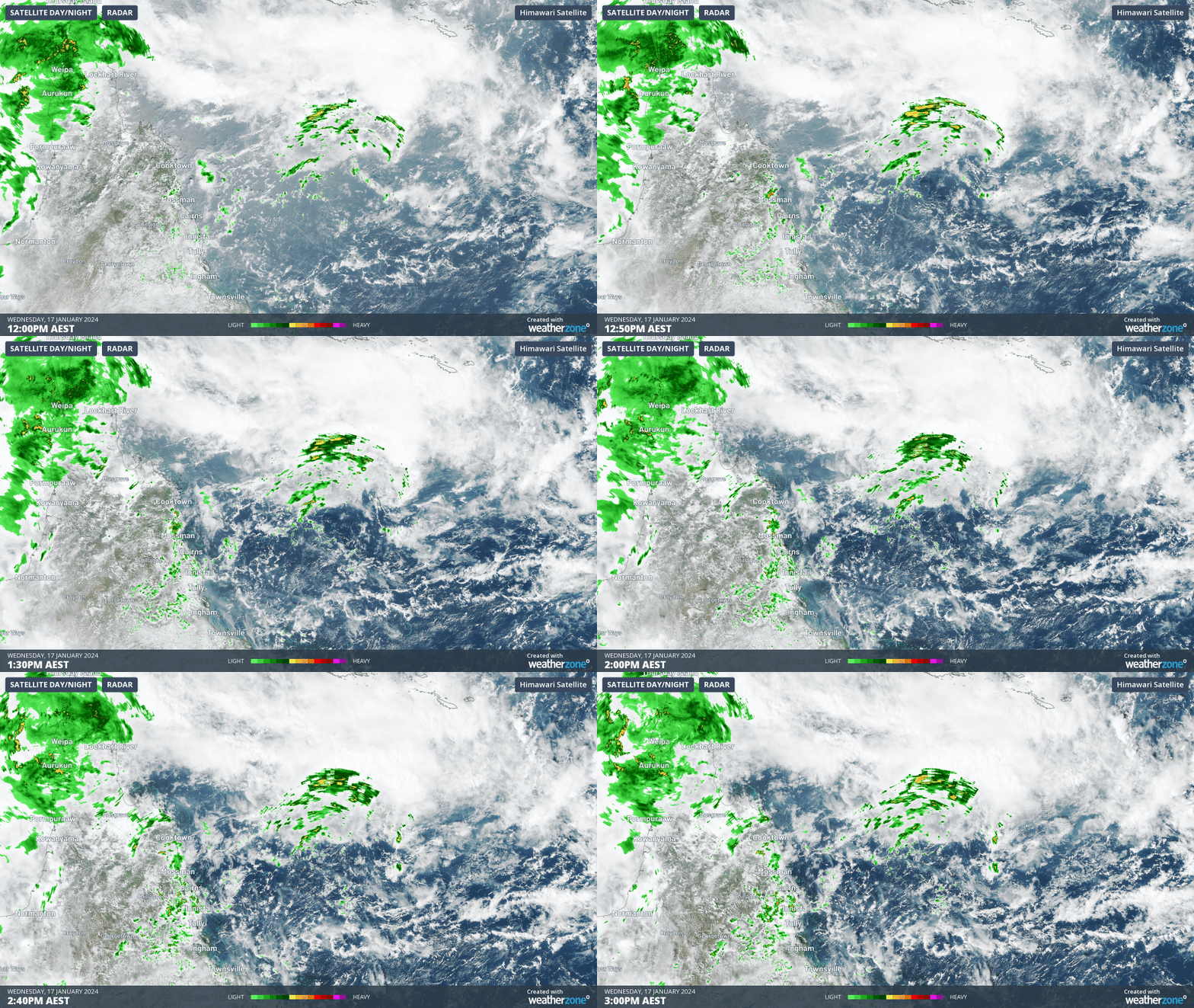
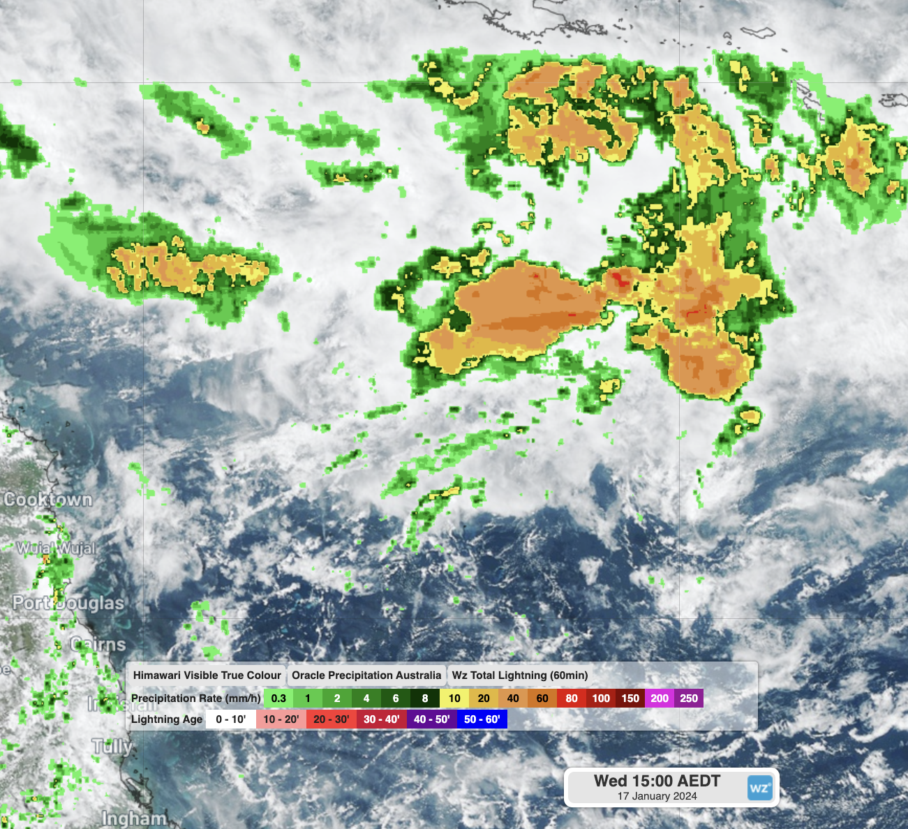
Image: Satellite and Radar (top) vs Weatherzone Oracle (bottom) of the developing tropical low. Orcacle shows the full extent of the convection on the north side of the low.
This low will move towards the east over the next two days before stalling over the eastern Coral Sea on the weekend.
Most forecast models expect the low to strengthen over the warm waters in the eastern Coral Sea during the weekend, with a high chance of the system becoming a tropical cyclone on Sunday or Monday.
There is a large amount of uncertainty regarding the movement and strength of the potential tropical cyclone beyond Monday. The Bureau of Meteorology’s tropical cyclone forecast map shows that the centre of the system could be located anywhere from eastern Qld to the eastern Coral Sea by the middle of next week.

Image: The Bureau of Meteorology’s tropical cyclone outlook for the Coral Sea on Wednesday, January 24, 2024. Forecast valid at 3pm AEST on January 17, 2024. The dark shading highlights areas that lie outside Australia’s area of responsibility for tropical cyclone monitoring. Source: Bureau of Meteorology
It is too early to know whether this system will impact Qld next week or stay out to sea. At this stage, anyone living in eastern Qld should keep up to date with the latest tropical cyclone outlook on the Bureau of Meteorology’s website, which is updated at least twice each day.
Meanwhile, Tropical Cyclone Anggrek is entering the far northwest corner of Australia’s area of responsibility today. Anggrek should strengthen into a category two system as it drifts south over the next few days, liekly passing to the west of the Cocos (Keeling) Islands.
While Anggrek won’t hit the Cocos (Keeling) Islands directly, it may cause wind, rain and waves to increase later this week.
Another tropical low located over the NT is likely to remain landlocked for the rest of this week, most likely drifting over the NT between now and Sunday before tracking over WA early next week.
This low will continue to cause persistent monsoon rain and thunderstorms over parts of the NT and WA during the coming week, which is likely to cause flooding.
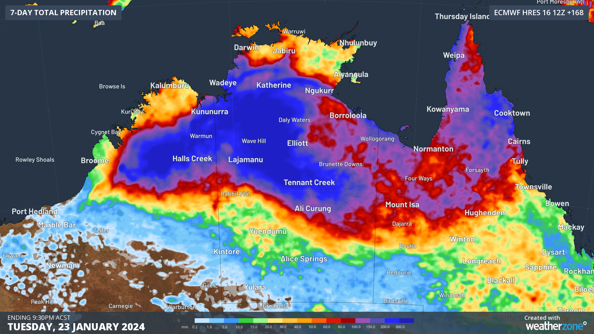
Image: Forecast accumulated rain during the 7 days ending at 9:30pm ACST on Tuesday, January 23, 2024, according to the ECMWF-HRES model.
There is a chance this low could drift off the northern coast of WA next week, although there is only a low risk of it becoming a tropical cyclone in WA waters.
DTN APAC has a suite of tropical cyclones services. We will likely be issuing Detailed Tropical Cyclone Impact Advisories (issued every 1-6 hours aligning with offical advisories) to our clients in the path of the this system over the coming week. Through our products you can have as much preparation as possible for tropical cyclones and their impacts. To find out more, please visit our website or email us at apac.sales@dtn.com.




