A large fire near Narrabri in North Western NSW has produced a fire-generated thunderstorm and a smoke plume so large that it can be seen from space stretching around 1500 km across the Tasman Sea.
An Emergency Warning was in place on Tuesday morning for the Duck Creek fire in the Pilliga Forest about 17km to the south of Narrabri. As of 9am AEDT on Tuesday, the fire had burnt close to 130 000 hectares and was out of control.
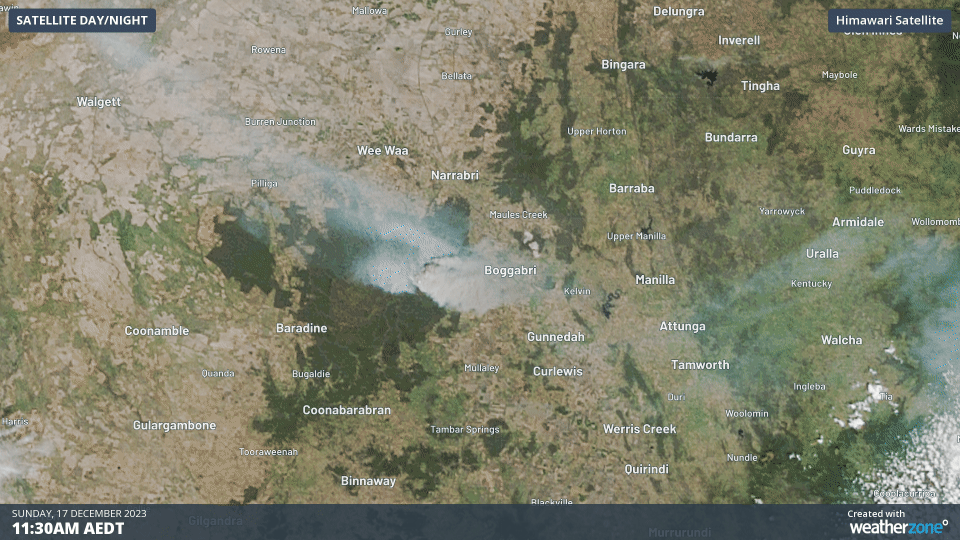
Satellites have captured smoke billowing from the fire over the last few days, with clear skies offing a perfect view of the smoke drifting towards the east of the fireground on Sunday.
Satellites and ground-based lightning sensors also detected a pyrocumulonimbus cloud generating lightning to the southeast of the fireground on Monday night. These fire-generated thunderstorms are caused by rising air associated with the intense heat created by a large bushfire.
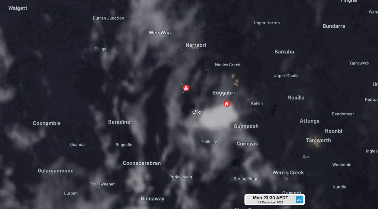
Image: Composite satellite and lightning observations showing a fire-generated thunderstorm to the southwest of Boggabri on Monday night.
While there is more cloud over NSW on Tuesday, widespread smoke can still be seen lingering over northern and eastern NSW and a large area of the Tasman Sea. Most of this smoke came from the fire near Narrabri.
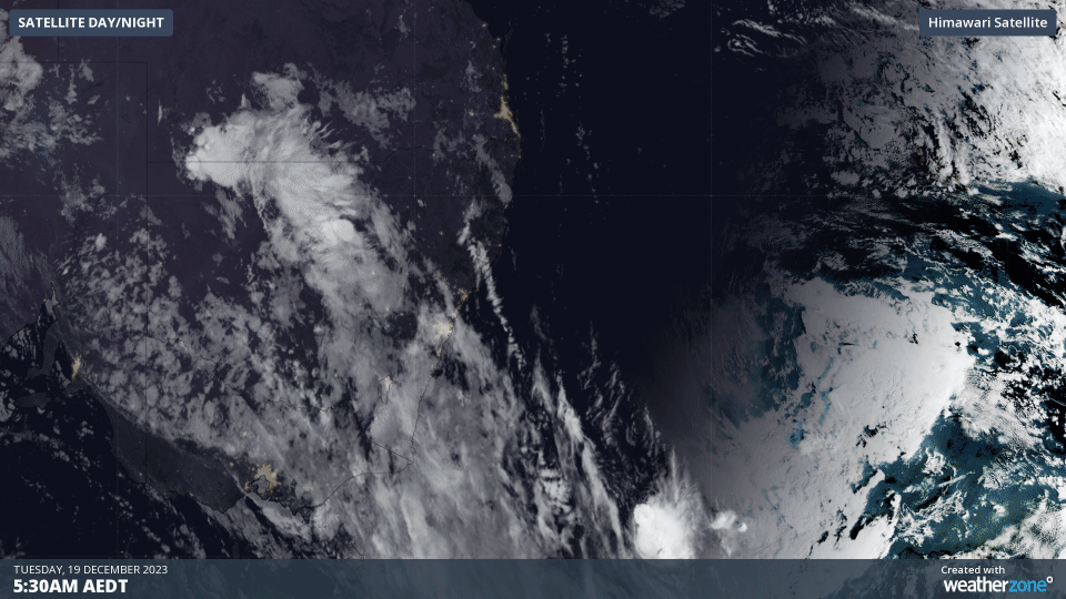
Images captured by the Himawari-9 satellite on Wednesday morning show that the smoke created by the Pilliga Forest fire is now stretching around 1500 km over the Tasman.
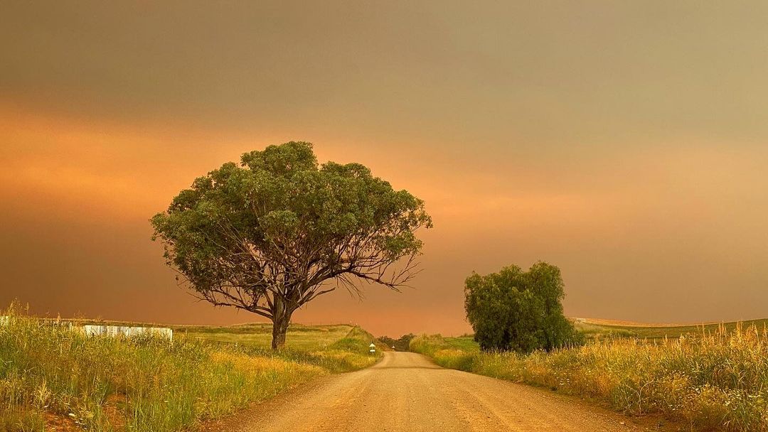
The smoke has been mixing with cloud over some parts of NSW to create an eerie sepia tone in the sky, caused by the airborne water droplets and smoke particles scattering sunlight. This phenomenon was seen over NSW frequently during the 2019-20 Black Summer fires.
According to the National Institute of Water and Atmospheric Research (NIWA), some of the smoke may even reach New Zealand this week.
Aussie bushfires are sending huge plumes of smoke across the Tasman Sea. Don’t be surprised if you see some hazy skies or unusually colourful sunsets over the next week ????
One fire is over 100,000 hectares and currently burning out of control in northern New South Wales. pic.twitter.com/mlzOs2FwpW
— NIWA Weather (@NiwaWeather) December 18, 2023
Hot northwesterly winds and thunderstorms will challenge firefighters in northern, central and eastern NSW on Tuesday, with some storms likely to be severe. Cooler weather will bring some relief for most of the state from Wednesday.
To find out more about the Total Lightning Network, lightning alerting, or bushfire services, please email us at apac.sales@dtn.com.


