
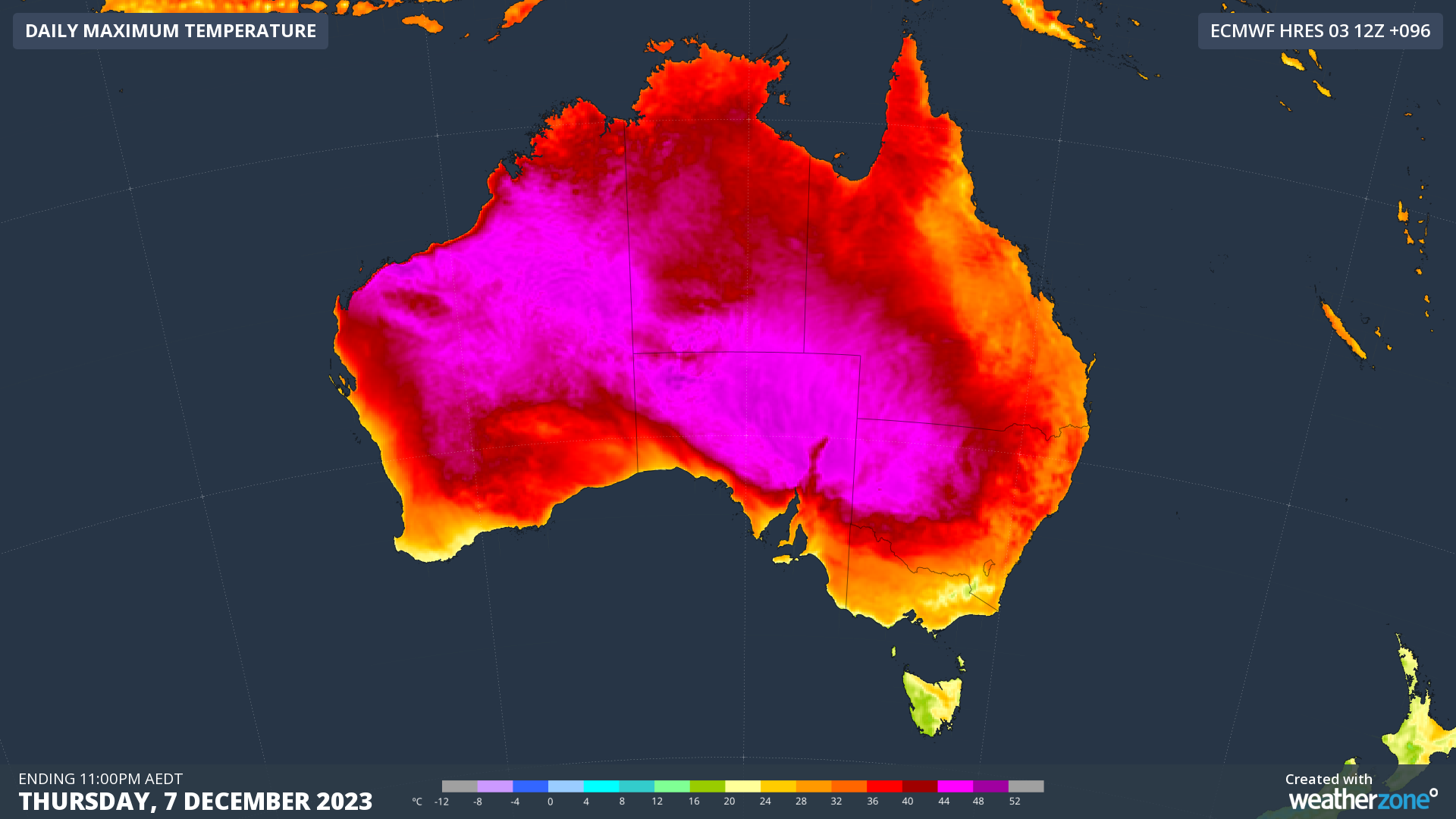
Our capital cities should dodge the worst of it, but the first heatwave of the 2023/24 summer will affect huge parts of the country this week, having already warmed up parts of WA over the weekend.
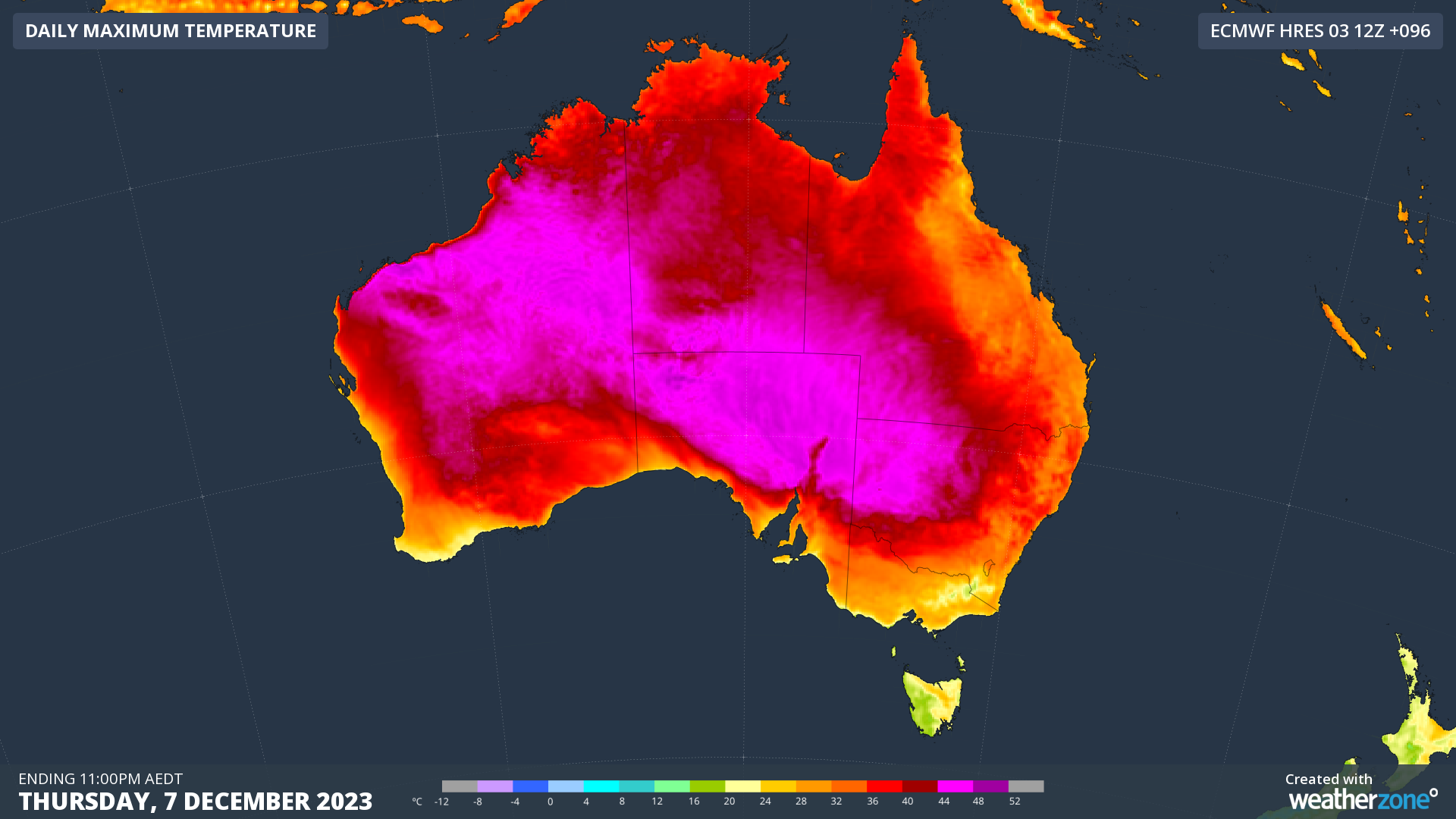
The pink zone on the map below shows areas that can expect maximum temperatures of 44°C or higher between now and Thursday. That’s around a third of the country.
On Sunday, the mining town of Paraburdoo in WA’s Pilbara region recorded the hottest temperature anywhere in Australia to date this summer, with 43.8°C. But hotter temperatures are expected to spread eastwards throughout the week. For example:
- Oodnadatta, the SA town which jointly holds the record for Australia’s hottest recorded temp, is looking at a run of maximums of 44°C, 45°C, 46°C and 46°C between Tuesday and Friday
- Several other SA locations are tipped to reach 47°C at least once between Tuesday and Friday, including Tarcoola, Marree and Oak Valley
- Western NSW and Qld will also reach the mid 40s, with Tibooburra temps tipped to top 45°C on Thursday, and the same peak expected for the Qld town of Birdsville that day.
This could be the hottest spell this early in summer for many of the areas mentioned in at least a decade, and towards the weekend, the east coast will start warming up significantly, with the worst of the heat being felt in low-lying areas between the ranges and the coast.
Penrith in outer western Sydney should reach 41°C on Friday, the high mark in a run of significantly above-average temps expected there from Wednesday onwards, which is reflected in the BoM’s heatwave map below.
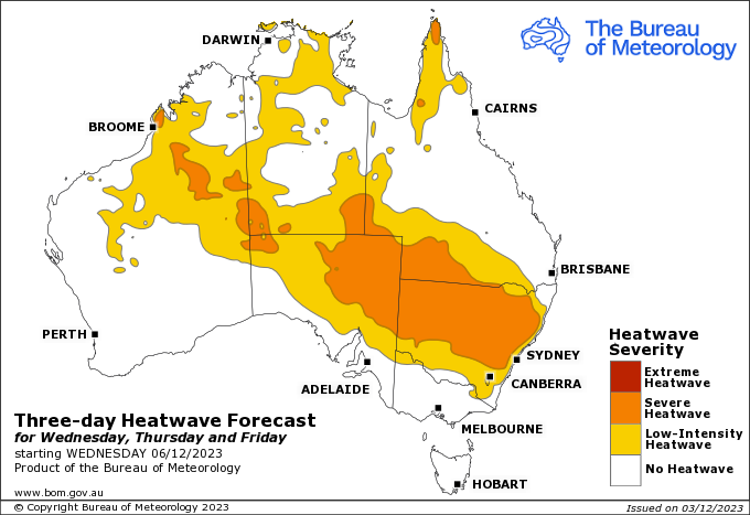
This week’s heatwave will be quite prolonged due to a relatively stable and slow-moving weather pattern allowing heat to build up over the interior of the continent.
But as mentioned, most Australians will be spared the worst of it, as it will largely be confined to inland regions.
Adelaide and Melbourne will be relatively warm this Monday, with top temps of 34°C and 30°C respectively, while Adelaide should again reach the mid-30s on Thursday with a top of 35°C.
Weatherzone Business has grown to become the outright leader within the Australian energy market, serving wind, solar, hydro, trading, utilities and network companies.
You can’t control the weather, but you can gain precision insights to optimise your response. What lights us up is providing your energy business with tailored weather information to reduce your risk and keep you moving ahead of the curve.
Our services cover all aspects – from wind and solar generation to demand forecasts, wholesale markets to retail so, no matter where your company sits, we have solutions for you. We have worked closely with market participants to create products that meet the evolving needs of the sector, aiming to increase safety and profitability for our customers.
Benefit from the timely delivery of accurate weather information, allowing informed and effective decision-making. For more information, please contact us at apac.sales@dtn.com.




