Damaging winds are a common feature in Australian severe weather and thunderstorm warnings. But did you know that some types of wind are more dangerous than others?
There are three things that can make the wind dangerous: strength, duration and direction.
What is the difference between a wind gust and average or sustained wind?
- Average or mean wind speed = the wind speed averaged over a 10-minute period.
- Wind gusts = sudden increases in wind for a short duration, typically a few seconds.
As a rule of thumb, wind gusts are usually about 40 percent stronger than the average wind speed over open water.
What wind gust speeds are classified as damaging or destructive in Australia?
In Australia, warnings are issued for:
- Damaging winds – when wind gusts of 90km/h or more are expected to occur.
- Destructive winds – when wind gusts are likely to reach 125 km/h or higher.
What damage to expect from wind
Wind damage can be predicted using the Beaufort Wind Scale, which was first developed over 200 years ago and is still used widely today.
While its original purpose was to estimate wind speeds based on the damage they caused, the Beaufort Scale can also be used the other way, to anticipate what impacts are likely from the predicted wind speeds.
Sustained wind speeds (10-minute average) of 40-50 km/h can cause large branches to sway and make it difficult to use an umbrella.
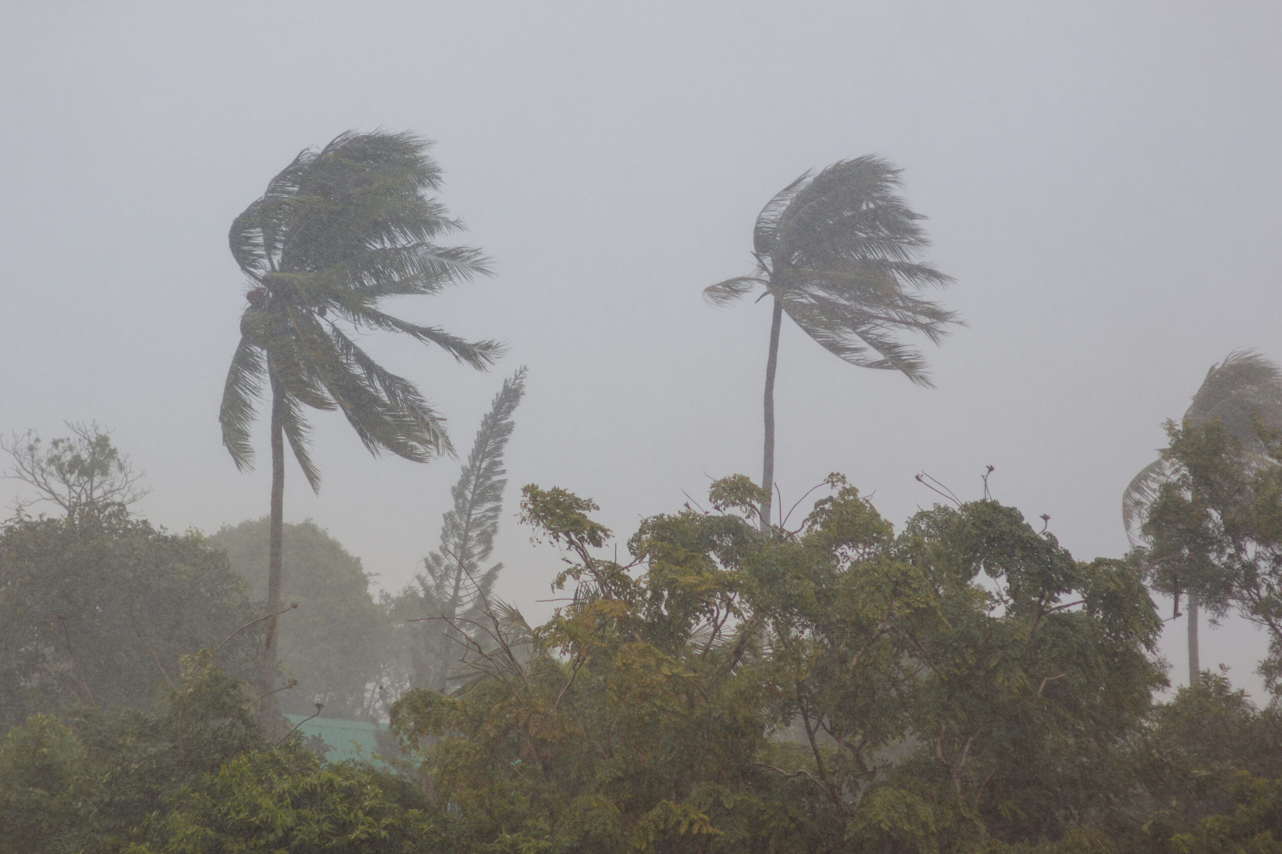
Wind speeds averaging 76-87 km/h can break large branches off trees, dislodge roofing and cause crests of waves to start toppling over in open water.
Wind speeds of 88-102 km/h are capable of uprooting trees and causing significant structural damage to buildings (figure 1).
Does duration enhance damage?
In addition to the peak wind speeds, the duration of damaging wind storm can exacerbate its impacts.
One of the reasons tropical cyclones, hurricanes and typhoons are so damaging is because of their large size, which exposes a broad area to damaging or destructive winds for hours on end.
Back in September 2019, Hurricane Dorian stalled over Grand Bahama for around 24 hours. This extremely slow-moving and powerful hurricane caused extensive flooding and damage across the island, with the Grand Bahama International Airport left in tatters.
What about wind direction?
In addition to wind speeds and duration, the wind direction also plays a big role in determining how severe the damage will be.
A landscape that is accustomed to prevailing winds from the west or north is likely to see more damage or destruction when powerful winds blow in from the east or south.
This was one of the contributing factors to a wind and rain event that brought down a large number of trees in Victoria’s Dandenong Ranges in June this year.
The Dandenongs usually experience their strongest winds from the north or southwest. However, the wind during this event came from the south and southeast.
Trees that had grown their root systems to withstand northerly-component winds were blindsided by powerful and persistent southeasterlies coming up from Bass Strait.
The risk of tree and infrastructure damage in events like this can be exacerbated even further by heavy rain, which helps soften the soil and adds weight to the tree’s branches and leaves.
So next time you see damaging winds mentioned in a severe weather or thunderstorm warning, be sure to read the detailed description to see how it might impact you and your business.
Please contact us at apac.sales@dtn.com for more information our average wind or wind gust forecasts out to 14 days.


