
While the east coast’s weather remains cool and cloudy, Australia’s southern states are set to see warm temperatures as summer arrives this week.
Melbourne, Adelaide and Hobart are all expected to see the mercury rise this week ahead of an approaching cold front.
A run of three days of 30 degrees and over is on the cards between Monday and Thursday for both Adelaide and Melbourne. The image below shows the European models maximum temperature forecast for Monday, November 29.

This week’s heat is going to be noticeable, given warm days have been few and far between for both cities in recent weeks.
Melbourne hasn’t had a single day over 30 degrees for the last six months. In Adelaide, there have only been two days over 30 degrees so far this month. In 2020, there were 15 days at or above 30 degrees during November.
This month’s below average November temperatures, and lack of hot days, have been brought about by above average rainfall and cloud cover.
The warmth is expected to peak in Adelaide on Tuesday, with 33 degrees on the forecast, which is a whopping nine degrees above the November average (figure 1).

Figure 1: ECMWF maximum temperature forecast for Tuesday, November 30.
While Wednesday will remain warm across the southern states, it is not expected to be the hottest day (figure 2).

Figure 2: ECMWF maximum temperature forecast for Wednesday, December 1.
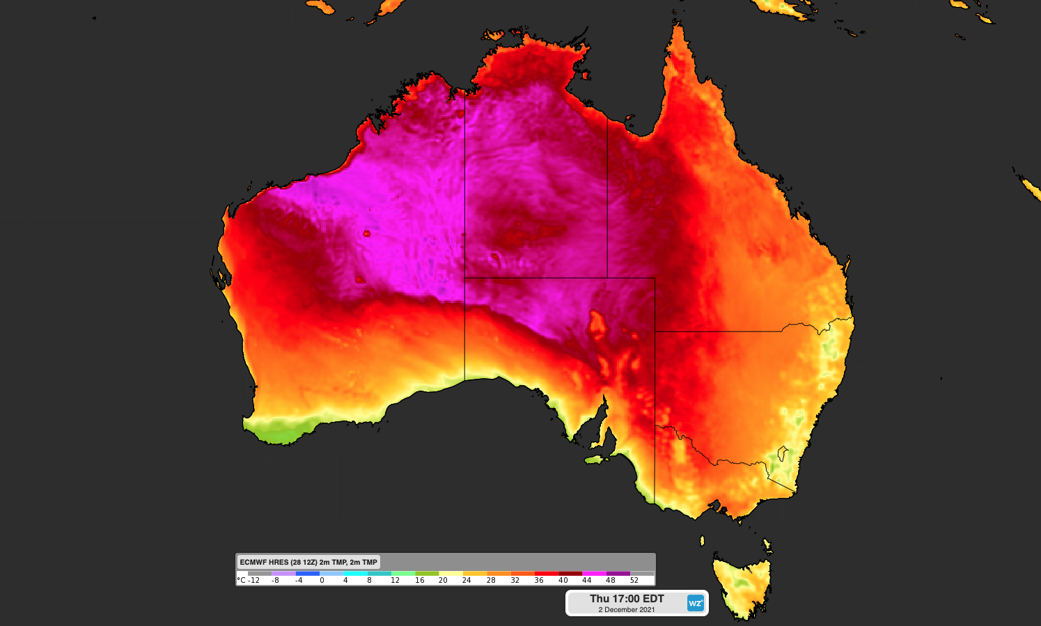
Melbourne’s temperature is forecast to top 31 degrees on Thursday, which is also nearly nine degrees above normal (figure 3)

Figure 3: ECMWF maximum temperature forecast for Thursday, December 2.
Hobart’s maximum temperature is also forecast to be 7 to 9 degrees above average on Tuesday, Wednesday and Thursday.
But it’s not just the days that will be warm this week, with southern capital cities also in for at least one very warm night.
Adelaide’s overnight temperature on Tuesday evening is not expected to drop below 22 degrees, while Melbourne’s minimum temperature is forecast to be 18 degrees on Tuesday and Wednesday night. This will make it two nights in a row with overnight temperatures nearly seven degrees above average.
This week’s spell of warm days and nights will come to an abrupt end when the cold front arrives on Thursday.
Temperatures will drop up to four degrees behind the cold front, which will arrive in Adelaide on Thursday morning and Melbourne and Hobart in the evening.
Meanwhile, Australia’s eastern states are also set to warm up on Thursday and Friday. However, it won’t be quite as warm in the east and temperatures will only reach around two degrees above average for this time of year.
For more information on Weatherzone’s 14-day temperature forecasts including confidence intervals and risk of extreme heat, please contact us at apac.sales@dtn.com.




