

This week’s weather will be a perfect example of how a negative Indian Ocean Dipole (IOD) affects Australia, with a thick northwest cloudband causing widespread rain and flooding.
The satellite image below shows a northwest cloudband extending over Australia on Wednesday, August 10.
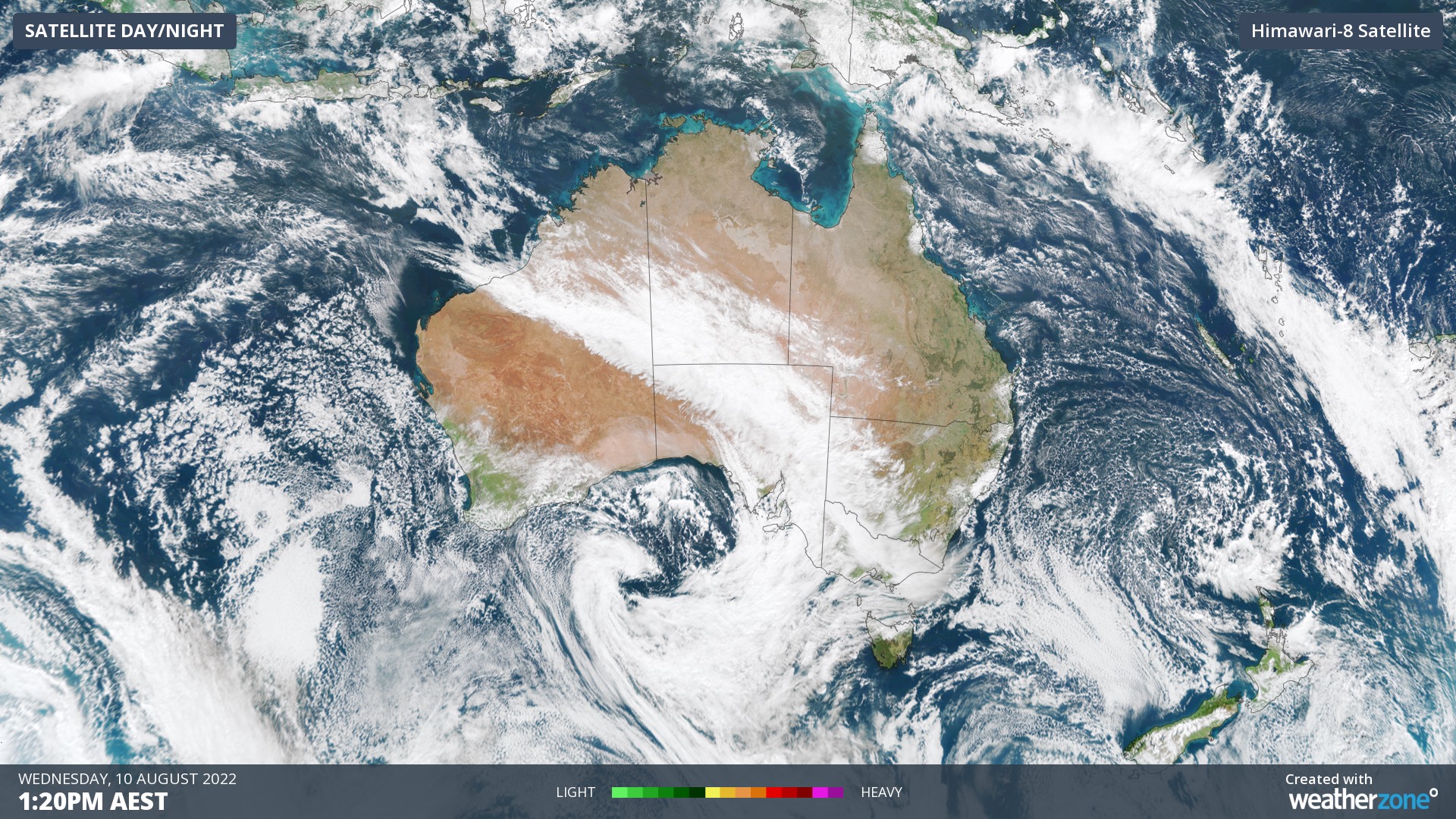
This northwest cloudband is forming as upper-level winds transport moisture-laden air from the tropical Indian Ocean across the Australian continent. This stream of tropical moisture is linking up with a mid-latitude low pressure system and associated cold air mass to creating a large and thick band of cloud.
This type of weather pattern is common during a negative IOD and this is the second such cloudband that has affected Australia since the negative IOD was declared last week.
After soaking parts of WA earlier this week, this cloudband will drift further east over the next few days and produce widespread cloud and rain over parts of every other state and territory in Australia. The maps below show where one forecast model predicts rain on each of the next four days.
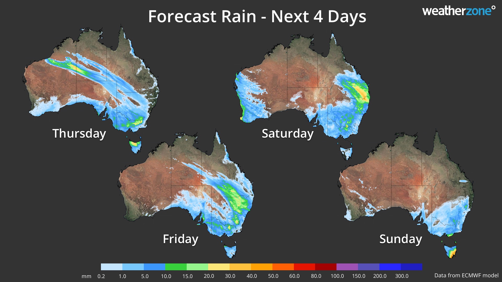
Image: Forecast daily rainfall during the rest of this week, between Thursday and Sunday.
This system is likely to produce around 10 to 30 mm of rain over a broad area of eastern and southeastern Australia between Thursday and Sunday, extending from central QLD down to TAS and SA.
Showers are likely to continue over parts of TAS, VIC and NSW early next week as a low pressure system lingers above the western Tasman Sea. Another cold front should also bring a burst of rain in WA from around Tuesday next week.
Over the next seven days, rain that is heavy enough cause flooding could affect several states and territories. This includes parts of the Murray Darling Basin, as well as areas in NSW, VIC and TAS that were affected by flooding last week.
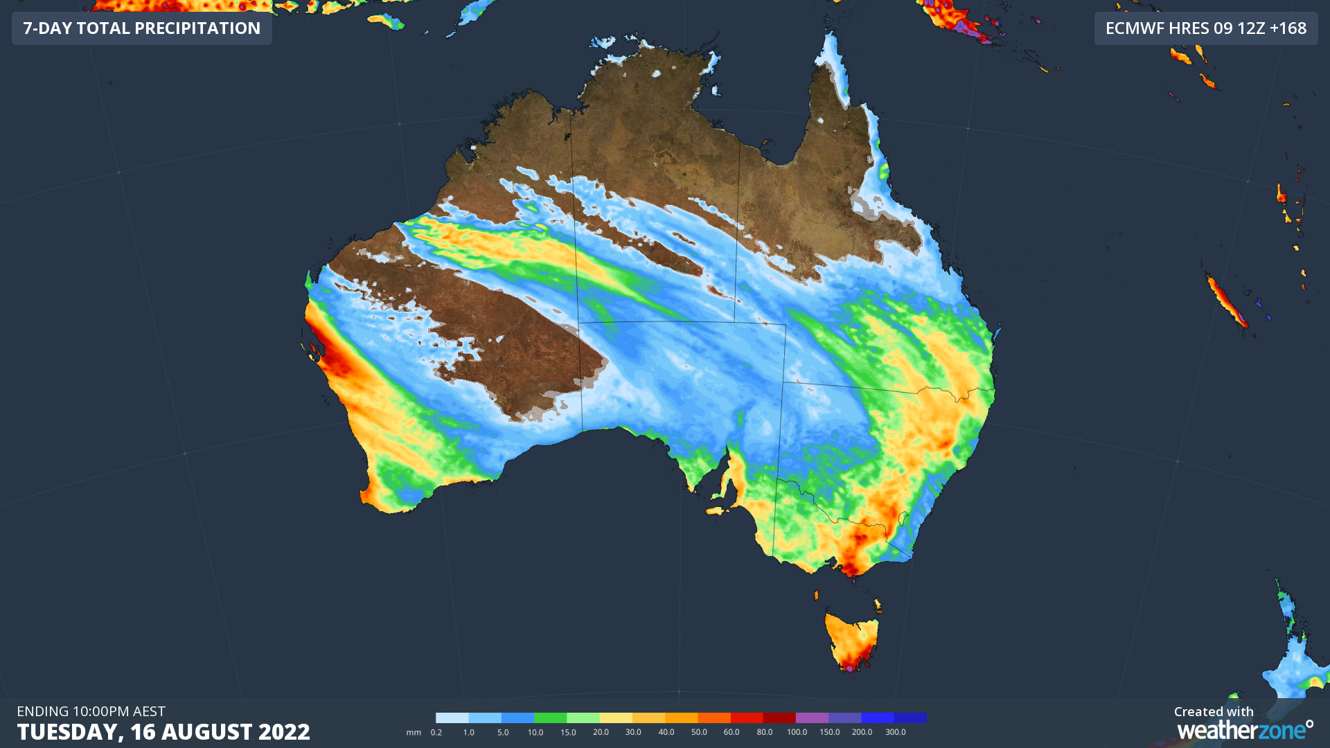
Image: Forecast accumulated rain during the next seven days (Wednesday to Tuesday) accoring to the ECMWF-HRES model.
The image below shows Weatherzone’s radar system Oracle, which is capturing the rainfall extending from the northwest down towards southern Australia on Tuesday afternoon. Thunderstorms have also formed within this cloudband across parts of the Pilbara, which were also captured by this system.

Oracle is a ‘radar’ system, which enables users to see rain as it’s happening anywhere in the world. On top of tracking current rain, Oracle provides live forecasts:
Rainfall forecasts out to 3 hours
⚡️ Lightning, and
☁️ Cloud for up to three hours in advance.
These live forecasts are available for anywhere in the world. This cutting-edge technology was built in collaboration with Solcast (Solar Radiation Data Experts).
ℹ️ For more information, get in touch with our team at apac.sales@dtn.com.




