
As the days get shorter and the temperatures begin to drop ahead of winter, fog becomes an imminent risk for port and offshore rigs safety and operations. Fog can occur at any time of the year, although they are most prevalent during the winter months.
Fog forms overnight when temperatures cool and the humidity of air increases significantly, such that there are many small droplets suspended in the air, reducing visibility. Fogs can form inland and be dragged or advected over ports, if the wind is blowing in the right direction.
In some parts of the world, fog can hang around all day or in London’s case 4 days in December 1952. Thankfully in Australia fogs usually clear a couple hours after sunrise, as sun warms and evaporates the water droplets.
Sea fog is another type of fog which can unfortunately hang around all day. Sea fog is a huge nuisance to port and offshore operations, as it reduces the visibility.
The reduced visibility can halt operations on the rig and ground helicopters, as it is a safety concern. If the cargo on the crane or hook cannot be seen, logistics operations halt, reducing efficiency and productivity.
But what is sea fog?
Sea fog is formed when warm and humid air moves over cooler waters. As the air the warm air moves over the cool waters the air condenses to form fog (figure 1).
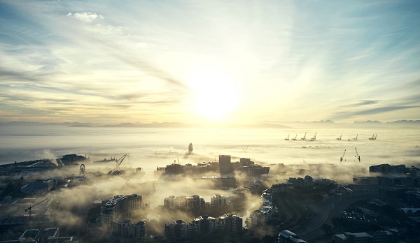 Figure 1: Sea fog moving over a port.
This can happen at any time of the year; however, it is more likely to occur in spring when the waters are still cool following the winter months.
Interestingly, breaking waves on the beach release salt particles in the air, which aids the condensation process that occurs when fog forms.
Sea fog can also be advected over land and into ports with the right wind direction, for NSW ports a northeasterly wind would do this.
Both types of fog occur when there is a high-pressure system nearby, which clears skies, promotes light winds and stable weather conditions.
How can Weatherzone reduce the fogs impact on port and offshore rigs operations?
Weatherzone forecast fog risk, density and onset and clearance times out to 7 days, which enables efficiency and safety. Weatherzone have developed a traffic light system for port and marine clients, with green having no impact on operations, yellow a moderate impact and red having a high impact.
We can alert for fog down to the hour, what the density will be, and we fine tune our models dependent on the individual port requirements and local topography. Weatherzone’s traffic light system enables ports to make decisions and plan well in advance.
Fog density alerts can be also set up, which go off up to 36 hours in advance. Of course, Opticast has many other weather solutions for ports, including alerts of thunderstorms and wind gusts. All the thresholds can be adapted to your individual port. For more information, please contact us at apac.sales@dtn.com.




