
Heavy rain and thunderstorms will continue in parts of Qld and the NT over the next few days, increasing the risk of flooding and outback road closures.
This week’s wet weather is being caused by the remnants of Tropical Cyclone Megan and an associated low-pressure trough extending across the NT and Qld.
The satellite image below shows that the moisture over northeastern Australia is also feeding a long band of cloud stretching over 7000km from the NT to the east of New Zealand.
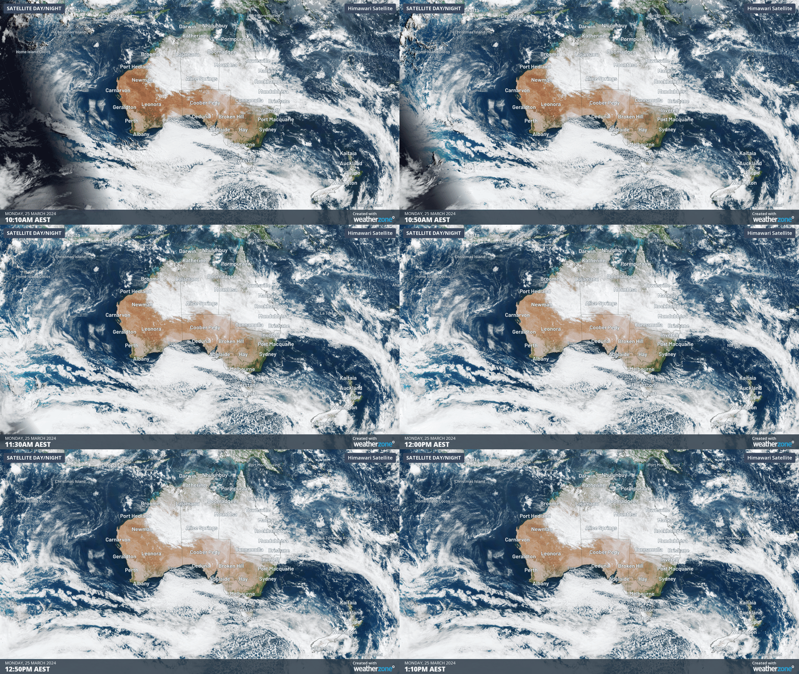
Image: Himawari-9 satellite image showing the 3 hours leading up to 1:10pm on Monday, March 25.
The moisture lingering over northeastern Australia should bring persistent rain and thunderstorms to parts of the NT, WA and Qld this week.
The largest rainfall totals on Monday and Tuesday are expected to fall across the central NT and central and northern Qld, including the Mackay, Isaac and Whitsunday regions.
The maps below show that in the next 48 hours, widespread falls of 30-50mm are forecast for parts of Qld, the NT and northeastern WA, with 50-100mm forecast in some areas.
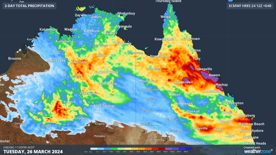
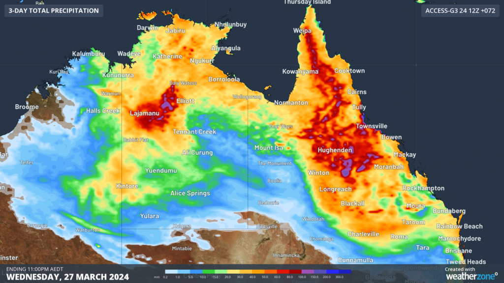
Image: Accumulated rainfall for the 48 hours leading up to 11pm on Tuesday, March 26, according to ECMMWF (Top) and Access-G (bottom) models.
This rainfall is a continuation of the recent rain and flooding observed in the NT last week, with more flooding expected in the NT and Qld over the coming days.
The map below shows several impassable roads due to water being over the roads or highways on Monday afternoon.
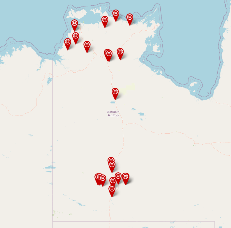
Image: Road report NT showing impassable roads (red) as of Monday afternoon, March 25
Later this week, this rainfall is expected to shift further south and east as the trough extends into NSW and SA.
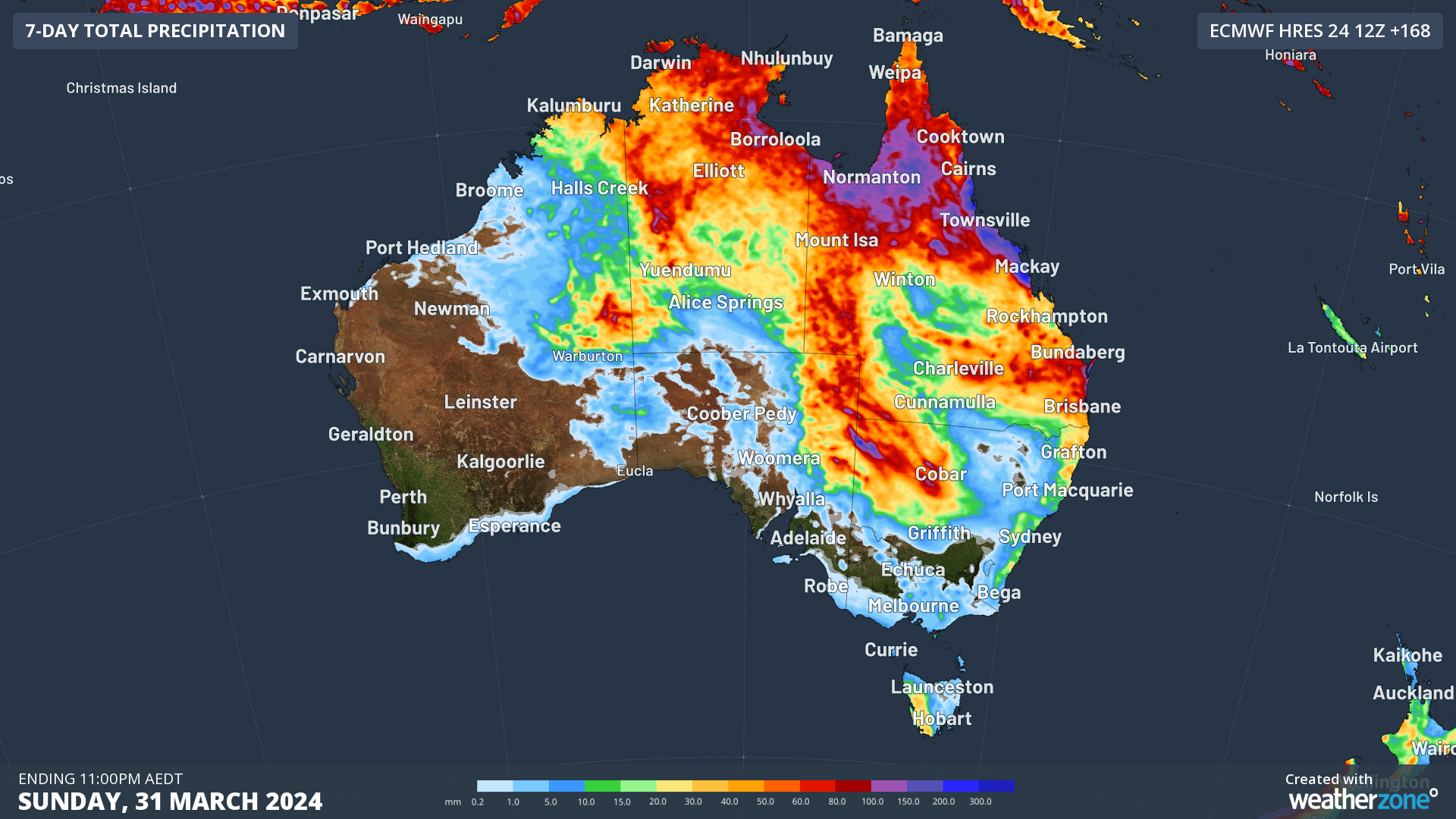
The map below shows the wet week forecast for these regions, with the heaviest falls expected to impact western NSW, northeastern SA, northern Qld and the NT.
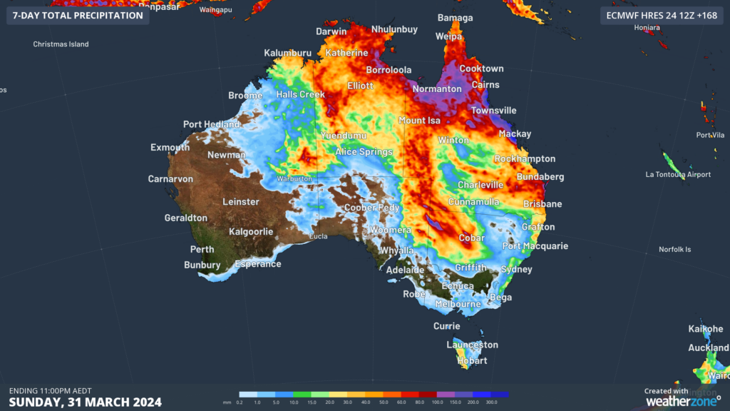
Image: Accumulated rainfall forecast for the 7 days leading up to 11:30pm on Sunday, March 31.
Please keep an eye out for the latest warnings and forecasts as this event unfolds.
Rail and transport networks are exposed to severe weather risk, every day. Our services significantly improve efficiency, safety and planning.
DTN APAC, a DTN company, specialises in building customised weather monitoring and alerting solutions.
These guide transport operators to plan and respond effectively. We tailor our data and analytics to your exact requirements.
For more information, please contact us at apac.sales@dtn.com.




