Rain and thunderstorms will soak parts of eastern and southwestern Australia this week, bringing drought relief in WA and a risk of flooding in NSW.
A series of upper-level troughs and low pressure systems will trigger multiple days of rain and thunderstorms over Australia this week.
In WA, showers and thunderstorms will develop over the state’s western districts on Tuesday, near a deepening low pressure trough. This wet and stormy weather will then spread further south and east between Tuesday and Thursday. Showers should contract to the south and southwest of WA from Friday as a low pressure system develops to the state’s south.
Accumulated rainfall totals of 5 to 20 mm are likely over a broad area of the Southwest Land Division in WA this week. Some areas of the far southwest could see more than 50 mm by the end of the week.
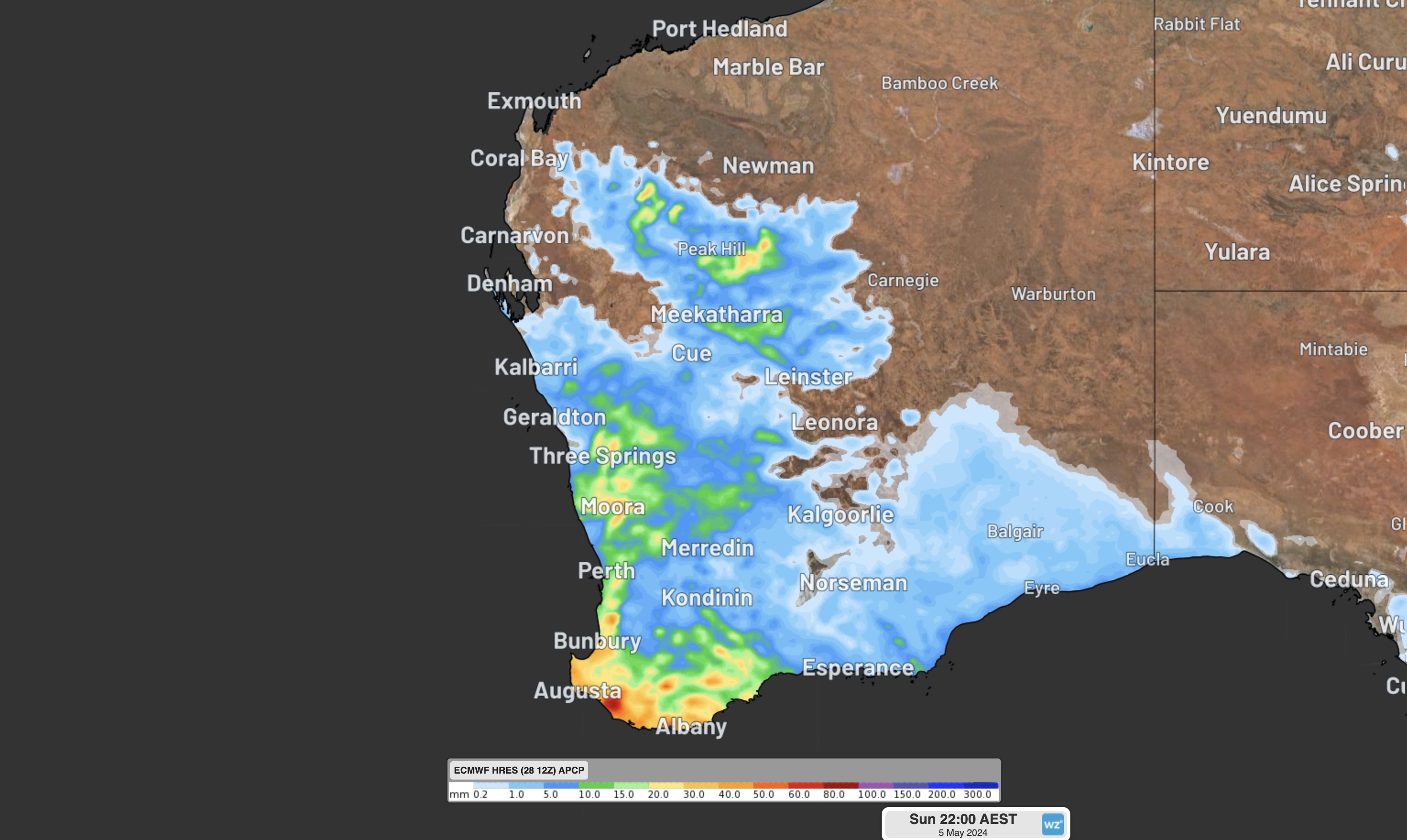
Image: Forecast accumulated rain during the seven days ending on Sunday, May 5, according to the ECMWF-HRES model.
This week’s rain will be falling over parts of WA that have just endured their driest seven-month period on record, including Perth and Bunbury. While there won’t be enough rain to completely eradicate the rainfall deficits from the past seven months, the wet weather will be a welcome change for the parched landscape.
Meanwhile, a significant week of rainfall and flooding lies ahead for some areas of eastern Australia.
A weak cold front and associated low pressure trough will sweep across southeastern Australia on Monday and Tuesday, causing a cool southerly change and some showers over several states.
From Wednesday, a large and slow-moving high pressure ridge will become established over the Tasman Sea, causing a steady flow of rain-bearing easterly winds to become established over eastern Australia for the rest of the week.
This constant feed of moisture will interact with an upper-level cut-off low pressure system in the second half of the week, causing widespread rain over NSW and southern Qld.
There is some uncertainty regarding the position of the upper-level low and the resulting rainfall towards the end of the week. However, most forecast models agree that heavy rain will affect parts of eastern NSW, with potential for substantial falls in southern Qld, and in western and central NSW as well.
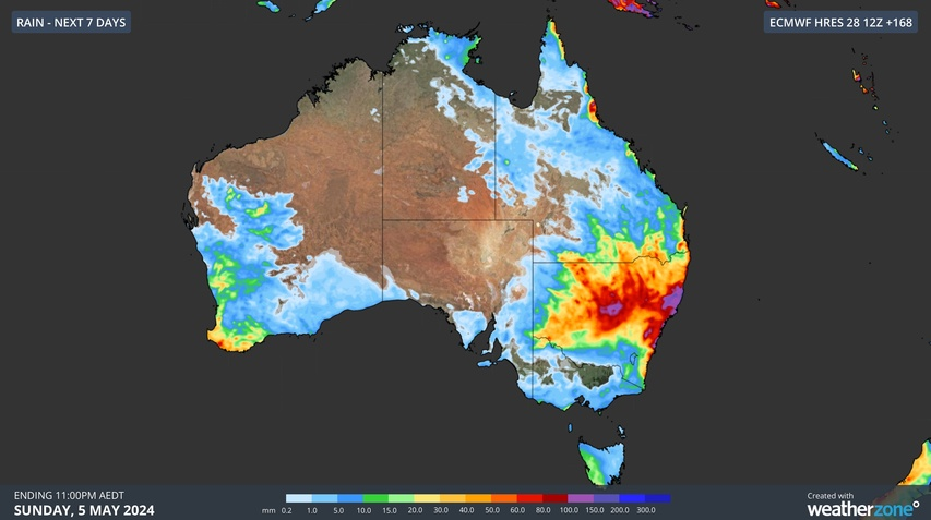
The maps below show forecasts from three different computer models for the next seven days combined.


Image: Forecast accumulated rain during the seven days ending on Sunday, May 5, according to the ECMWF-HRES (top), GFS (middle) and ACCESS-G (bottom) models.
Weather patterns like this can cause several hundred millimetres of rain along the NSW coast and adjacent ranges, particularly when low pressure systems or troughs form near the coast.
Daily rainfall forecasts for individual locations may jump around this week as new weather model guidance becomes available. Flood and severe weather warnings should also be issued later in the week as we get closer to the heaviest rain days.
DTN APAC, a DTN company, can assist during severe weather events such as this with our expert insights and daily briefings, helping to reduce the disruptive delays across the network.
We specialise in building customised weather monitoring and alerting solutions. These guide transport operators to plan and respond effectively. We tailor our data and analytics to your exact requirements. The following tools help the transport and rail sector daily.
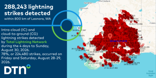
- Total Lightning Network- Precise lightning detection which pinpoints where your personnel need to prepare and respond.
- Stormtracker- visualise adverse weather conditions impacting your network, with multiple weather and alert layers which animate over your infrastructure.
- Nowcasting, forecasting and severe weather alerting services to help coordinate your team, limiting downtime and scheduling maintenance in optimal weather windows.
We provide customised weather intelligence to keep your transport business moving, for more information, please contact us at apac.sales@dtn.com.