What is the monsoon and MJO and how do they impact Australia’s weather?
A reminder, the Australian monsoon begins in December and lasts until around March and is characterised by cloud, heavy rainfall and cyclone activity over northern Australia (during an active phase).
The monsoon is a band of cloud and rain that moves over northern Australia in the wet season (summer) and well to the north of Australia during the dry season (winter). During the austral summer, the sun’s energy is focused further south on the southern hemisphere, bringing the monsoon or rain zone over the north of Australia.
The active monsoon was not the only factor at play during January. A pulse of cloud and rainfall that moves eastward around the equator called the Madden-Julian Oscillation (MJO), was also located near northern Australia. The MJO near northern Australia typically generates widespread heavy rainfall across the tropics and elevates the risk of cyclone development in Australian waters.
The MJO is currently located in the central Pacific and is expected to weaken, which typically reduces the chance of widespread heavy rainfall and tropical cyclone activity across the tropics. The MJO is most likely related to the break in the monsoon that is forecast for the remainder of this month. However, a trough over northeastern Australia will bring increased rainfall during the next week.
Monsoon break and the impacts on northern Australia.
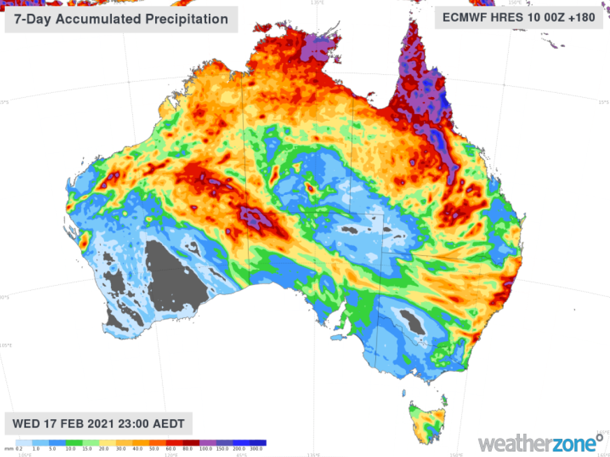
A break in the monsoon (or inactive monsoon), brings relief from widespread rain and storms and reduces the potential for cyclone activity for the tropics. However, northeastern Australia is still likely to observe above normal rainfall, due to a trough (not the monsoon) lingering in the region in the next week. While a trough remains in the northeast, any cyclone development will remain away from the Queensland coast. Otherwise, the tropics during an inactive monsoon phase still experience thunderstorm and shower activity, high humidity and lighter winds.
How will a monsoon break impact southern Australia? Heatwaves?
Active monsoon periods may provide increased moisture to the southern Australian weather patterns. In the right conditions, the monsoon can lead to above normal rainfall, storm activity, cloud cover and humidity in southern Australia. This was observed during January. The elevated moisture and cloud over southeastern Australia lead to cooler daytime temperatures and fewer extreme temperatures during January.
During a monsoon break, the moisture available to southern Australian weather patterns is reduced. Therefore, the likelihood of heatwaves and or extreme temperatures increases.
As such, models are in agreement regarding heat building over the region for an extended period from Tuesday the 16th of February. At this stage, extreme heat is possible for southeastern Australia between Wednesday 17th and Monday 22nd, depending on the timing of a southerly change.
While a rain band is expected to move through southeastern Australia from today to Sunday 14th, skies are predicted to be clearer during the monsoon break, increasing solar influx.
For detailed information on the late summer heat, cyclone and rainfall potential please head to your dashboard or contact us at apac.sales@dtn.com.


