
Prosper in a dynamic world
Search

Tropical cyclone Karim forms out of season


A late-season tropical cyclone over the Indian Ocean will fuel rainfall over southwestern Australia later this week. 

Australia’s tropical cyclone season officially ended more than a week ago April 30th. However, unusually warm water over the eastern Indian Ocean has helped spawn an out-of-season tropical cyclone just inside the western boundary of Australia’s area of responsibility. 

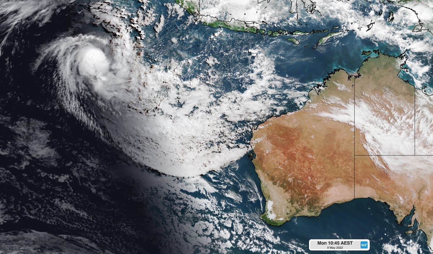
Tropical cyclone Karim developed well to the northwest of WA on the weekend and strengthened into a category two system overnight. At 2am AWST on Monday, Karim was located 700 km west of Cocos Island. 

 MicrosoftTeams-image (394)

Image: The sun rises over Tropical Cyclone Karim on Monday morning. 

Fortunately, Tropical Cyclone Karin is expected to move south and gradually weaken over the next few days, staying well away from the Cocos (keeling) Islands and mainland Australia. 

However, tropical moisture associated with the weakening cyclone will drift south and bring rain to southwestern Australia on Thursday and Friday. 

Showers will start to increase over the west coast of WA from late Wednesday, before rain becomes heavier and more widespread on Thursday into Friday. 

The map below shows how much rain one computer model is predicting by Friday night. 

 MicrosoftTeams-image (393)

Image: Forecast accumulated rain between Monday and Friday this week, according to the ECMWF-HRES model. 

Tropical Cyclone Karim is the 10th tropical cyclone to move through the Australian region since the start of the 2021/22 tropical cyclone season in November 2021. For more information on Weatherzone’s tropical cyclone services, please contact us at apac.sales@dtn.com. 

Latest news

Satisfy your weather obsession with these news headlines from around the nation, and the world.

Signs of a positive Indian Ocean Dipole, but it may not follow the textbook

Waters off Indonesia have cooled in recent weeks, an indication that a positive Indian Ocean Dipole (IOD) event could be developing. It’s an important climate driver for Australia, and it could shape rainfall and temperatures heading into summer, with flow-on effects for farmers, energy and other industries.  What is the Indian Ocean Dipole?  The IOD […]

1.3 million lightning strikes and a record September downpour: the storms testing WA’s Goldfields

Leonora, WA, had its wettest September day on record earlier this month. Three weeks later, more than 1.3 million lightning pulses were detected within 800 km of the town in 48 hours. Why is a stalled trough delivering storms to mining country, and what it could mean for operations?  The DTN Total Lightning Network detected […]

A very low wind power week, likely to continue

A stubborn blocking high over southern Australia will make for a very quiet week for wind generation and the pattern behind it isn’t a one-off.   It’s the seasonal signature of a super (very strong) El Niño combined with a positive Southern Annular Mode (SAM), and both the historical record and the current seasonal forecast suggest it’s likely to keep recurring through spring before a potential switch from November.  The setup right […]

Fastest strengthening El Niño on record: Impacts on Australian monsoon timing and wet season planning

Australia’s Mining and Resources sectors are bracing for a wet season shaped by one of the most rapidly developing El Niño events on record.    Looking back at how the strongest El Niño events in Australian history have played out, it becomes apparent that mining operations in Australia should be planning for a later monsoon […]


