A tropical cyclone looks to form during the week and should make landfall over the Western Australian coast this weekend.
A weak tropical low is currently just north of the Top End and is tracking to the west. While it will remain weak over the next few days, the monsoon is bringing rain and squally storms to the Top End coast, including Darwin, on Monday and Tuesday.
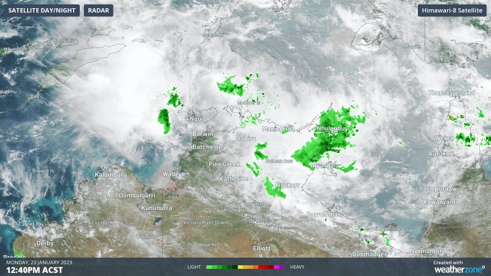
Image: The tropical low and monsoon over the Top End on Monday afternoon
This low will start to intensify on Wednesday when it is just of south of Indonesia’s East Nusa Tenggara. This is also when the low will begin its recurving course to head towards the Kimberley or Pilbara coast at an accelerating pace.
This is the crucial stage for this low, because its following landfall position could vary widely based on where it starts this recurve track. Currently, both the EC and Access models predict this tropical cyclone will form, but previous runs have it making landfall anywhere between Broome and Exmouth, but most likely near Eighty Mile Beach.
When the tropical low tracks towards the coast it is expected to intensify and is considered a high chance (greater than 50% chance) to become a tropical cyclone before making landfall, most likely as a category 1 or 2. It is likely to cross the coast on Saturday 28th and dissipate over land during Sunday 29th.
Category 1 tropical cyclones bring wind gusts of 90-125km/h, while category 2 can bring gusts of 126-165km/h near the powerful eyewall. The next tropical cyclone to form in the Australian region will be named ‘Freddy’.
Intense rainfall is also likely to occur as this system crosses the coast and is still expected even if the system doesn’t fully intensify into a tropical cyclone. Models are predicting areas near the low and on its eastern flank to receive 150-300mm of rainfall in 12-36 hours, but landfall will be short and sharp due to its fast-moving speed. Furthermore, its fast movement could push heavy rainfall well into the interior of WA.
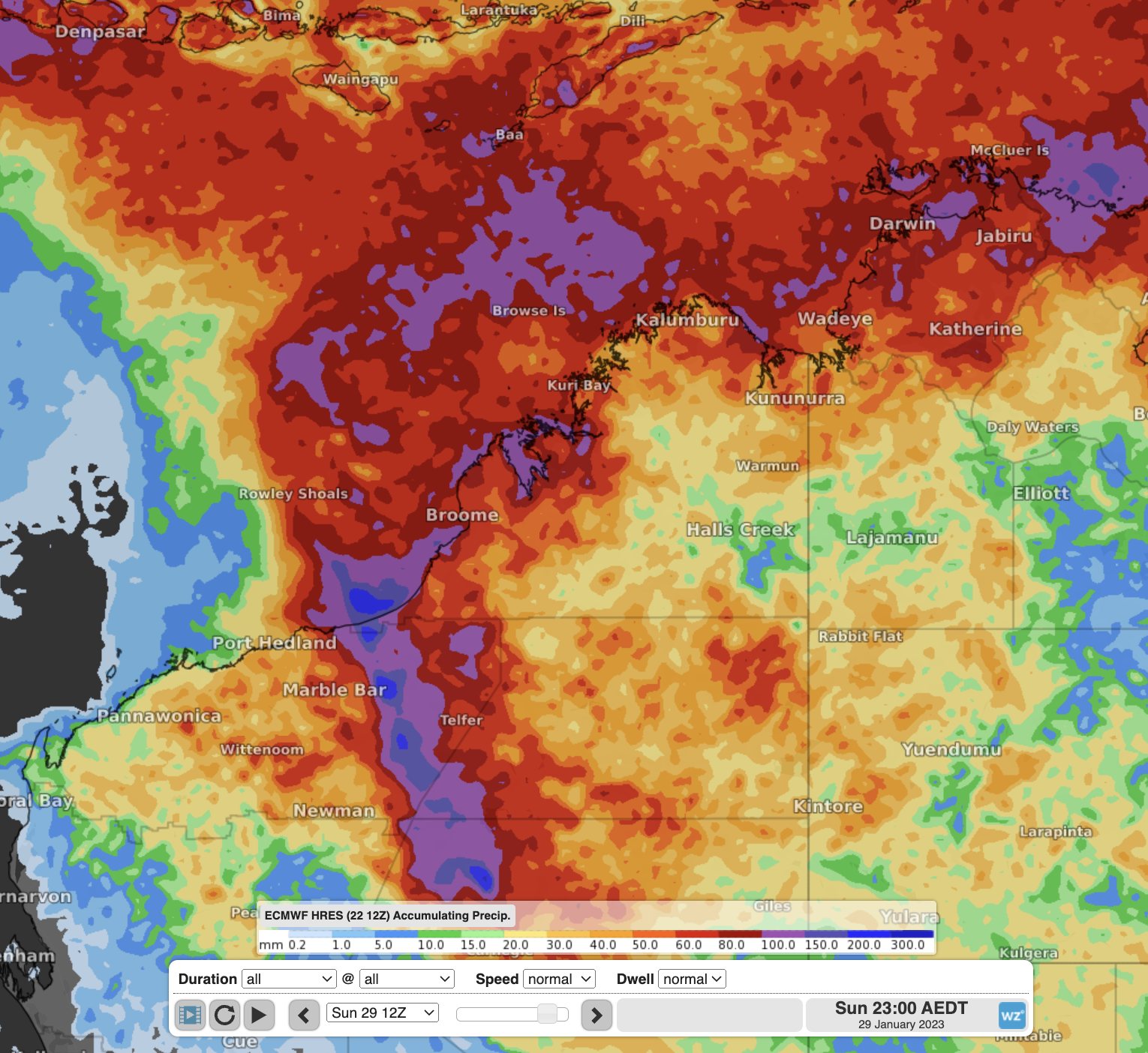
Image: Accumulated rainfall to Sunday 29th from EC, showing the high-rainfall track of the tropical low/cyclone.
There is quite a bit of uncertainty with this system, but forecasts will start to become clearer from Wednesday after the curve towards Australia has taken place. Stay up to date with the latest warnings here and the latest advisories and track maps issue by the BoM here.
DTN APAC provides detailed specific forecasts to clients when a tropical cyclone is expected to impact them. We provide detailed forecasts of wind, rainfall, and waves for you particular unique assets so you know what weather is headed your way. To find out more, please email us at apac.sales@dtn.com.


