Tropical Cyclone Freddy has made landfall near Vilankulos, Mozambique. Although the system is weakening it will continue to cause heavy rainfall leading to flooding for parts of Mozambique and Zimbabwe.
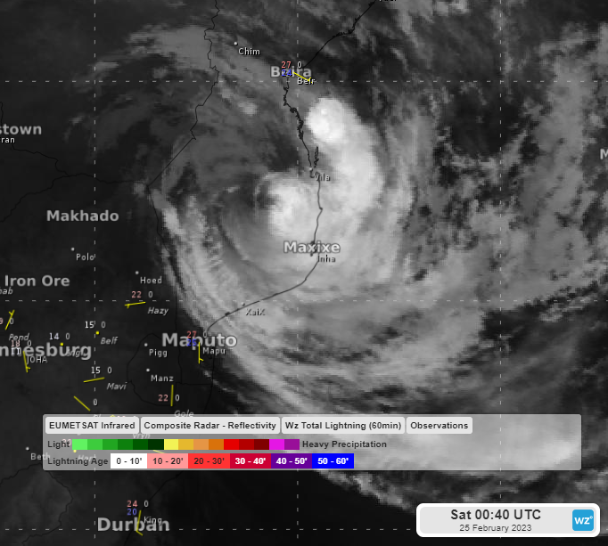
Image: Infrared satellite imagery at 00:40 UTC February 25th. Source: EUMETSAT.
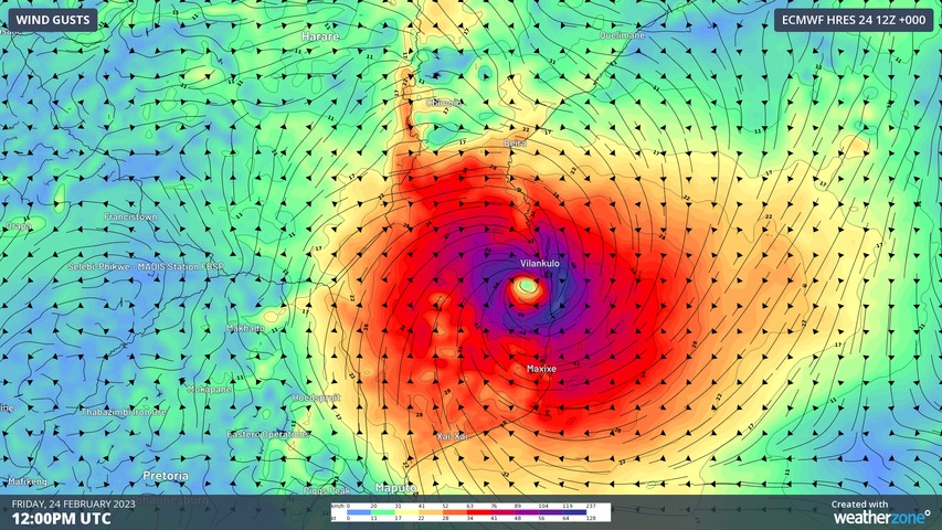
Wind gusts exceeding 90km/h should continue for the next 24 hours but weaken beyond that time. However, heavy downpours will continue for several days, heaviest during the next two.

Image: Wind gusts at 12 UTC Friday 24th according to the ECMWF model
Rainfall totals during the next 48 hours are predicted to reach 300-600mm as shown with the ECMWF model below (colour scale only goes to 300mm).

Image: 48-hour rainfall totals to 12 UTC Sunday 26th according to the ECMWF model.
This is not the first country that Tropical Cyclone Freddy has brought its destructive force against. It smashed Madagascar on February 21st, destroying houses, displacing thousands, and killing at least seven people. As the tropical cyclone continued westward over the Mozambique Channel, the warm water allowed it to restrengthen before crashing into Mozambique at 2pm local time on February 24th.
Tropical Cyclone Freddy has now crossed the entire Indian Ocean, about a 10,000 km journey, or about 1/4 of the earths surface. 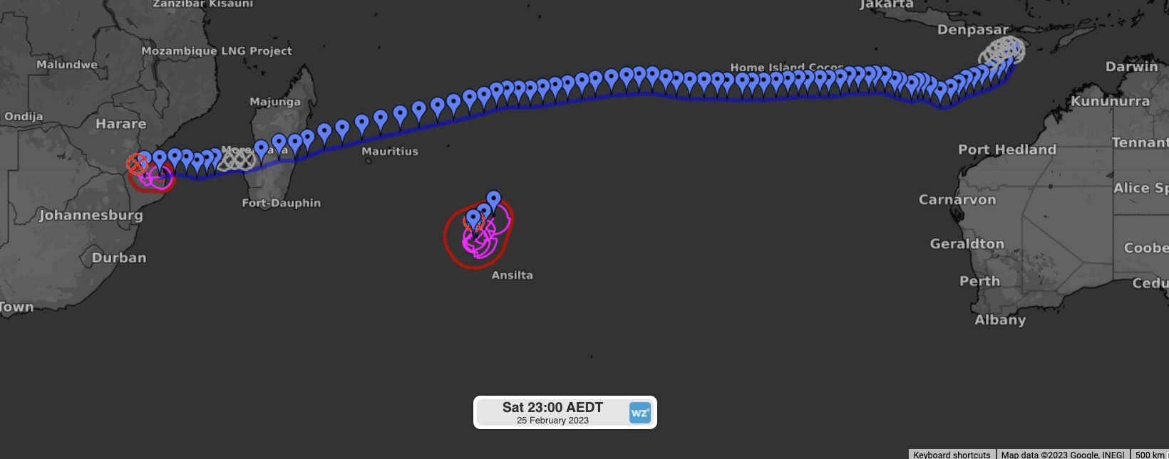
Image: JTWC track of Tropical Cyclone Freddy
See also:
- Cyclone Freddy now most energetic S Hemisphere cyclone on record
- Tropical Cyclone Freddy could be headed for the record books
How Weatherzone can help you prepare for Tropical Cyclones
DTN APAC has a suite of tropical cyclones services we provide to deliver our clients with as much forewarning of tropical cyclones as we can. We have 4 levels of forecasts timeframes:
- Tropical cyclone seasonal outlooks
- Weekly tropical update
- Daily 7-day tropical cyclone forecast
- Detailed tropical cyclone impacts (issued every 1-6 hours aligning with offical advisories)
Through these products you can have as much preparation as possible for tropical cyclones and their impacts. To find out more, please email us at apac.sales@dtn.com.


