Tropical Cyclone Fili formed over the eastern Coral Sea on Tuesday morning and is likely to gain strength over the next few days.
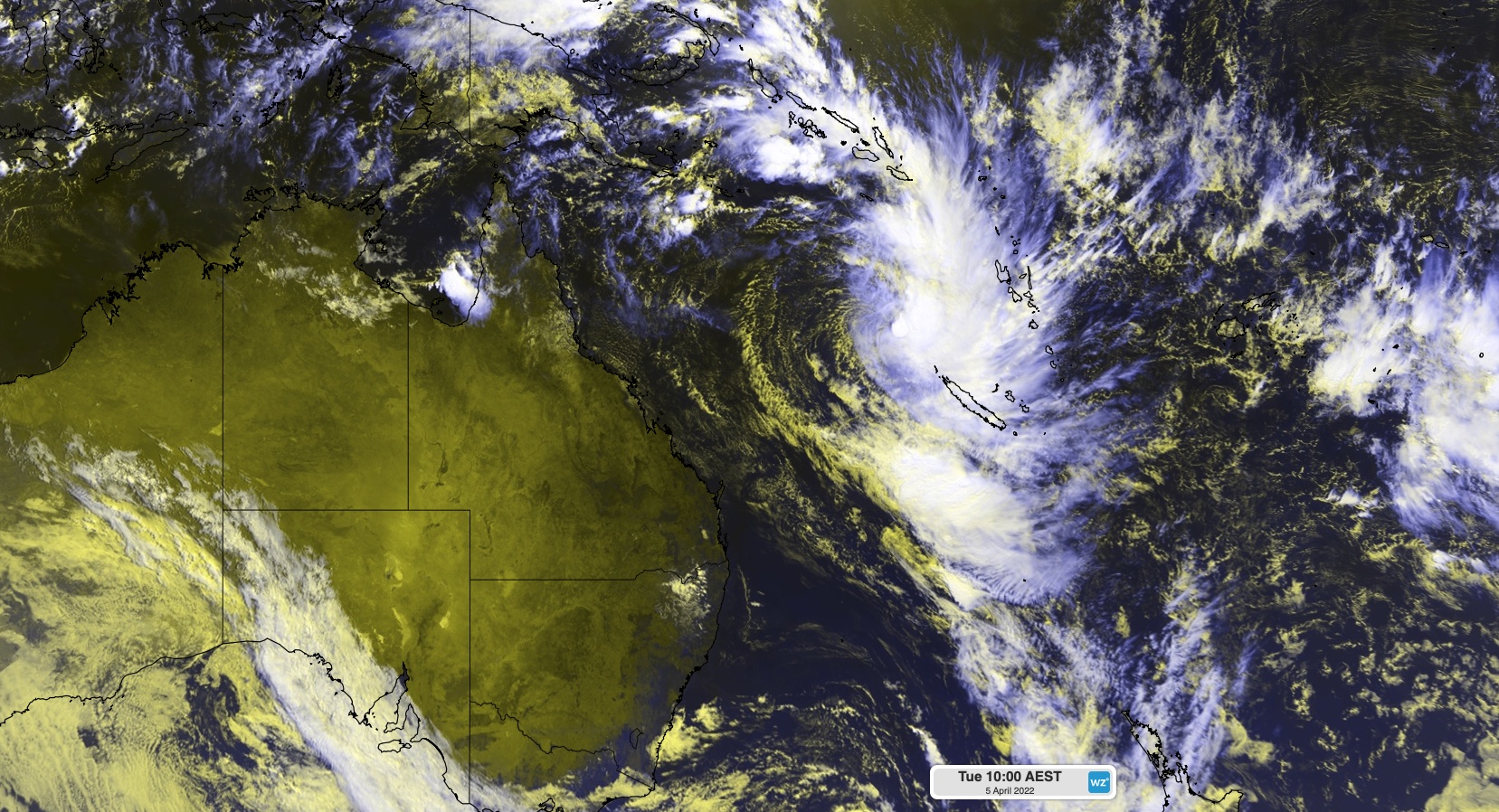
The satellite images below show a mass of cloud encircling the tropical cyclone around 750 kilometres to the west of Vanuatu at 10am AEST on Tuesday, April 5.


Images: Enhanced visible infrared/visible satellite images showing Tropical Cyclone Fili located to the west of Vanuatu at 10am AEST (0000 UTC) on Tuesday morning.
The cyclone is currently located just outside the Eastern Region of Australia’s area of responsibility for tropical cyclone monitoring. This means it was named by the Fiji Meteorological Service and did not take one of the names from Australia’s pre-determined list.
Fili is likely to move towards the south southeast over the next few days, most likely passing to the west of New Caledonia between now and Thursday. Despite staying well offshore, the passing tropical cyclone could still cause damaging winds and heavy rain over northern parts of New Caledonia in the middle of the week.
There is a chance the system could fleetingly move into the eastern fringe of Australian region over the coming days, although it is expected to remain well to the east of the Australian mainland.
Looking further ahead, there is some model uncertainty with the track of the system later in the week, with several model showing the low passing to the north of Norfolk and to the north of New Zealand. However, one model shows the system tracking south and passing to the west of Norfolk Island over the weekend, before moving towards New Zealand early next week. This model uncertainty makes it difficult to predict the system’s impacts beyond about Thursday.
The maps below show the predicted positions of the low pressure system on Saturday night from two different computer models. By this stage, it may have transitioned into an extra-tropical cyclone.


Images: Forecast mean sea level pressure and accumulated 24-hour rain at 10pm AEST (1200 UTC) on Saturday, April 9, according to the ECMWF-HRES model (top) and GFS model (bottom).
While this tropical cyclone is not expected to move towards the Australian mainland, it will create a tight pressure gradient over the Tasman Sea as it pushes against a high pressure system located further south. This pressure gradient will drive easterly winds towards Australia, promoting wet and windy weather across parts of eastern NSW and QLD in the second half of the week. If the low does pass to the west of Norfolk Island, this would increase the wind and rain over eastern Australia.
The persistent easterly winds ahead of this approaching low should also whip up more large swell for parts of NSW and southern QLD, particularly if the system tracks closer to the mainland.
Official track maps for Tropical Cyclone Fili can be found on the Fiji Meteorological Service website. For more information on Weatherzone’s tropical cyclone forecasting, please contact us at apac.sales@dtn.com.


