
Tropical activity is set to increase across northern Australia, thanks to a pulse of cloud and rainfall called the Madden-Julian Oscillation (MJO) which is approaching the Australian region. This is expected to bring widespread rain and storms and an increased chance of tropical cyclones.
Most models show a low developing in the waters south of Indonesia by the end of this week (figure 1), however from then onwards the models have it moving in many different directions. Some models show the low moving towards the Top end while others show the low heading towards the Kimberley.
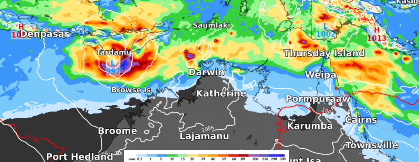
Figure 1: European model mean sea level pressure (MSLP) and 24-hour rainfall up to Friday 2 April at 5pm EDT.
Given the uncertainty in the track of the low/s, please continue to check the forecasts in the coming days.
A summary of the tropic cyclone season so far..
Coming into the 2020/21 tropical cyclone seasons, all signs were pointing towards an above-average number of cyclones in the Australian region.
So far this season, this hasn’t eventuated. So what happened?
The tropics have actually been very active this season with 22 tropical lows generating widespread rainfall and strong winds across northern Australia. During summer, much of Australia saw above normal rainfall, with parts of the Top End observing the highest rainfall on record.
Despite the high number of tropical lows that have formed, only six have developed into tropical cyclones. This falls well below the average of nine to eleven a season.
This went against expectations because we were primed for an above normal tropical cyclone season owing to La Niña and warm oceans across northern Australia. The warm oceans are one of the ingredients cyclones need to develop- think of the oceans as their energy source or fuel.
So why have there been so few cyclones this season?
Firstly, many of the low pressure systems have developed on or near the coastline, which has deprived them of their ‘fuel’ (warm ocean) that they need to develop.
Secondly, the wind setup has not been quite right, with opposing winds at different heights in the atmosphere, breaking the storm apart and working against each other.
Finally, the season is not over, it ends late April with an active beginning to the month forecast. Never fear our meteorologists will be watching any tropical low development in the next month or so. So please ensure you stay abreast of our updates and warnings during the last part of the cyclone season. For further information please contact us at apac.sales@dtn.com.




