
A dangerous burst of wild weather will strike the southwest of WA on Monday and Tuesday as a deep low pressure system rolls in from the Indian Ocean.
Satellite imagery captured the deep mid-latitude low pressure system hovering about 600 km to the southwest of WA as the sun rose on Monday morning.

Image: Himiwari-8 visible true-colour satellite image captured at 9am AWST on Monday, May 23.
This low will approach WA on Monday and should pass over the state’s southwest on Monday night, bringing damaging to destructive winds, heavy rain and potentially severe thunderstorms. This is the type of low pressure system that southwestern Australia only sees once or twice a year.
Heavy rainfall is likely to occur on Monday afternoon and night, with six hourly rainfall totals of 50 to 70mm possible. Rain should start easing into Tuesday morning.
The map below shows one model’s rainfall forecast between Monday morning and Tuesday morning, with widespread rainfall totals of 40-60mm forecast along the coastal fringe, with pockets of 80-100mm possible in some areas. Most of this rain will fall by Monday night.

Image: ECMWF forecast accumulated rainfall from Monday morning to 8am WST on Tuesday.
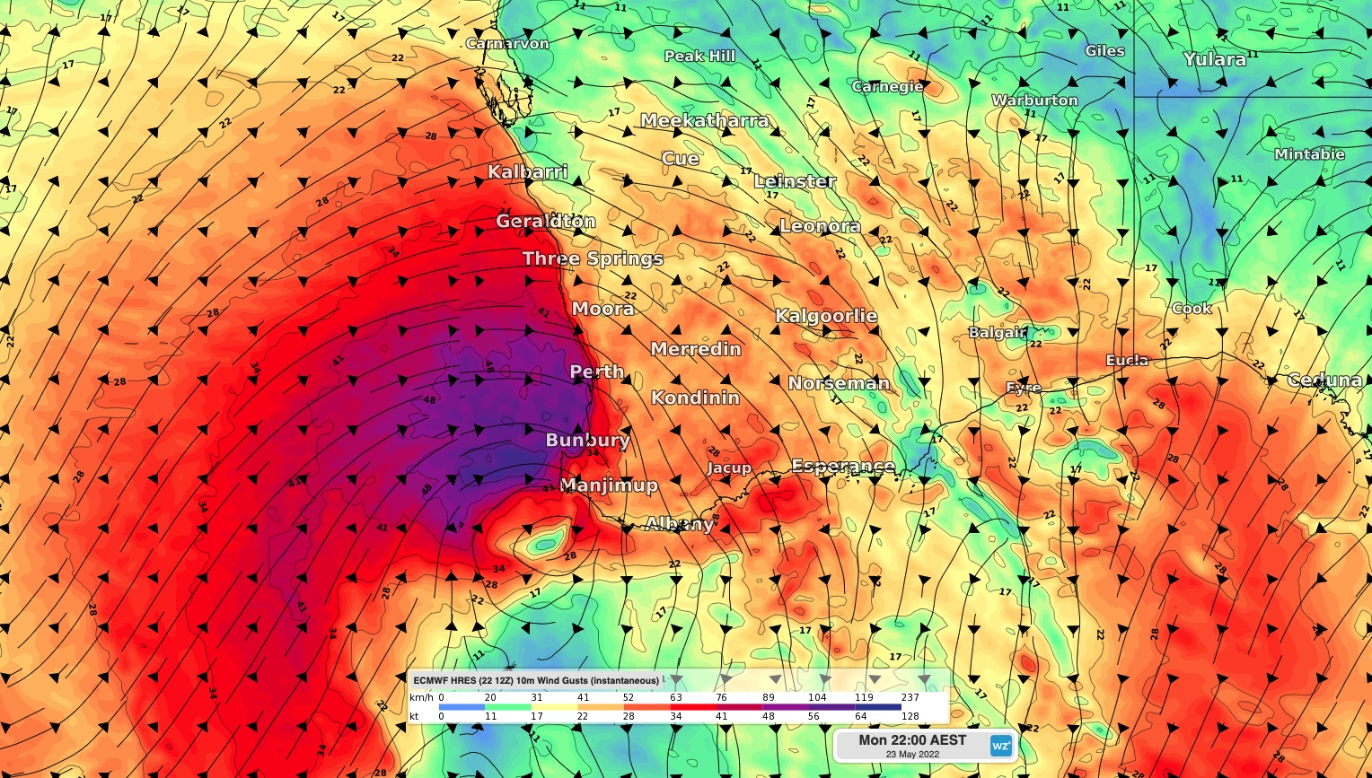
As the low pressure system nears the west coast, fierce winds will also lash parts of southwestern WA. On Monday morning wind gusts reached 104 km/h at Mandurah and 93km/h at Rottnest Island.
Widespread damaging winds with average speeds of 60 to 70 km/h are forecast across the state’s southwest on Monday into Tuesday, with gusts potentially reaching 100 to 120km/h. Locally destructive gusts exceeding 125 km/h are possible during Monday afternoon and overnight into Tuesday. These dangerous winds may affect Perth, Mandurah, Bunbury, Margaret River, Busselton, Geraldton and Albany.
The map below shows one model’s wind gust forecast for Monday evening as the strong winds impacting southwestern WA.

Image: Forecast wind gust speed and direction at 8pm AST on Monday, according to the ECMWF-HRES model.
While winds should ease below damaging strength during Tuesday, strong southwesterly winds will persist for most of Tuesday before easing on Wednesday.
In addition to a severe weather warning that has been issued for destructive winds and heavy rainfall, severe thunderstorm warnings may be issued on Monday and early Tuesday morning. Be sure to keep an eye out for the latest warnings as this dangerous low-pressure system moves over the state. For more information on Weatherzone’s wind, heavy rain and thunderstorm forecasting and alerting, please contact us at apac.sales@dtn.com.




