Australia just recorded its second hottest summer, with southern Australia continuing to experience drought heightening fire risk in autumn.
The Australasian Fire and Emergency Services Authorities Council (AFAC) released their autumn bushfire outlook for 2025 on Thursday, February 27, showing an increased fire risk stretching the coastline from Carnarvon in WA down towards the Gippsland in Vic.
The red shading on the map below shows areas that have an increased risk of fires over the next three months. The remaining grey areas on the map have a near-normal risk of autumn fires, according to the AFAC outlook.
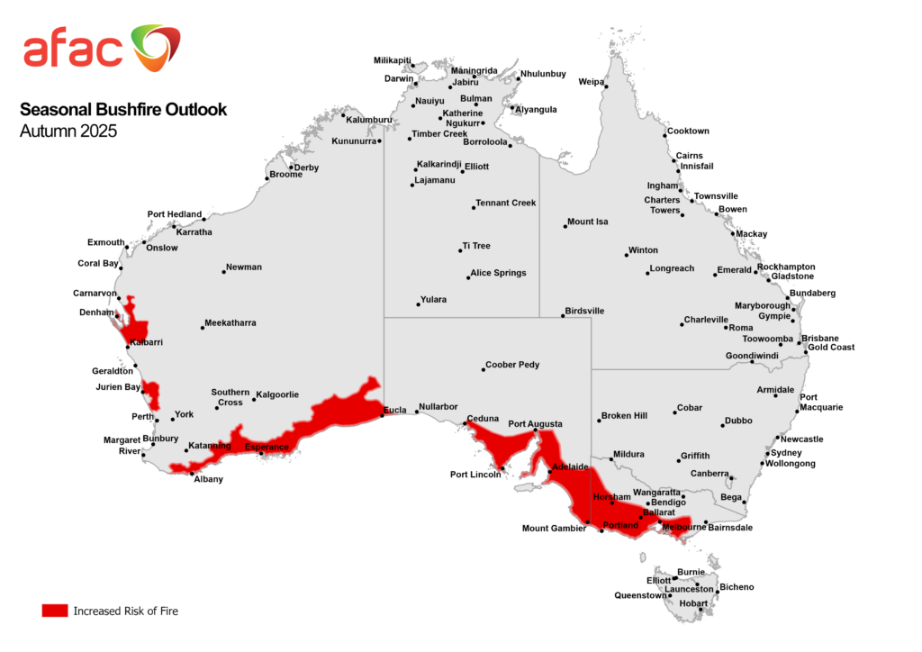
Image: Australian seasonal bushfire outlook for Autumn 2025. Source: AFAC
A key driver behind the high fire risk forecast in the south is the severe rainfall deficiencies that parts of Australia have been experiencing in over a year. The lowest rainfall on record was recorded in the past twelve months across parts of southern WA and SA and western Tas.
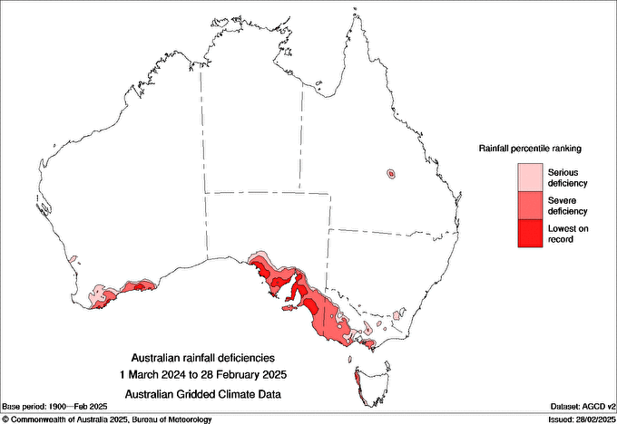
Image: Australian rainfall deficiencies between 1 March 2024 and 28 February 2025. Source: Bureau of Meteorology.
Summer was also very dry in these areas, particularly for the southern districts of SA. In addition to the dry weather, Australia saw its second-hottest summer since national records were first kept in 1910, while it was the hottest summer on record in Western Australia. The hot and dry weather across southern Australia during summer meant that vegetation has dried out, making it more flammable.
As we head into autumn there are no major climate forcings for rainfall across southern parts of Australia and the models below show a lower chance of wetter than normal conditions in the coming months.
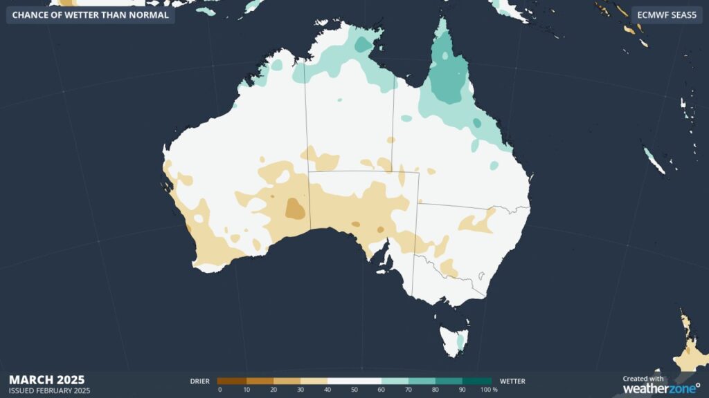
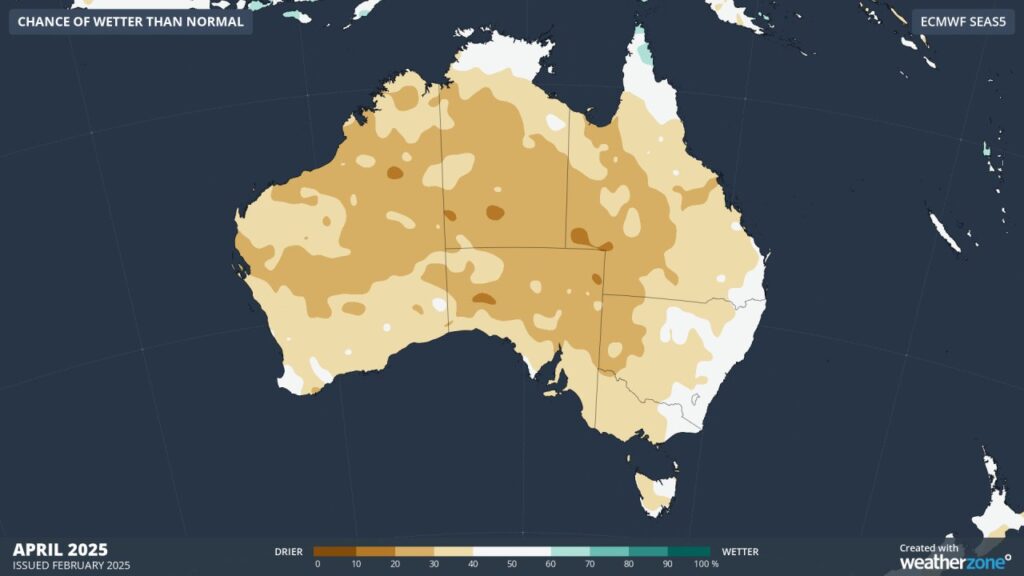 Images: Chance of wetter than normal conditions for March and April 2025, according to ECMWF
This rainfall forecast means that conditions should continue to be dry with increased fire risk across the south of the country in the coming months. Meanwhile, temperatures are forecast to be above average in autumn, although by mid to late autumn the risk of heat will lower significantly.
Working in often severe conditions in the high-risk fields of forestry and emergency, our consolidated weather services can ensure full situational awareness for you and your team.
DTN APAC serves the forestry and emergency sectors, delivering trusted weather data and severe weather alerting to maintain safety, protect your assets and underpin your planning.
DTN APAC’s trusted nowcasting and forecasting system, OpticastTM, is independently proven to outperform other industry models, allowing you to respond rapidly to changing conditions. Opticast can ingest data from your on-site weather observation equipment, ensuring your forecast is customised to your local microclimate. From nowcasting and 14 day forecasting to seasonal outlooks, you have powerful, hyper-local weather alerting and intelligence, giving you decisive confidence when it’s most needed.
With lightning a prominent cause of forest fires throughout Australia, DTN APAC’s Total Lightning Network offers real-time detection and unsurpassed accuracy of lightning strikes to <200m. Based on a vast sensor network, both intra-cloud and cloud-to-ground strikes are located, ensuring you are alerted when severe weather is building and threatening your teams, assets and infrastructure. When volatile conditions increase the ferocity of fire it’s imperative you have lead-time to enact safety plans, keeping your people out of harm’s way.
Your weather intelligence is accessible across all devices in your network via our Weatherguard App, and your customisable interface.
We are there for you when you need us the most – 24/7, 365 days a year. To find out more about large range of products and services contact us at sales.apac@dtn.com
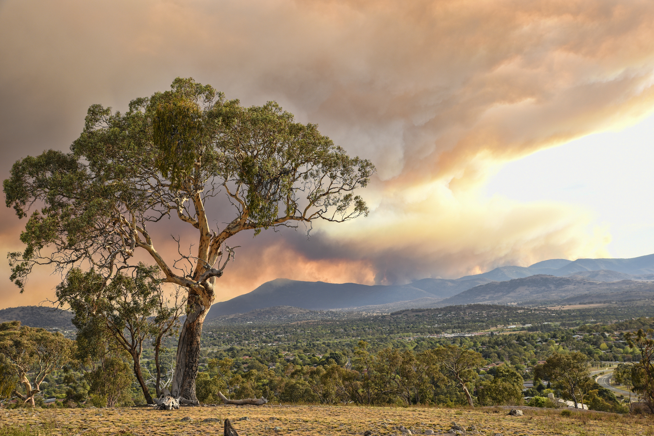
Thumbnail credit: Istock/Daniiielc


