Prosper in a dynamic world
Search

Sky forecast for this week’s trio of meteor showers

The peak of three meteor showers will coincide with a new moon later this week, offering Australian sky-watchers a chance to catch a glimpse of meteors streaking across a dark sky. But will the sky be clear enough to witness the spectacle from your place?

The Southern delta Aquariids, alpha Capricornids and Piscis Austrinids meteor showers are all currently underway, and will all reach a peak in activity between the 28th to 30th of July.

This year, the trio of meteor showers occurs at the same time as a new moon. So, while these aren’t the year’s most active meteor showers, there will be plenty of dark sky to help you see any meteors that fly by in the coming nights.

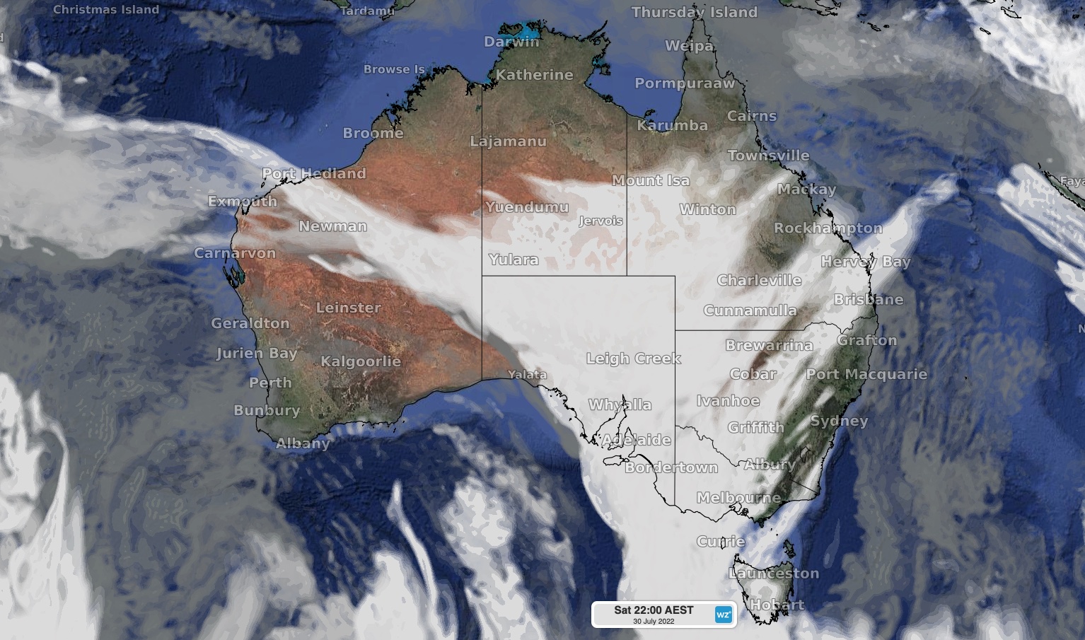
The maps below give a guide as to where clouds will be located at 10pm AEST on each of the next three nights.
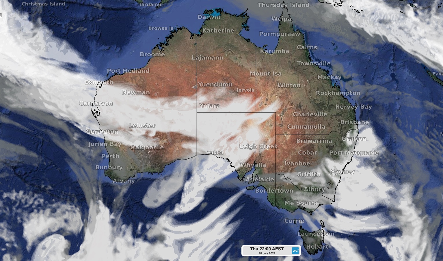
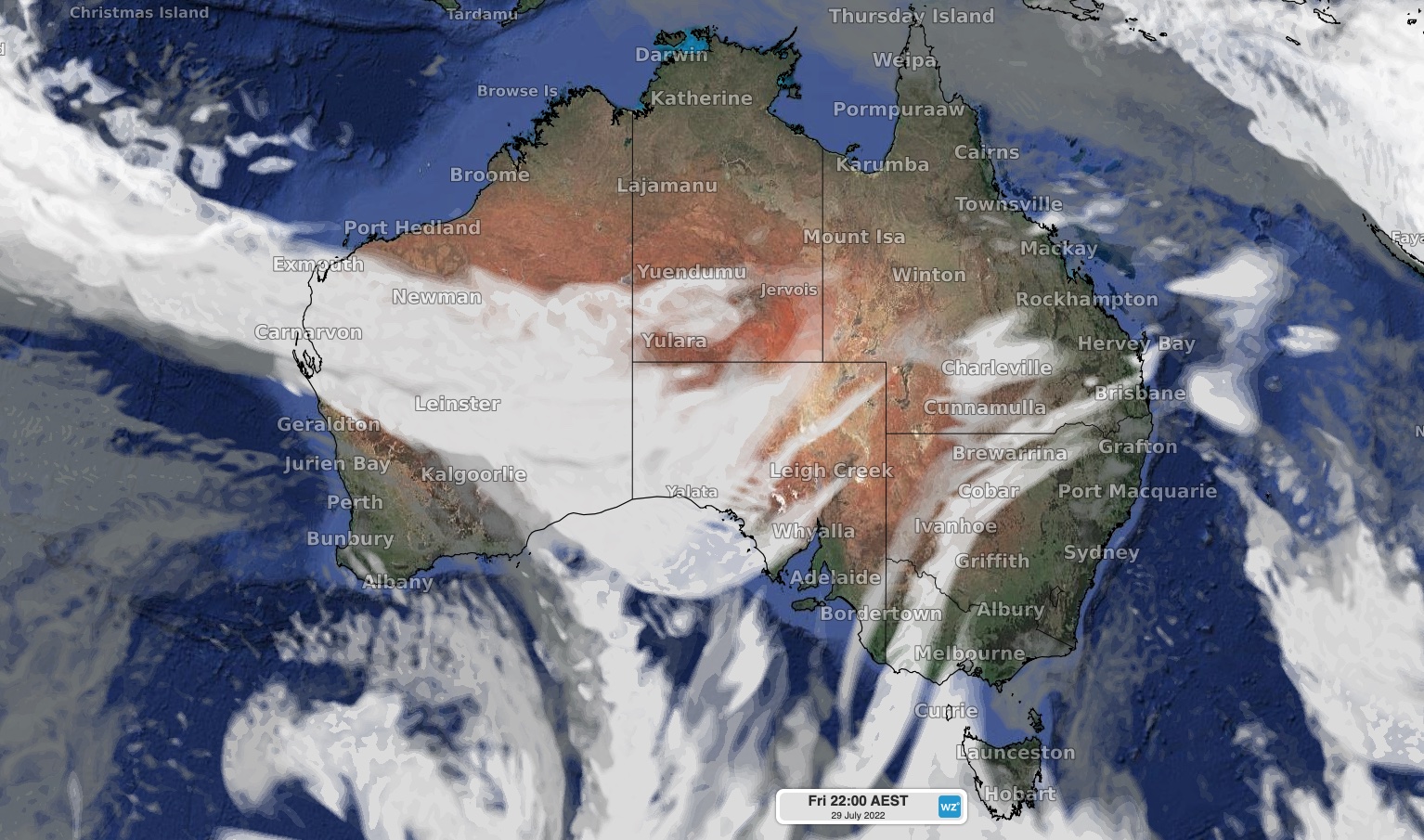
Images: Forecast cloud cover at 10pm AEST on Thursday (top), Friday (middle) and Saturday (bottom) this week, according to the ECMWF model. The darker grey shading represents low-level clouds, while lighter grey represents higher cloud tops.

Unfortunately, parts of western, central and southern Australia will have some cloud to contend with over the coming nights thanks to the passage of a cold front. But the good news is that the meteor showers will be visible into early-August as well.

For more information, please contact us at apac.sales@dtn.com.

Latest news

Satisfy your weather obsession with these news headlines from around the nation, and the world.

Signs of a positive Indian Ocean Dipole, but it may not follow the textbook

Waters off Indonesia have cooled in recent weeks, an indication that a positive Indian Ocean Dipole (IOD) event could be developing. It’s an important climate driver for Australia, and it could shape rainfall and temperatures heading into summer, with flow-on effects for farmers, energy and other industries.  What is the Indian Ocean Dipole?  The IOD […]

1.3 million lightning strikes and a record September downpour: the storms testing WA’s Goldfields

Leonora, WA, had its wettest September day on record earlier this month. Three weeks later, more than 1.3 million lightning pulses were detected within 800 km of the town in 48 hours. Why is a stalled trough delivering storms to mining country, and what it could mean for operations?  The DTN Total Lightning Network detected […]

A very low wind power week, likely to continue

A stubborn blocking high over southern Australia will make for a very quiet week for wind generation and the pattern behind it isn’t a one-off.   It’s the seasonal signature of a super (very strong) El Niño combined with a positive Southern Annular Mode (SAM), and both the historical record and the current seasonal forecast suggest it’s likely to keep recurring through spring before a potential switch from November.  The setup right […]

Fastest strengthening El Niño on record: Impacts on Australian monsoon timing and wet season planning

Australia’s Mining and Resources sectors are bracing for a wet season shaped by one of the most rapidly developing El Niño events on record.    Looking back at how the strongest El Niño events in Australian history have played out, it becomes apparent that mining operations in Australia should be planning for a later monsoon […]