A lone lightning strike from a tiny storm on Friday was all it took to start an intense blaze near Serpentine on Friday, serving as a reminder as to the danger thunderstorms can pose.
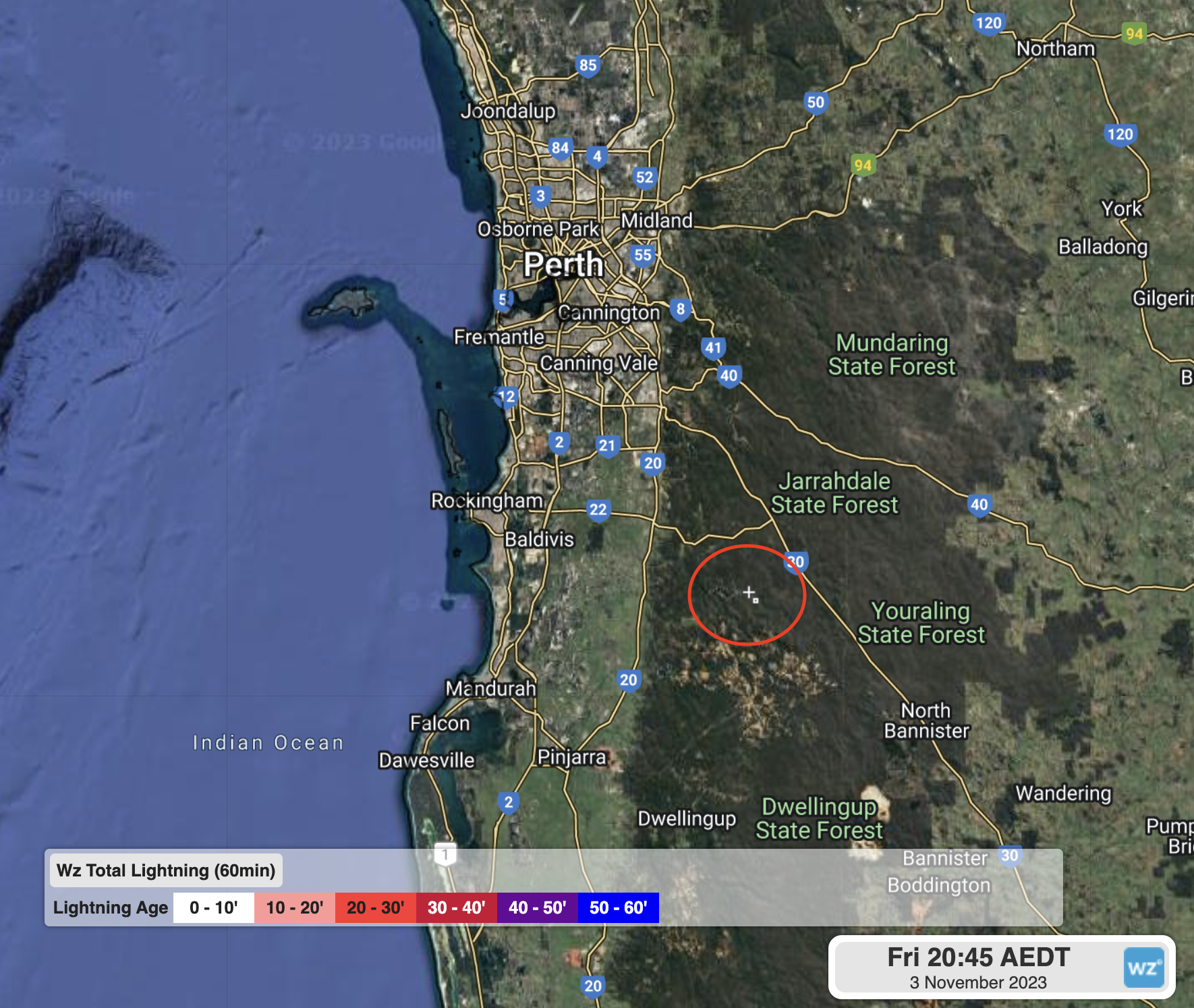
Image: A single cloud-to-ground lightning strike (circled in red) recorded on Friday afternoon near Serpentine Main Dam from the Total Lightning Network (WZTLN).
A broken line of showers was crossing the region from the north late on Friday 3rd November afternoon when one cell turned into a thunderstorm, producing the lightning strike.
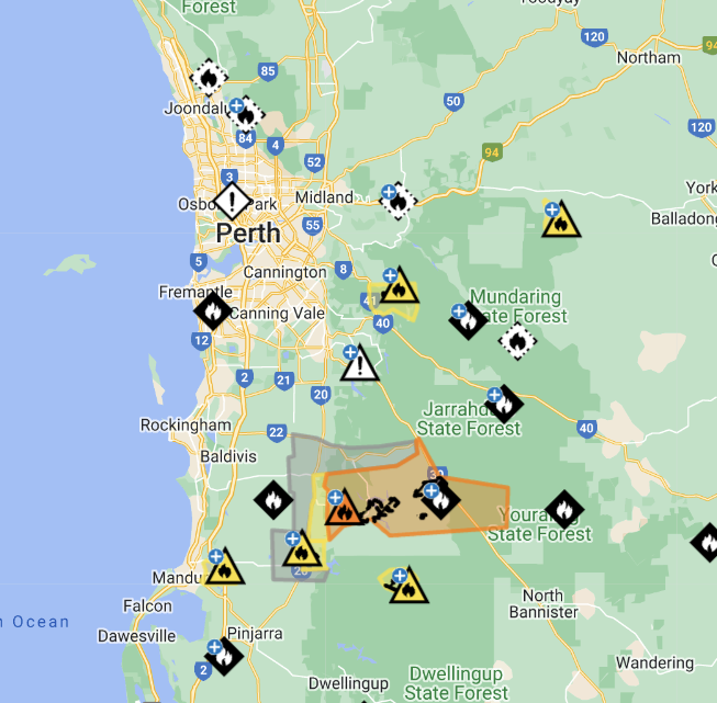
Image: Fires monitored by Emergency WA around Perth at 1pm Monday 6th. The Serpentine fire is coloured in orange.
Lightning is extremely hot; about 30,000°C or five times hotter than the surface of the sun. When a bolt strikes a tree, it superheats the water contained within, usually causing part of the tree to explode. If the rest of the tree is dry enough, it can light the tree or limbs on fire, starting a bushfire. Similarly, a single strike can light nearby dry grass on fire and start a grass or scrubfire.
This storm couldn’t have occurred at a worse time for bushfire weather in the region. Southwestern parts of WA were in the middle of a low-intensity heatwave, with temperatures reaching 34.6°C and 36.0°C in Perth on Friday and Saturday respectively. Coupled with low surface humidity and persistent easterly winds, the newly started fire quickly grew in size and intensity.
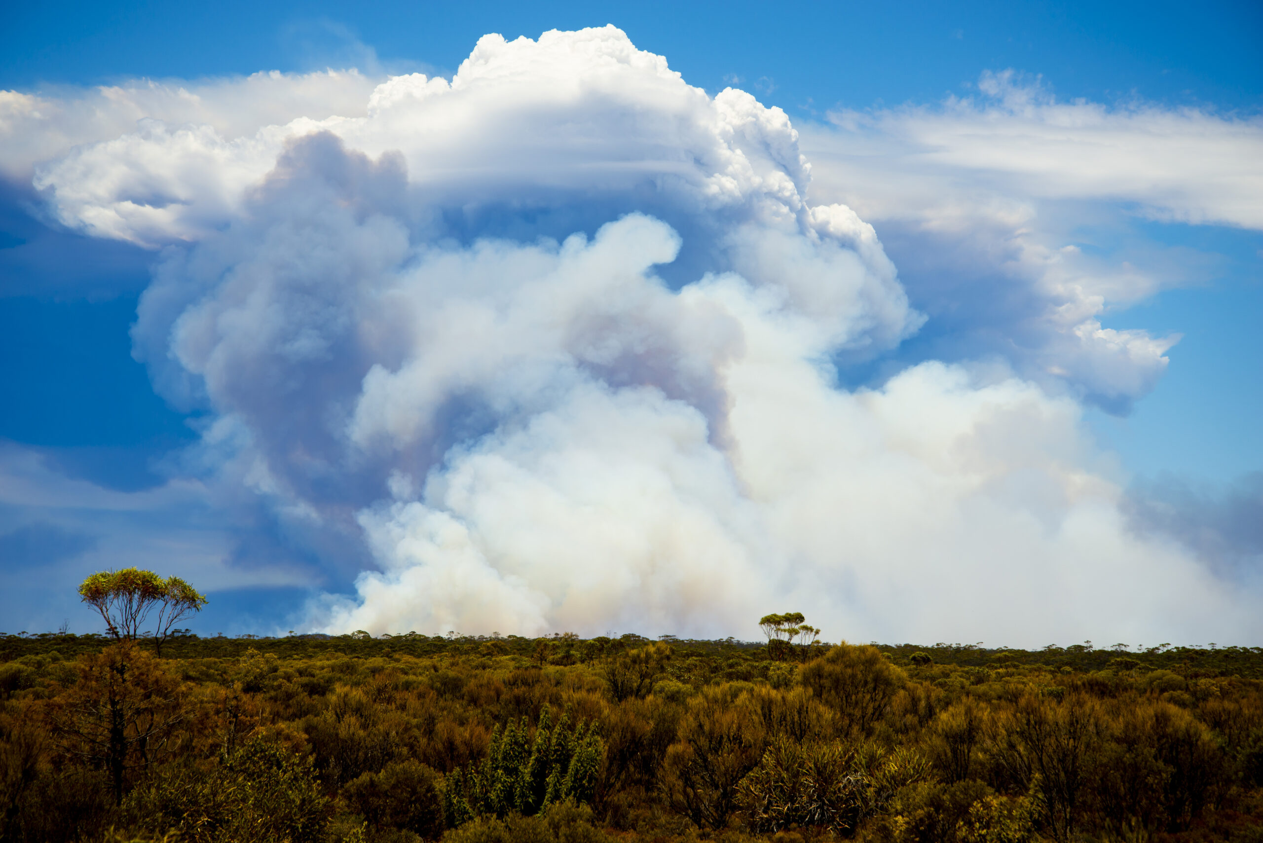
Less than 24 hours after starting, the fire was burning out-of-control at emergency level. The smoke from this blaze can be seen below.
The good news is that while the Serpentine fire is still at a ‘Watch and Act’ level as of 1pm Monday, conditions have eased considerably from the weekend with temperatures hovering in the mid-to-high twenties over the coming week. Winds will be light-moderate until a cold front delivers fresh S/SW winds on Thursday.
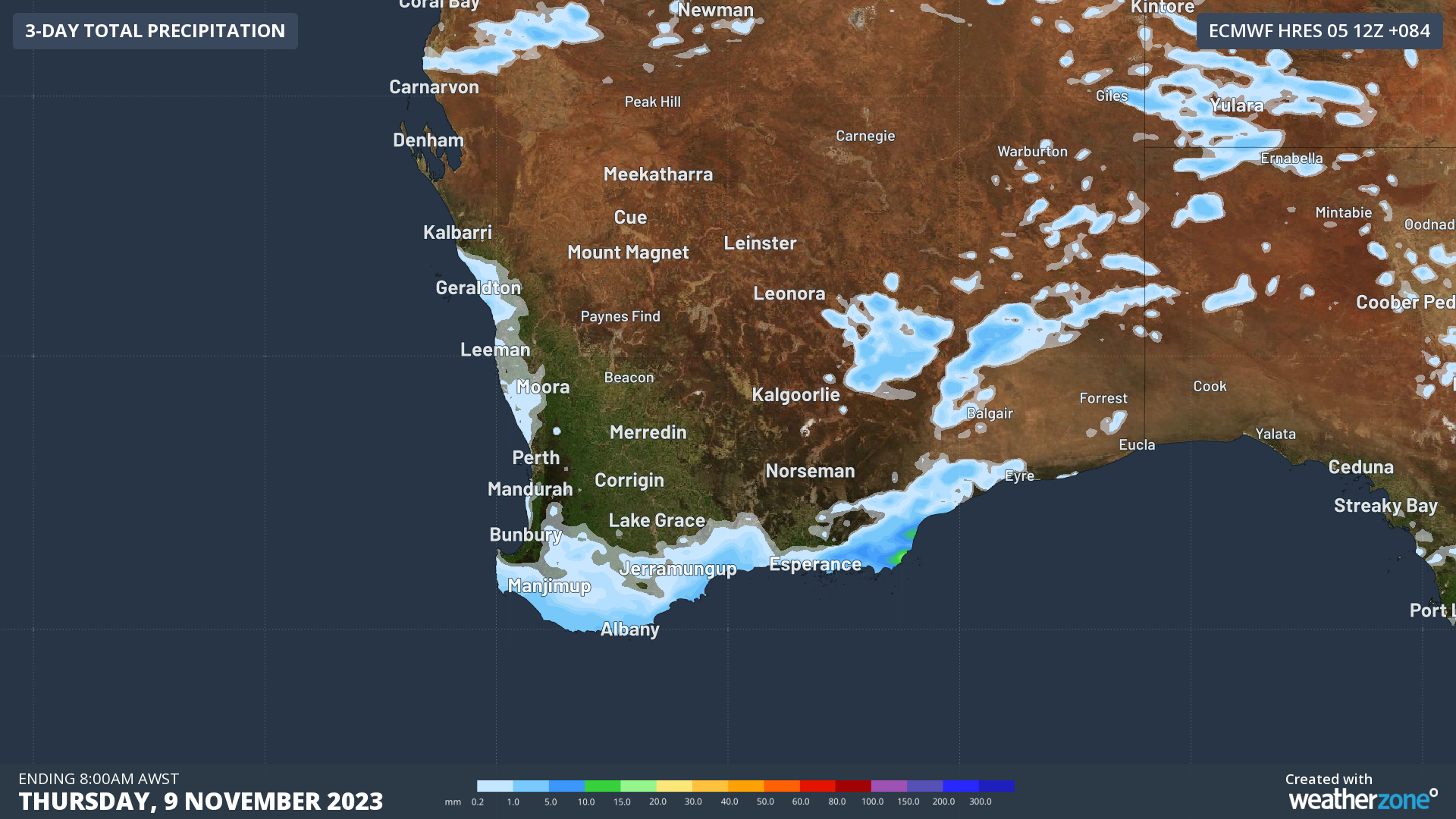
Image: Accumulated rain forecast to Thursday evening
Unfortunately, apart from a slight chance of a shower or storm later on Monday (similar to conditions on Friday), conditions will likely be dry over the fire area until at least Sunday, when a trough could scatter rain, showers, and thunderstorms over the region.
To find out more about the Total Lightning Network, lightning alerting, or bushfire services, please email us at apac.sales@dtn.com.


