
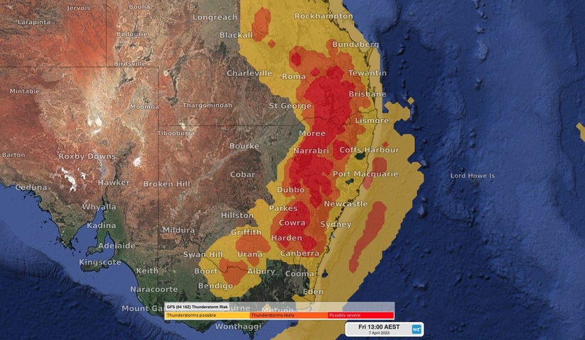
An outbreak of severe thunderstorms will affect parts of Qld, NSW, the ACT and Vic on Good Friday, with a chance of very dangerous supercells as people hit the roads for the long weekend.
This Friday marks the start of the four-day Easter long weekend across Australia and the beginning of the school holidays for most of the country. It’s one of the busiest days of the year for travelling in Australia and the last thing anyone wants to see is dangerous weather.
Unfortunately, that is exactly what’s on the cards for a large swathe of eastern and southeastern Australia this Good Friday.

An upper-level trough passing over southeastern Australia on Friday will cause the atmosphere to become unstable and primed for severe thunderstorms. This volatile weather pattern will result in widespread showers and thunderstorms over central and southeast Qld, eastern and southern NSW, the ACT and Vic.
While any widespread outbreak of thunderstorms is dangerous, this Friday’s dynamic weather pattern will feature an unusually cold pool of upper-level air and a high amount of vertical wind shear (large change in wind speed and direction with height). These factors increase the likelihood of large-to-giant hail and damaging-to-destructive winds.
Some of Friday’s thunderstorms are likely to occur in the morning, although the most widespread and intense storms will hit during the afternoon and early evening. The most likely areas to see supercells will be from central NSW up to southeast Qld, covering the highly populated areas between Sydney and Brisbane.
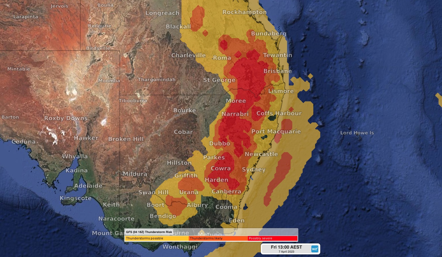
Image: Model-based thunderstorm potential for the early afternoon on Good Friday.
Anyone that’s planning to go outside in eastern and southeastern Australia this Good Friday should pay close attention to the latest weather and thunderstorm warnings and check the radar before heading out. Some flights may also be affected by Friday’s stormy weather.
Impact on Aviation Travel
Airport delays could come in two waves on Friday. The first will occur in the morning around 7-11am in Sydney and 8-12pm for Brisbane, when showers and scattered thunderstorms are expected, reducing runway capacities. The second is the more unstable line with the upper trough from 4-10pm for both Sydney and Brisbane. Note that if the first line of instability is strong, with plenty of severe thunderstorms, it will likely reduce the impact of the second unstable line. However, if the first line is weak (e.g. just showers) then the second line is a higher chance to be severe, and potentially even produce supercell thunderstorms.
To find out more about Weatherzone’s Aviation, lightning detection or forecasting services, please visit our website or email us at apac.sales@dtn.com.




