
Flood-weary areas of eastern and northern NSW are being hit by severe thunderstorms today, with more heavy rain on the way this weekend and into next week.
The satellite image below shows severe-warned thunderstorms moving over northeast NSW and southeast Qld at 2pm AEDT on Friday. These storms dropped around 50mm in two hours at Goonengerry and just over 40mm nearby at Mullumbimby Creek.

Image: Composite radar, satellite and lightning on Friday afternoon.
Severe thunderstorm warnings were also issued in parts of Sydney as slow-moving storms dumped heavy rain over some southern suburbs, with rain rate reaching 20-30mm per hour around Lucas Heights and the Royal National Park.
Friday’s wet and stormy weather is part of multi-day rain and storms outbreak in eastern Australia that will continue through the weekend and at least the first half of next week.
The map below shows rain each day over the next seven days for NSW and southeastern QLD.

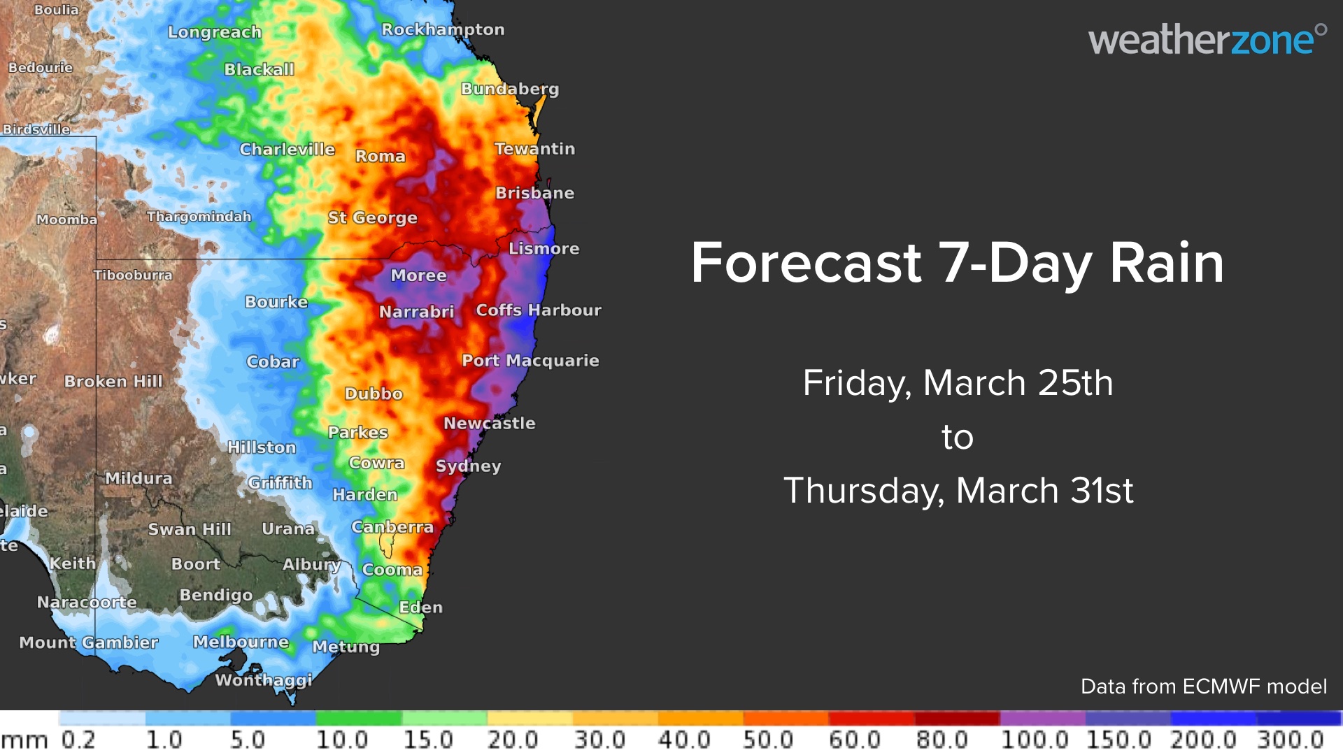
The maps above show that moderate to heavy rain is likely on each of the next six day, with the largest 24-hour rainfall totals most likely occurring over the weekend and around Tuesday next week.
Daily totals of 20-40mm are forecast across much of southern QLD and northern and eastern NSW between now and Tuesday, March 29. However, daily totals exceeding 60mm, and three-hourly rain rates exceeding 40 mm, are possible in thunderstorms, most likely in pockets of northeast NSW and southeast QLD.
The rainfall each day will accumulate over this multi day event, with weekly rainfall totals potentially reaching 100-200mm over the north coast and ranges in NSW, southeast Qld, and the northern inland and central coast and ranges in NSW.

This rain is likely to impact some areas which have seen flooding in recent weeks, possibly including Sydney, the Central Coast and the Northern Rivers in NSW, and parts of southeastern QLD.
Weather affects the insurance business at all levels of operation, from risk assessment to sales and claim management. For this reason, a sound understanding of short and long term weather risks is an essential component of any insurance business.
Geo-tagged severe weather and real time lightning alerts to a street level can keep your customers better informed to minimise losses, whilst embargoes on new policies can be set before severe weather strikes. For more information, please contact us at apac.sales@dtn.com.




