
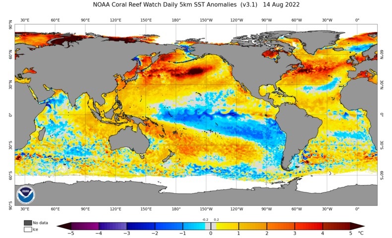
New data reveals that a negative IOD is gaining strength in the Indian Ocean and La Niña is re-emerging in the Pacific Ocean, boosting the likelihood of heavy rain and flooding across Australia during the months ahead.
The weather in Australia, and many other parts of the world, is strongly influenced by sea surface temperatures in the tropical Pacific and Indian Oceans.
When the Pacific Ocean is in a La Niña pattern, cooler-than-normal water sits near the central and eastern equatorial Pacific Ocean and wetter-than-average water sits in the western tropical Pacific.
This pattern of sea surface temperature anomalies drives moisture-laden winds towards Australia, which typically increases rainfall over large areas the country’s north and east.
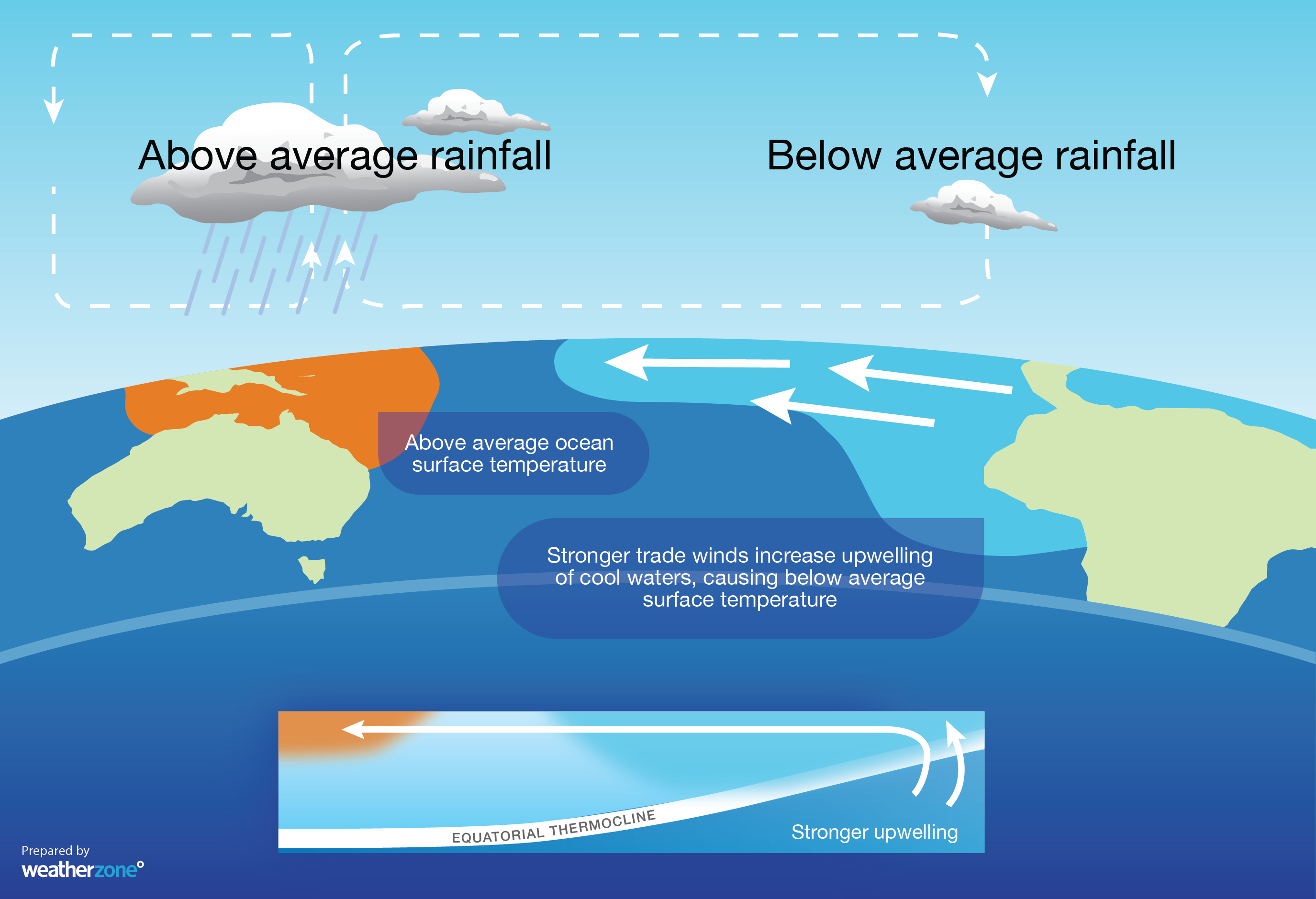
Image: Typical changes in sea surface temperatures and rainfall patterns during La Niña.
A similar mechanism also occurs in the Indian Ocean, called the Indian Ocean Dipole (IOD). When the IOD is in a negative phase, abnormally cool water sits near eastern Africa and unusually warm water lies around Indonesia. This pattern of sea surface temperature anomalies sends more rain-bearing winds towards Australia from the northwest.
A negative IOD typically enhances the frequency and strength of northwest cloudbands over Australia, which increases rainfall over parts of the country’s south and southeast.
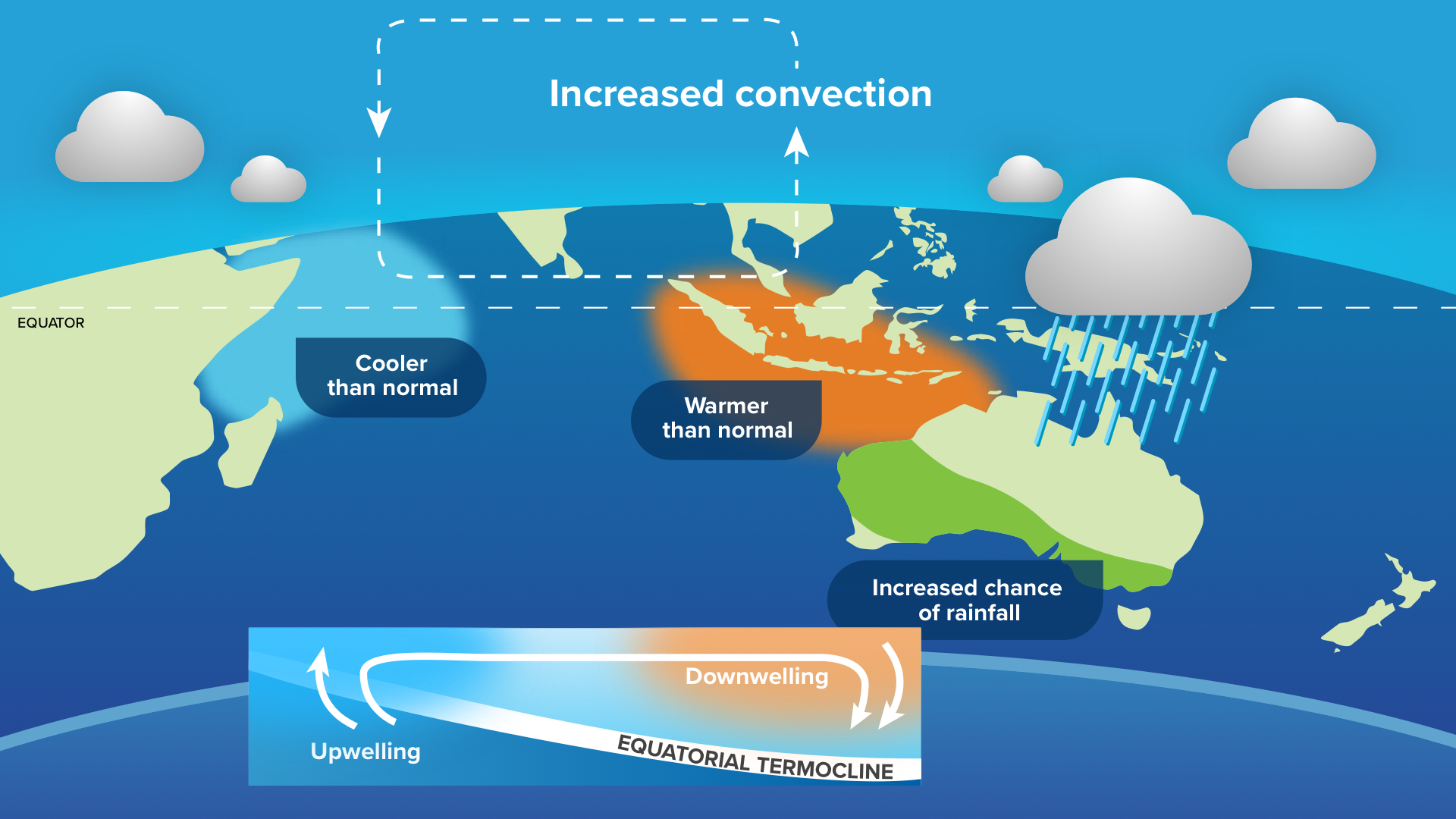
Image: Typical changes in sea surface temperatures and rainfall patterns during a negative IOD.
New data out this week
The Indian Ocean is currently in a negative IOD phase, which was officially declared earlier this month. However, new data came out at the start of this week showing that the IOD index had dipped to its lowest value since 2016. This means that the negative IOD is becoming entrenched to the northwest of Australia and is likely to enhance rainfall and flooding over our continent in the coming months.
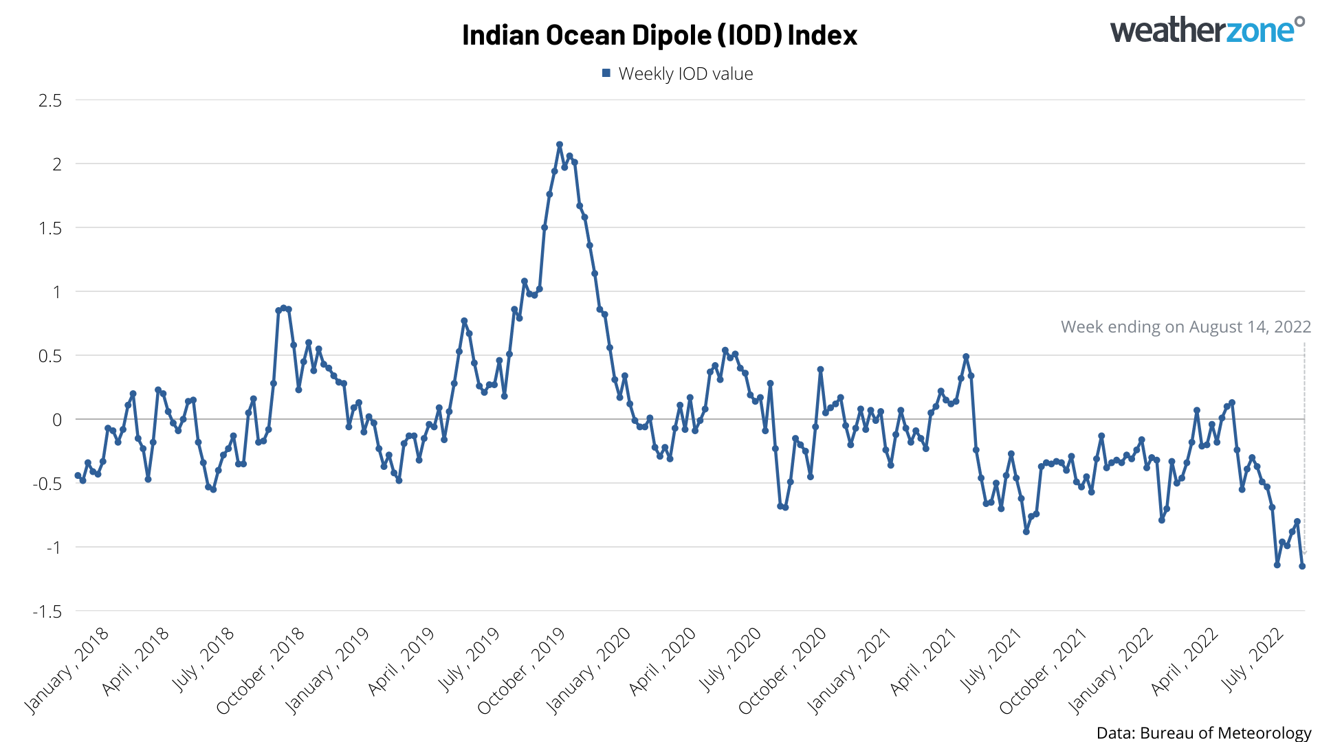
Image: Indian Ocean Dipole (IOD) weekly index values from the past 4.5 years.
Likewise, the latest observations from the Pacific Ocean show that La Niña is now re-emerging after briefly weakening over the last couple of months. The graph below shows an index that monitors sea surface temperature anomalies in the central equatorial Pacific. Sustained negative values of this index represent periods of La Niña and as you can see, it has become more negative over the last five consecutive weeks.
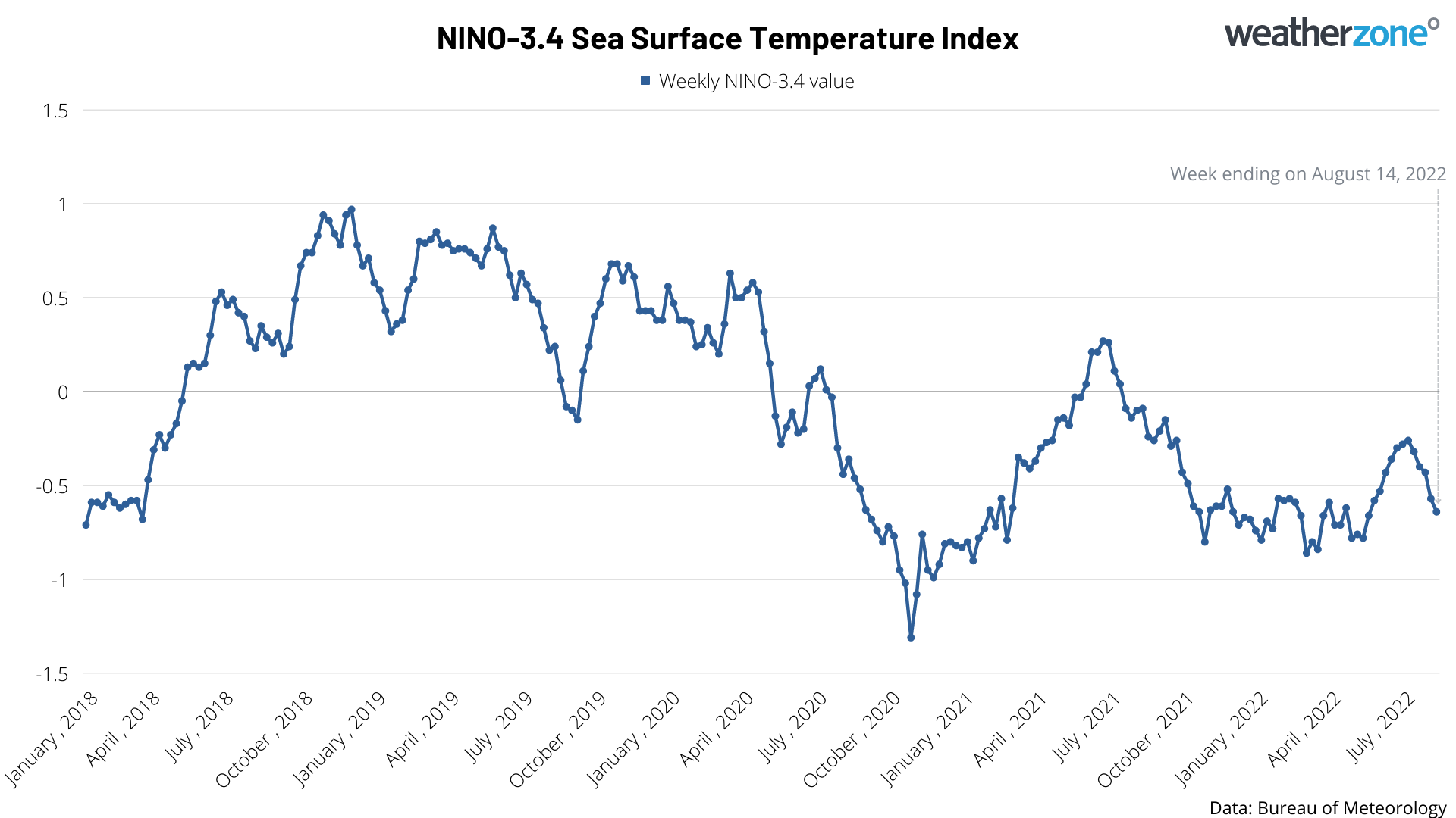
Image: NINO-3.4 weekly sea surface temperature anomaly values from the past 4.5 years.
This latest data shows that both the Indian and Pacific Oceans are trending more towards a state that promotes rainfall and flooding over Australia. With most forecast models suggesting that this trend will continue over the coming months, large areas of Australia are expected to have a wetter-than-average spring, particularly over the eastern half of the country.
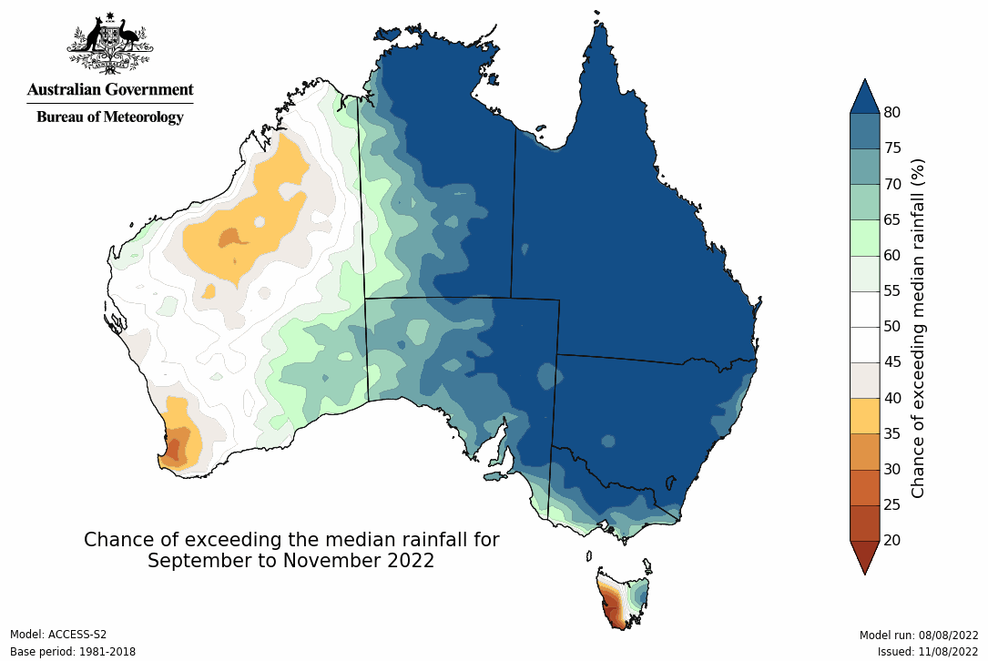
Image: Seasonal rainfall outlook for spring from the Bureau of Meteorology.
For more information on Weatherzone’s seasonal forecasts and presentations, please contact us at business@weathezone.com.au.




