Warmer than usual winter in all states and territories
Winter in Australia was warmer than usual across Australia, with all states and territories recording a mean temperature above the historical average.* Here’s a rundown of mean winter temperatures across the country, as compared to the historical average....
Spring 2022 outlook
Tomorrow marks the first day of spring, a season which typically brings a mix of dynamic weather across Australia. But what will spring be like this year across the country? When predicting how this spring will unfold,...
Sydney’s fastest 2000 mm amid record-wet start to 2022
Sydney just experienced its wettest January to August period in 164 years of records, with the city also obliterating a long-standing record for the shortest time to amass two metres rainfall in a single year. The weather station...
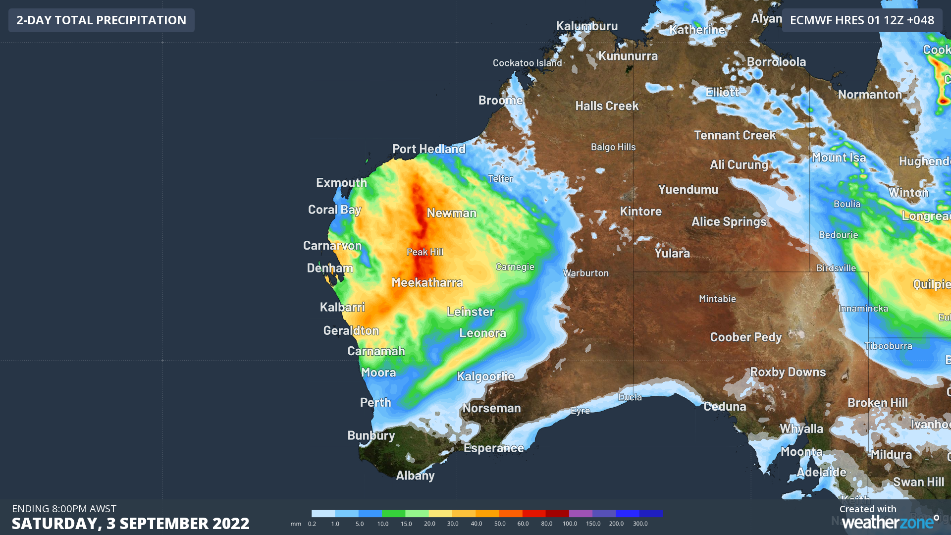
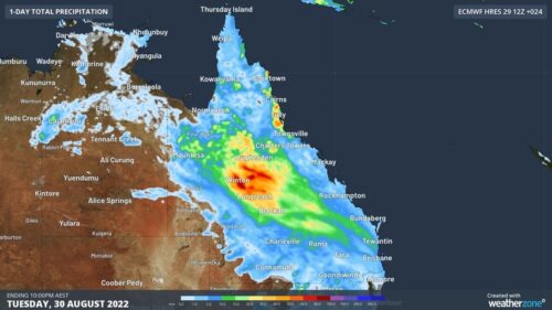
Heaviest August rain in over a century hits outback QLD
A rare late-winter soaking has swept across outback QLD during the last 24 hours, with some places picking up their heaviest August rain in more than 100 years. The animation below shows rain, thunderstorms and thick cloud spreading...
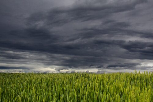
Hobart hits rare winter 21ºC as storms brew over Tassie
Tasmania is having a spring-like day, with Hobart hitting 21ºC and thunderstorms building over the state. Northerly winds are carrying warm and relatively humid air over Tasmania today ahead of an approaching cold front. Amid this pre-frontal northerly...
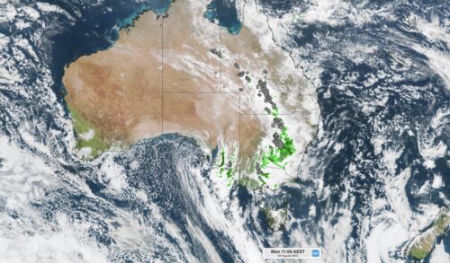
3000 km of thunderstorms hitting Australia today
A late-winter thunderstorm outbreak is unfolding across eastern and southeastern Australia today, with severe thunderstorms likely in several states. As the sun rose on Monday morning, thunderstorms were stretching from the eastern inland of the NT down to...
Tropical cyclones becoming less frequent near Australia
New data has revealed that tropical cyclone numbers have been declining in the Australian region in recent decades, including both severe and non-severe tropical cyclones. The Bureau of Meteorology’s tropical cyclone database has reliable historical records of every...
Solar power on the rise
The warm and sunny months of the year are fast approaching, with the potential for solar generation to increase in the coming months. As we near spring, the days are slowly becoming longer and warmer as we approach the spring...