
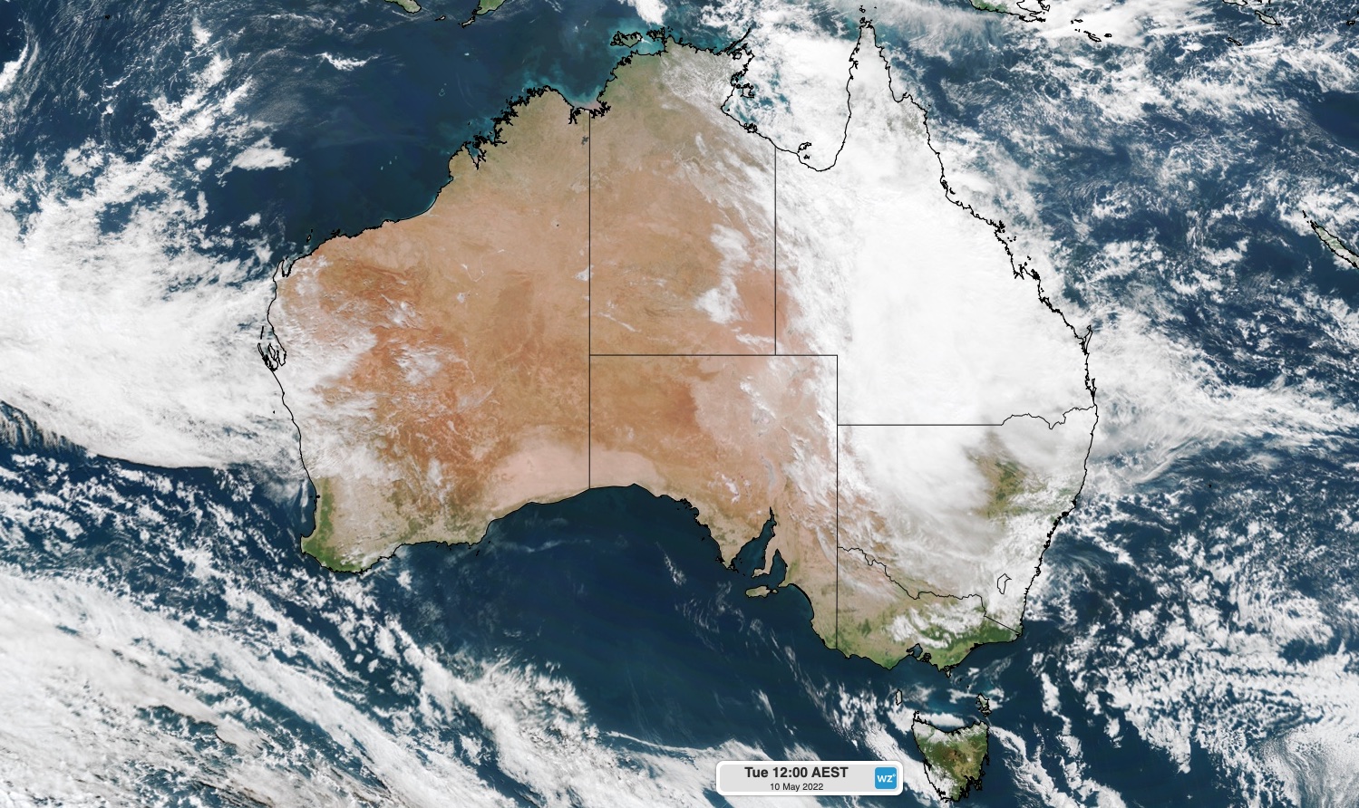
Unseasonably heavy rain will spread across northern and central QLD during the next 48 hours, after the heaviest May rain in a decade inundated roads in the state’s west.
Almost all of QLD is hidden beneath a thick layer of cloud today as moisture-laden winds from the Coral Sea clash with an upper-level trough passing over Australia.

Image: Visible true-colour satellite image showing QLD covered with cloud at midday on Tuesday, May 10.
The heaviest rain on Monday into Tuesday morning fell over the state’s western inland and North Tropical Coast. This unseasonable deluge has closed many roads in the state’s west, cutting tranport routes between some communities.
In the 24 hours to 9am on Tuesday, Carisbrooke Station (southwest of Winton) picked up 156 mm and The Boulders, near Innisfail, collected 115 mm. Longreach (17mm), Julia Creek (29mm), Normanton (30mm) and Blackall (10mm) all had their heaviest May rain in about 8 to 12 years.

The heaviest rain and thunderstorms are now spreading further east as the upper-level trough gradually moves over QLD towards the coast.
A severe thunderstorm swept over the North Tropical Coast near Innisfail late on Tuesday morning, delivering one-hour rain rates 113 mm at Mourilyan Mill and 102 mm at Garradunga.
Heavy rain is likely to continue over QLD’s central and northern inland, North Tropical Coast and Herbert and Lower Burdekin Districts during the remainder of Tuesday. Six-hourly rain rates of 50 to 150mm are possible over the central and northern inland during the remainder of Tuesday, and possibly reaching 100 to 200 mm along the coast and adjacent inland.

On Wednesday, the heavy rain and thunderstorms will spread further south along the coast and ranges as a low pressure system develops near the coast.
Daily rainfall totals of 150 to 250 mm are possible over the coast and adjacent inland between about Innisfail and Rockhampton on Wednesday, with six-hourly totals once again likely to exceed 100mm in some places. This intense rainfall may cause flash flooding over a broad area of central eastern QLD on Wednesday.

Areas of heavy rain and thunderstorms are expected to continue over some central and southern parts of QLD on Thursday and Friday, possibly including parts of the southern inland and southeast coast. There is still some uncertainty about which areas will see the heaviest rain beyond Wednesday, so be sure to keep checking the latest forecasts and warnings in the coming days for more up-to-date information.
While the heaviest rain from this system will target QLD over the next few days, moisture will also spread further south and generate rain in parts of NSW, the ACT, VIC and TAS during the second half of the week. Warnings may also be issued in these states in the coming days. For more information, please contact us at apac.sales@dtn.com.




