
A long-lasting rain, wind and storm event will impact southwestern WA during the next 76 hours as a series of strong cold fronts sweep across the region.
These fronts will produce the kind of weather you only see in WA about once a year, with strong winds expected to last several days across the state’s west and southwestern.
Strong winds and squally showers began to impact the states southwest on Monday morning as the first cold front approached, with Cape Naturaliste and Bussleton Jetty recording 91km/h and 85km/h wind gusts respectively.
Strong winds, showers and thunderstorms are set to continue throughout Monday, which has prompted the Bureau of Meteorology to issue a Severe Weather Warning for damaging winds, heavy rainfall and damaging surf.
Wind gusts could exceed 90km/h on Monday across parts of the west and southwest, extending to parts of southern WA late Monday into Tuesday. Localised destructive wind gusts are also possible with thunderstorm activity.
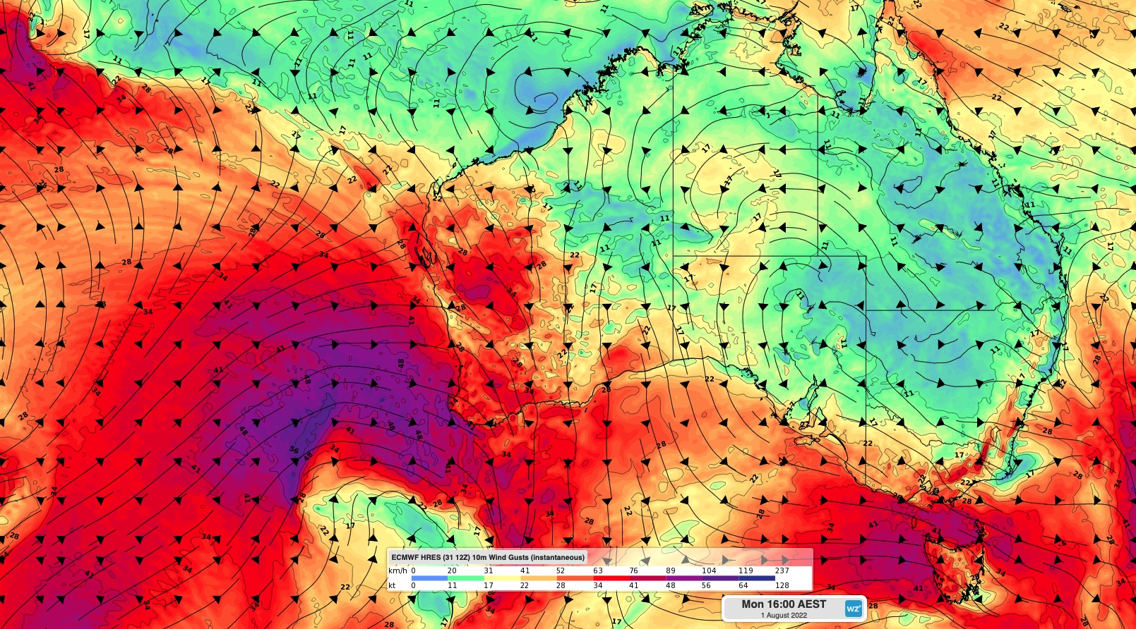
The winds are likely to be strongest near the coast or nearby inland and could cause damage to homes and property. The map below shows one model’s wind gust forecast during Monday afternoon.

Image: Forecast wind gust speed and direction at 2pm AWST on Monday, according to the ECMWF-HRES model.
The fierce winds, showers and thunderstorms should continue Tuesday and Wednesday as a series of cold fronts move over the region and associated low pressure systems pass to the south of the state.
Heavy rainfall exceeding 30mm per hour could impact areas west of Bremer Bay on Monday, particularly coastal or nearby areas. The map below shows the rainfall forecast during the next three days.

Image: Forecast accumulated rain between Monday and Wednesday according to the ECMWF-HRES model.
A sheep graziers warning has also been issued for the Lower West, South West, South Coastal, South East Coastal, Great Southern and Central Wheat Belt forecast districts, where the cold temperatures, rain and blustery winds may pose a threat to livestock on Monday and Tuesday. For more information, on our wind, heavy rainfall and thunderstorms forecasts and alerts, please contact us at apac.sales@dtn.com.




