
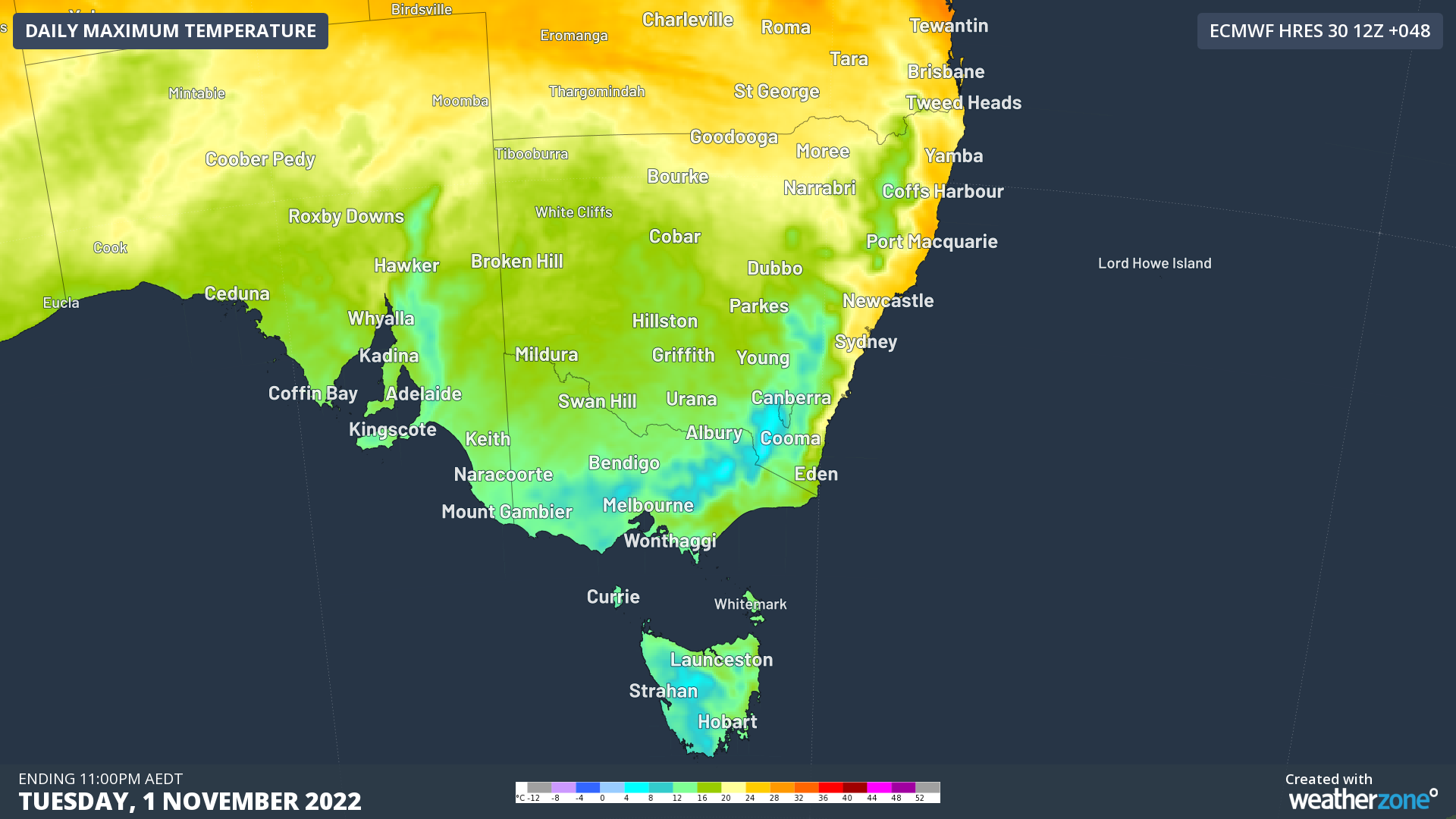
A huge pool of cold Antarctic air is being hurled northwards by a deep low pressure system near Tasmania, and it’s going to make much of southeastern Australia feel as cold as the bitterest day in July.
Strong cold fronts are not unknown outside of winter in our southern states, but this one really is remarkable for both its strength and its duration, with chilly weather likely to set in for at least a couple of days.
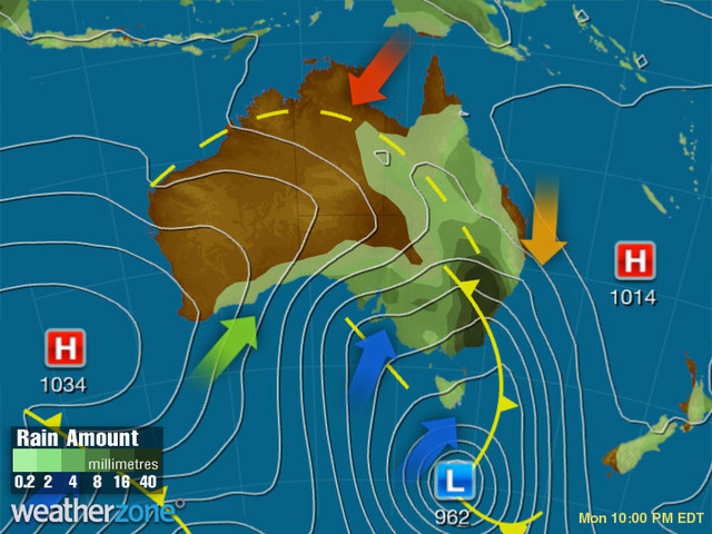
You can see the front illustrated really well in our synoptic chart for 10 pm Monday. It shows the front crossing the southeast, drawing frigid Antarctic air northwards in the direction indicated by the blue arrow.
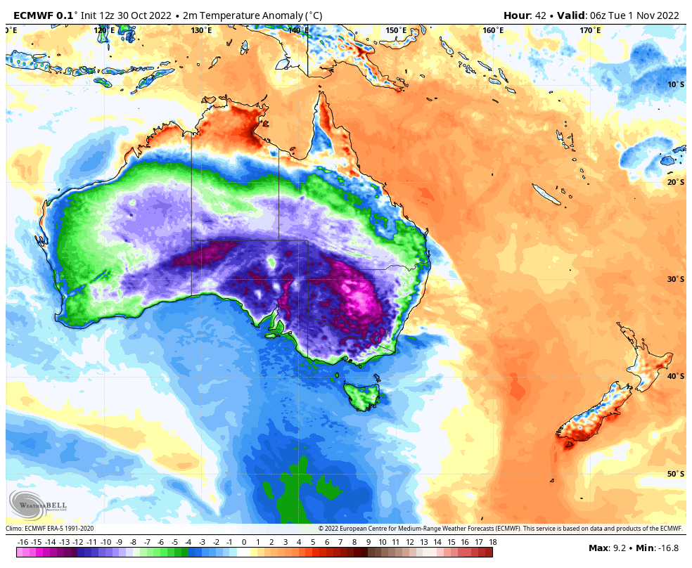
The strength of this system would be noteworthy in midwinter. On Tuesday, many places will have a maximum of as much as 10-15 below normal, as illustrated in the image below which shows tomorrow’s expected temperature anomalies (how far above or below the monthly average the max temp will be).
In addition to being cold and very windy, this will also be a wet system for pretty much anywhere on the southeast mainland, with the exception of the narrow strip east of the ranges along the east coast.
The subtropical jet stream is hurtling over south east Australia at around 330 km/h today, with a loop in the polar jet also paying a visit. pic.twitter.com/q0lhNAV3vv
— Andrew Miskelly (@andrewmiskelly) October 30, 2022
So Melbourne will cop the full force of this system, while Sydney will be insulated from the worst of the cold and wet, although it should get some pretty strong winds.
With so much cold air around, heavy snow is likely on the mountains of Tasmania, Victoria and New South Wales, with lighter snowfalls extending up to the Central Tablelands of New South Wales above 1000m on Tuesday and 800m on Wednesday.
Snow is even in the forecast for the NSW regional city of Orange (elevation 860 m) on Wednesday morning. We can recall several significant snowfalls on the Central Tablelands and nearby Blue Mts in October, but it’s unclear when significant snow last fell in that region in November, and we’ll try to let you know later this week.
Meanwhile, as we write this story on Monday morning, the pressure of the low to the west of Tasmania is a very low 973 hPa. A hectopascal is a measure of air pressure and as you can see on the synoptic chart higher on the page, it’s predicted to drop to 962 hPa this evening.
That’s seriously low. Indeed, it’s approaching the sort of level you see with most tropical cyclones, and tells you something about the dynamism of this system.
So all in all, this is a remarkably cold system for November, but it’s also a potentially very dangerous weather event. Strong wind warnings are already in place today for parts of the Victorian coastline, and there will likely be many more such warnings across several states in the coming day or so.
To find out more about Weatherzone’s weather and climate services, email us at apac.sales@dtn.com




