A tropical cyclone is expected to develop near Australia this weekend and may make landfall along the north coast of WA mid-to-late next week.
A tropical low formed on Wednesday night about 550km NNE of Darwin, above the warm tropical water of the Arafura Sea. While the low itself isn’t too impressive on satellite imagery just yet, a large cluster of thunderstorms could be seen along its southern and western flanks on Thursday morning.
.gif)
Over the Easter weekend, the low pressure system is expected to gain strength while moving towards the southwest, roughly parallel to the WA coast. This path will take the system into an environment that is favourable for further intensification, with:
- very warm ocean temperatures of around 30-31°C
- plenty of upper-level divergence, meaning air moving away in the higher levels of the troposphere
- low-to-medium amounts of vertical wind shear, which should reduce even further over the coming days
About half of the main global forecast models expect this system to reach tropical cyclone strength by Monday, and all have it developed into a tropical cyclone by Tuesday. About half of the models also predict this system will become a category 3 severe tropical cyclone, or higher, mid-to-late next week.
At this stage, this tropical cyclone could impact the northern coast of WA coast (potentially including landfall) at some stage next week. The highest likelihood of severe weather over land is currently over the Kimberley and/or Pilbara from Thursday onwards. Confidence on when and how this system will impact the coast and where will improve over the coming days.
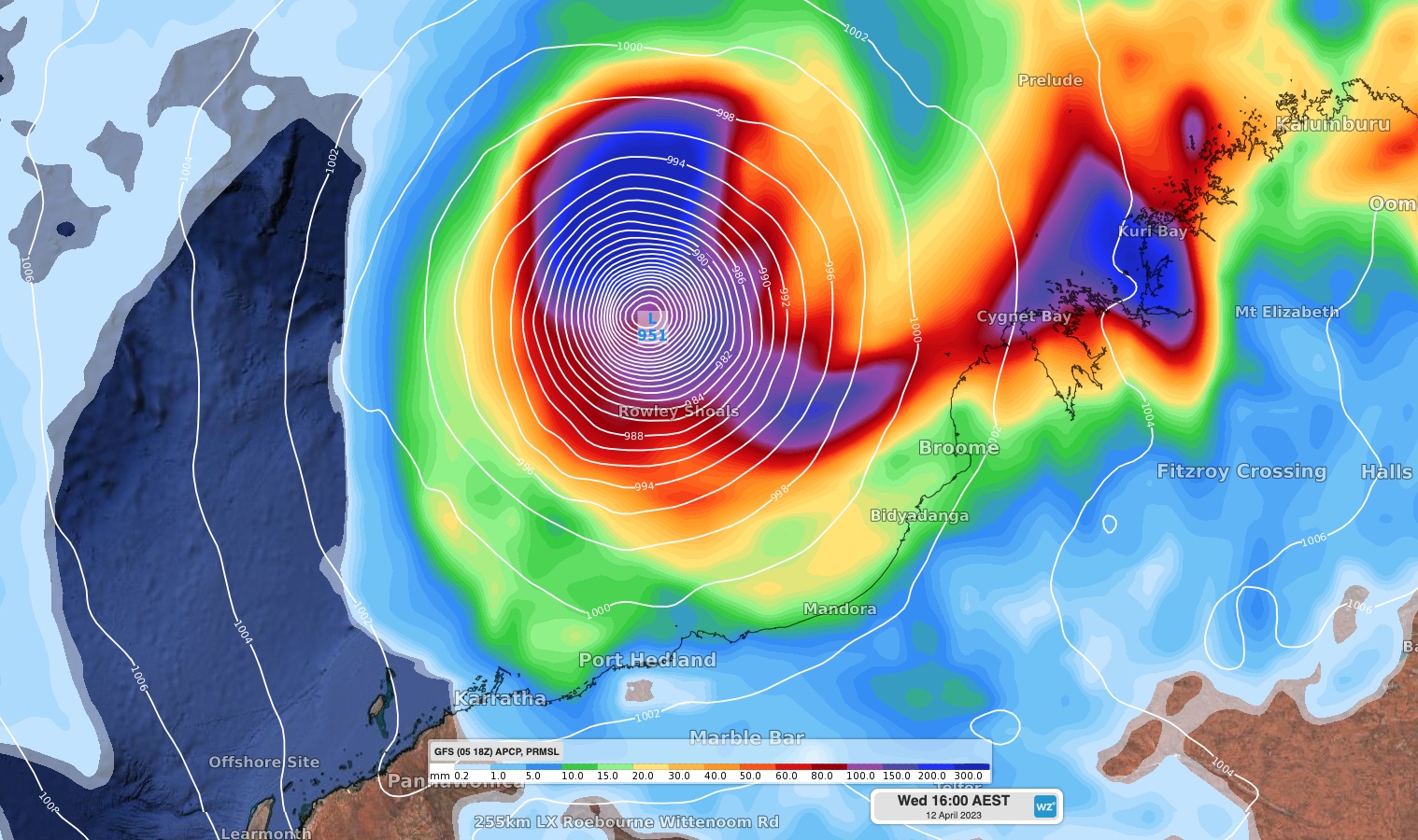
The images below show the location of the projected tropical cyclone on Wednesday night according to four different forecast models. As you can see, there is still quite a bit of disagreement in the position of the system by this point, although models are generally in agreement on the cyclone’s intensity.
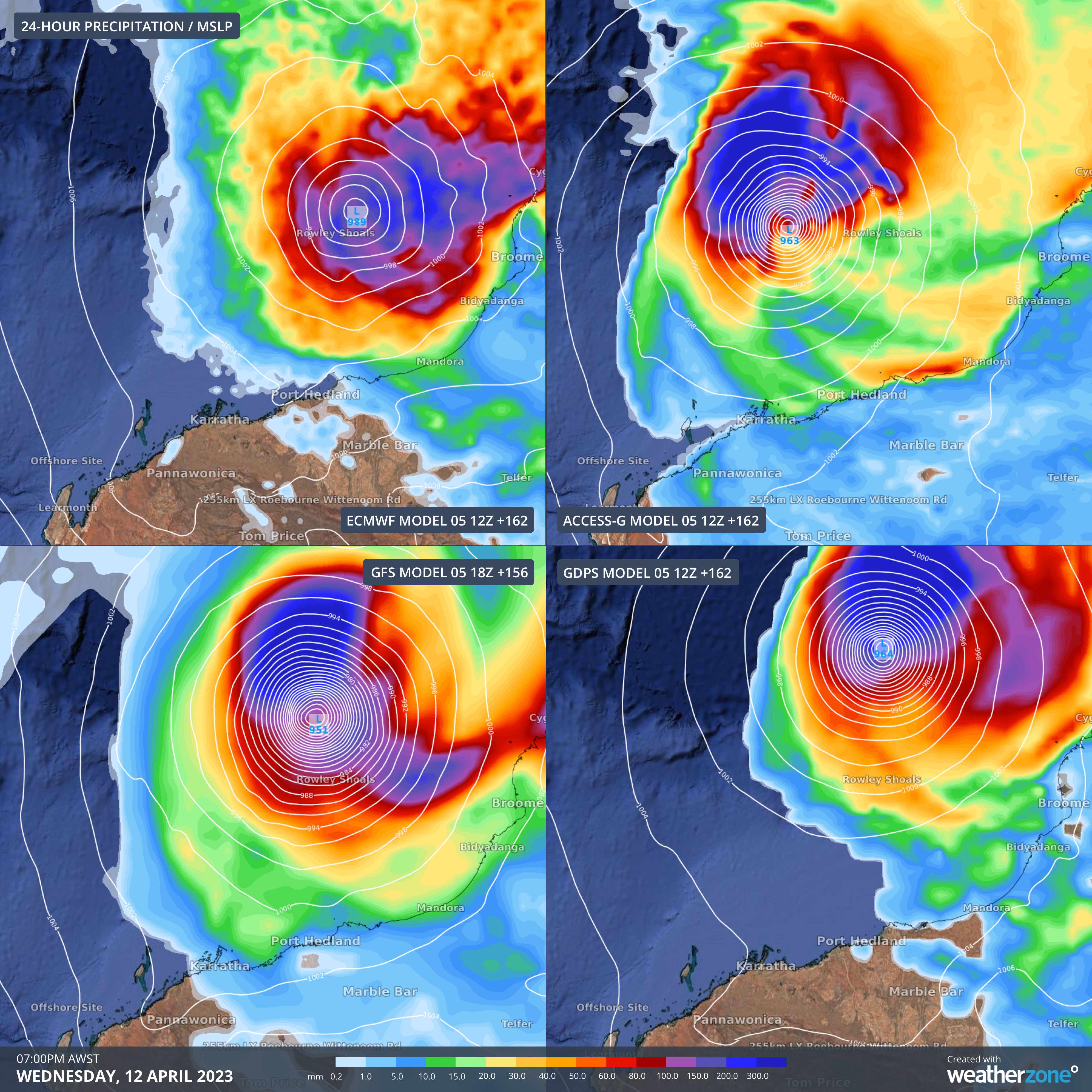
Image: Forecast 24-hour rainfall and mean sea level pressure (MSLP) at 7pm AWST on Wednesday, April 12, according to four different computer models.
As this is likely to be the next tropical cyclone to form in Australia’s area of responsibility, it will be named Ilsa (pronounced ‘il-suh’).
Stay up to date with the latest tropical cyclone outlooks and track maps over the coming week to see how this developing system is likely to affect northern Australia.
DTN APAC has a suite of tropical cyclones services we provide to deliver our clients with as much forewarning of tropical cyclones as we can. We have 4 levels of forecasts timeframes:
- Tropical cyclone seasonal outlooks
- Weekly tropical update
- Daily 7-day tropical cyclone forecast
- Detailed tropical cyclone impacts (issued every 1-6 hours aligning with offical advisories)
Through these products you can have as much preparation as possible for tropical cyclones and their impacts. To find out more, please visit our website or email us at apac.sales@dtn.com.


