
Thick clouds and heavy rain have continued to spread across Australia’s eastern states today after inundating parts of QLD with five months’ worth of rain over the last few days.
Large areas of western, northern and central QLD have experienced unseasonably heavy rain and flooding this week as an airborne river of tropical moisture clashed with an upper-level trough over northeastern Australia.
This dynamic and unseasonable weather pattern has delivered around three to five months’ worth of rain in parts of QLD over the last two to three days.
Some of the notable accumulated rainfall totals ending at 9am on Wednesday included:
- 233 mm in 24 hours at Major Creek, south of Townsville, including 191 mm in 6 hours on Tuesday night. This intense rain caused major flooding.
- 313.2 mm in 72 hours at South Johnstone. This includes 191.4 mm in 24 hours, which is the highest daily total for May since 1964.
- 85 mm in 48 hours at Hughenden, which is 4.8 times their May monthly average.
- 102 mm in 24 hours at Townsville Airport, three times the May monthly average and the 2nd wettest May day on record.

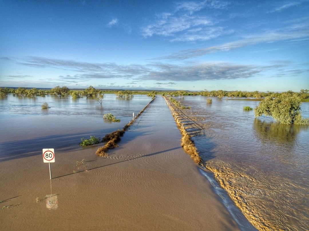
Image: Flooding covers the access road to Australian Age of Dinosaurs in Winton, QLD on Wednesday.
This week’s torrential rain has caused flash flooding across a large swathe of QLD, crippling transport routes in the state’s west and triggering moderate to major flooding along parts of the North Tropical and Central Coasts. Tragically, one woman died in northern QLD after her car was swept from the road near Mount Ossa on Tuesday night.
Fortunately, the heaviest rain moved off the Central Coast of QLD on Wednesday and spared the region from what could have been a very dangerous day of flooding. However, eastern Australia remains shrouded in thick clouds and rain is now spreading from QLD down through NSW, the ACT and VIC.

Rain and thunderstorms will continue to soak a broad area from eastern Australia on Thursday, Friday and even linger over some areas into the weekend. The maps below show how much rain one computer model is predicting during each of the next four days.

While the heaviest rain has now cleared western and northern QLD, other areas in central and southern QLD, and northern, central and southern NSW could see localised flooding during the next 48 hours. For more information on Weatherzone’s heavy rainfall forecasting and alerting, please contact us at apac.sales@dtn.com.




