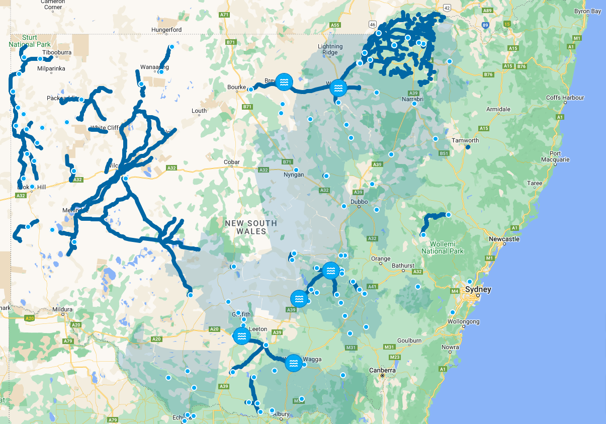
New South Wales is dealing with a transportation challenge with 256 main road closures from flooding present across the state.

Image: Main road closures and incidents due to flooded roads in NSW. Source: Live Traffic NSW
NSW has seen a lot of rain over the past year, and particularly over the last few months, thanks to back-to-back La Niñas and negative Indian Ocean Dipoles (IOD). Both of these climate drivers typically increase rain over the state, but both being strong and occurring together has been the difference in making this one of the wettest years on record.

Image: Rainfall between August and October 2022 compared to average. Source Bureau of Meteorology
All the dark blue areas in the above map indicate the last three months have been the wettest on record. That’s over half the state and about three-quarters of the land west of the Great Dividing Range!
All that water has culminated in saturated catchments, swollen rivers and flooded roads.
Across NSW there are 190 confirmed road closures due to flood, and a further 66 affected by partially flooded roads. This is mainly referring to main roads and highways, with likely hundreds more local roads facing floodwaters.
All these road closures have certainly increased delays on the transportation of goods across the state, flowing onto other parts of the country. Some detours have been on the order of hundreds of kilometres, with some routes requiring accessing towns by ‘going the long way around’. One example is Mildura to Cobar requiring a 230km detour to go via Broken Hill instead of through Ivanhoe.
The good news is that the IOD is starting to break down, reducing the wet influence west of the Divide. However, La Niña still has a few months left to go yet, so it is expected for flooded roads to be an ongoing issue for at least the rest of the year.
DTN APAC provides climate and weather services to help mitigate the risk of flood by providing advanced warning of when they are coming. To find out more about our services, please email us at apac.sales@dtn.com.


