Tropical Cyclone Kirrily was declared on Wednesday evening and will cross the Queensland coast on Thursday evening.
- The most likely time of landfall is around 8 pm AEST, although it could occur anytime between about 6 pm and midnight.
- The most likely location for landfall is just north of Townsville around Magnetic Island although the BoM is forecasting a fairly wide range from Ayr (about an hour by road south of Townsville) to Ingham (just over an hour north).
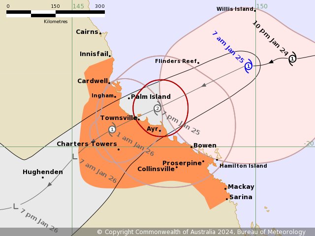
Image: The latest projection of Kirrily’s path. Source: BoM.
Kirrily took a while to develop. As we wrote on Wednesday, a tropical low had been spinning over the Coral Sea for several days but due to the large size and elongated shape of the tropical low, combined with an unfavourable environment, the system developed slowly.
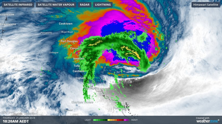
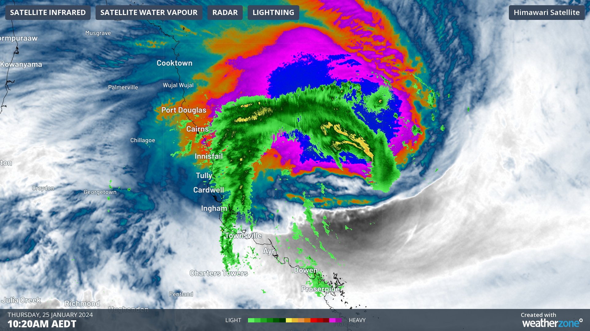
But TC Kirrily is now a fully fledged Category 1 system with wind gusts in excess of 100 km/h already recorded before dawn on Hamilton Island, about 250 km southeast of Townsville.
Kirrily is a large Tropical Cyclone in terms of its area (as opposed to strength) and is expected to intensify to Category 2 status when it crosses the coast this evening.
Gales with damaging wind gusts to 120 km/h are persisting on Thursday morning over the Whitsunday Islands and are expected to extend to mainland communities between Ayr and Sarina (just south of Mackay) during the morning.
Gales with damaging wind gusts to 120 km/h will likely extend northward to coastal and island communities between Ayr and Ingham, including Townsville, during this afternoon and evening, and the damaging winds could even extend as far north as Innisfail if the system tracks slightly further north.
After landfall
Like Tropical Cyclone Jasper which lashed far north Queensland in mid-December 2023, the after-effects of Kirrily could be as severe or even more devastating than the immediate impact of the storm due to the strong likelihood of flooding.
Heavy rainfall which could lead to flash flooding is likely to develop from Thursday evening into Friday along a huge stretch of the coast from Innisfail to Sarina. Those two towns are almost 700 km apart.
The cyclone will likely become a tropical low by Friday, meaning its winds will lose strength but the potential for heavy rainfall will persist.
At this stage, the impacts of heavy rainfall look likely to extend to an area well beyond the Qld coast, with heavy rainfall potentially developing across the northern interior and western Queensland into the weekend as the system tracks inland.
Storm surge
The BoM warns that a storm tide is expected between Townsville and Mackay as Kirrily crosses the coast. A storm tide is an increase in the overall water height, similar to the normal astronomical tides, but caused by the weather rather than by the gravity of the sun and moon.
Large waves could produce minor flooding along the foreshore, and people living in these areas are urged to take measures to protect their property as much as possible and be prepared to help their neighbours.
This is going to be a dangerous night and ensuing few days in Queensland, so as ever, please check the latest on our warnings page or learn more about Tropical Cyclones. For more information on our clients specific briefings and warnings, please contact us at apac.sales@dtn.com.


