One look at the map of rain predicted over Australia this week shows that part of every state and territory will see some wet weather during the next 7 days, with a few areas in line for a soaking.
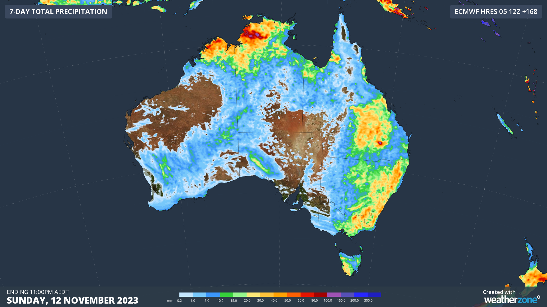
Image: Forecast accumulated precipitation between Monday and Sunday this week, according to the ECMWF-HRES model.
The map above shows how much rain one global forecast model is predicting over Australia this week. Several weather systems will align to create this widespread wet and stormy weather, including:
- Persistent easterly winds carrying moisture across Australia from the Tasman and Coral Seas.
- A broad and stubborn region of low pressure over Australia, involving several surface-based low pressure troughs.
- A series of upper-level troughs crossing southern and southeastern Australia.
- A combination of heat, moisture and low pressure across the northern tropics.
The heaviest rain this week should fall over the Kimberley and the western Top End, and across a broad area stretching from central Queensland down to Tasmania. However, part of every state and territory should see some showers and thunderstorms between now and Sunday.
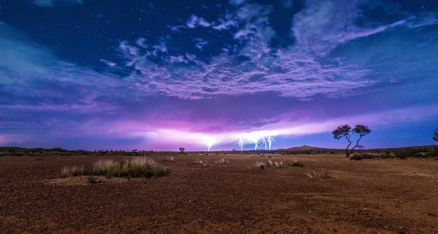
With storms likely over Australia each day this week, we could see several million lightning strikes across the country over the next seven days. This is off the back of a stormy weekend that produced more than one million lightning strikes above Australia on Saturday and Sunday.
Some of this week’s storms are likely to become severe, so be sure to check the latest warnings for the most up-to-date information throughout the week.
Are you in a remote area of Australia without radar coverage?
Oracle has you covered this week. It is a satellite-derived, gridded nowcasting system. It forecasts out to 3 hours at a 1-2km resolution, and rapid updates every 5 minutes. With this enhanced forecasting detail, Oracle has the upper hand over 9-12km resolution models when capturing temperature, lightning, cloud cover, wind and rainfall. This ensures that no matter where you are in Australia, you will have access to precision nowcasting and forecasting that can rapidly inform your critical business decisions. For more information, please contact us at apac.sales@dtn.com.


