A developing tropical low off Australia’s northwest coast has a high chance of becoming a tropical cyclone by the middle of this week, possibly as early as Tuesday.
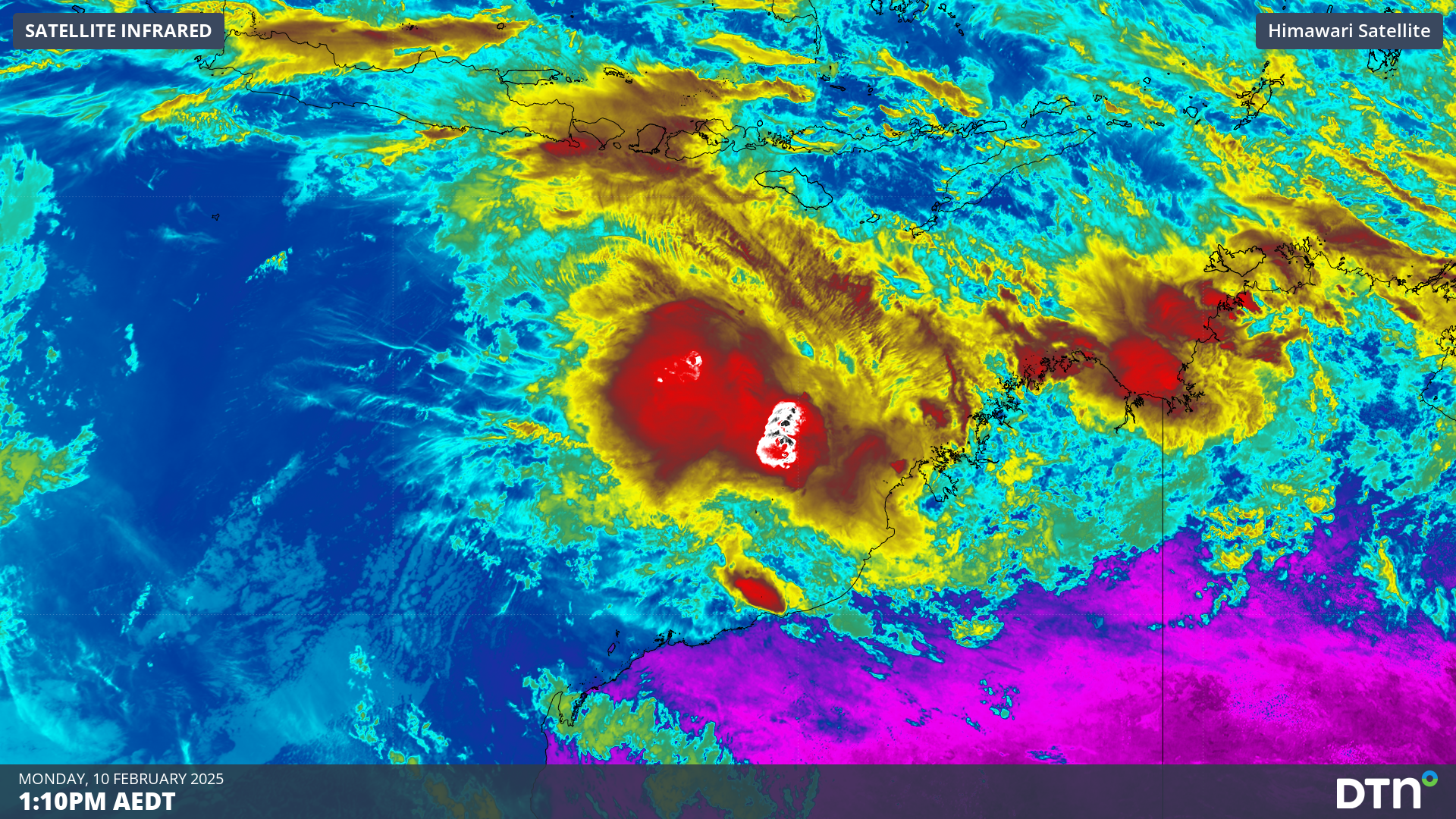
The animation below shows a large mass of convective clouds to the north of WA on Monday morning, revealing the location of the developing tropical low.
Image: Day/night satellite images showing cloud near Australia’s northwest coast on Monday morning.
This system is currently drawing energy from warm water off Australia’s northwest coast, where sea surface temperatures are hovering around 30 to 31°C. Atmospheric conditions in the region are also in a state that should allow the low to gain strength in the next few days, increasing the likelihood of tropical cyclone development.
Most forecast models predict that the tropical low will move towards the west or southwest on Monday and Tuesday, tracking roughly parallel to the WA coastline. The track then becomes harder to predict for Wednesday and Thursday, with some models keeping the system offshore and others taking it towards the Pilbara coast.
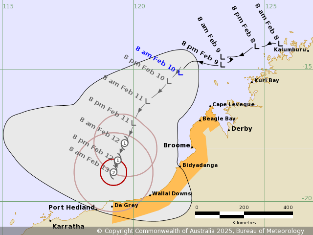
Image: Forecast track map for the developing tropical low, issued by the Bureau of Meteorology at 8:54am AWST on Monday February 10, 2025. A more recent track map may be available. Source: Bureau of Meteorology.
It’s currently too early to know exactly where this developing system will move and how strong it will get in the coming days. However, there is a good chance that it will become a tropical cyclone by Wednesday, and it may get close enough to the coast to cause severe weather in the north of WA.
Forecasters will start to get a better idea of the future strength and movement of this system in the next day or two. Anyone in the north of WA, particularly in the Pilbara region, should pay close attention to this developing system in the coming days.
The next tropical cyclone to form in Australia’s area of responsibility will be named Zelia.
DTN APAC, specialises in industry-leading forecast, alerting and threat analysis of tropical cyclones, offering you expert, customised solutions when the weather turns wild.
Providing rapid-update forecast information, we alert you to any low-pressure system gaining power within your region and, unlike other providers, can track its development out to 7 days. This gives you the time to prepare and safeguard your staff, sites and assets.
You will have the most precise weather intelligence charting rainfall, wind speeds and potential storm surges to help you make critical decisions quickly. Whether it’s adjusting key work schedules, protecting your staff or securing your site, we have the alerting capability to keep you steps ahead of the storm.
We will support you, 24/7, keeping you informed and making your critical decisions easier. For more information contact us at sales.apac@dtn.com


