Five tropical lows are forecast to form over the northern Australia waters this week, with an increased risk of heavy rainfall and tropical cyclone potential.
The enhanced tropical activity comes as two giant tropical waves clash near Australia this week, called the Madden Julian Oscillation (MJO) and an equatorial Kelvin Wave.
In addition to the tropical waves, a monsoon surge is forecast to move over Indonesia towards Australia later this week, enhancing the potential for a tropical cyclone to develop in the region.
The map below shows one model is forecasting 80 to 100mm during the next week across parts of northern Australia, with isolated falls of 200 to 300mm possible particularly if any of the lows come close to the mainland.
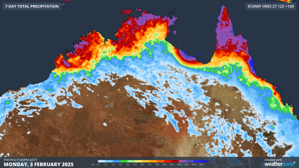
Image: Accumulated rainfall for the next 7 days leading up to Monday, February 3, according to ECMWF
During the next 48 hours a tropical low could form over the Coral Sea to the east of Qld and the Indian Ocean off the Northwest Shelf of WA.
By the end of this week the Bureau of Meteorology are forecasting five lows in the Australian region, with the two lows in the Coral Sea and one in the Gulf of Carpentaria a moderate risk of developing into a tropical cyclone.

Image: Chance of a tropical cyclone at 8pm WST on Sunday, February 2. Source: Bureau of Meteorology
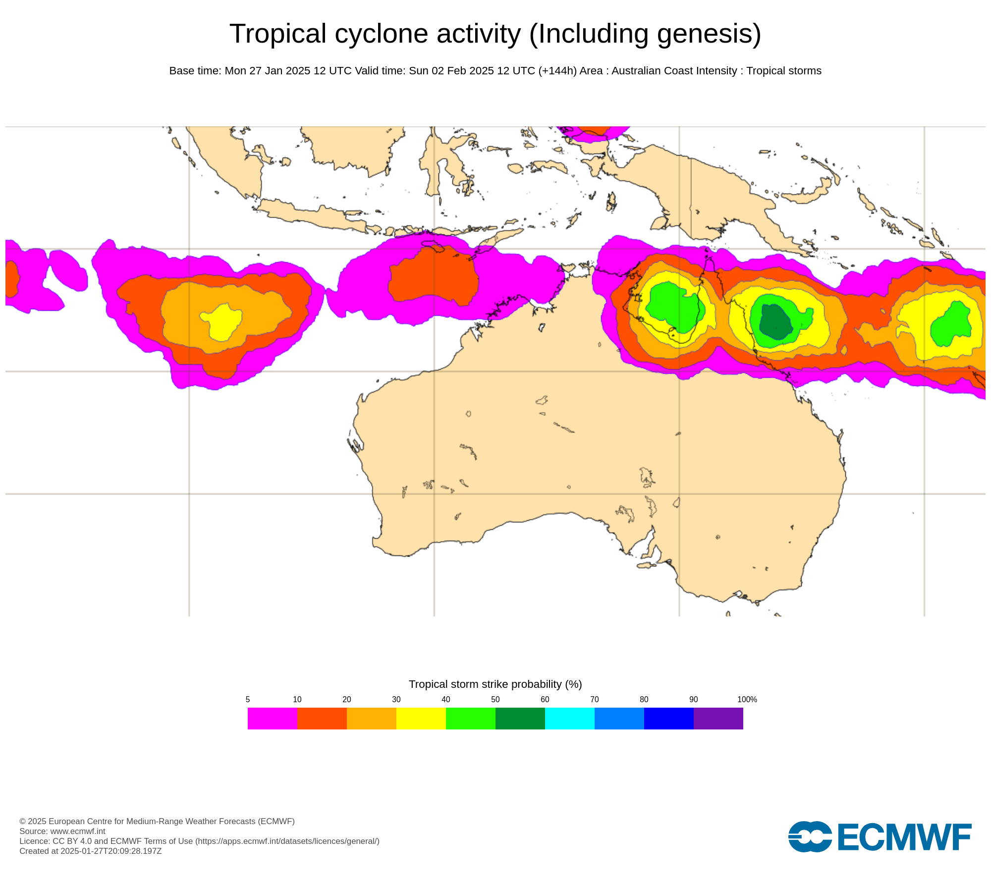
Some other international forecast organisations also show a moderate possibility of tropical cyclone development near the NT and Qld on Sunday, February 2. The image below shows the likelihood of tropical cyclone activity within a 48-hour window of Sunday, according to the European Centre for Medium-Range Weather Forecasts (ECMWF).

Image: Tropical cyclone likelihood according to the ECMWF ensemble model. The colours show the probability that a tropical cyclone will pass within 300km of a given location within a time window of 48 hours. Source: ECMWF
Both organisations show an increased risk of tropical cyclone development late this week into next, however there is still large degrees of uncertainty on the strength of these systems and whether they will cross the mainland or not. If you live in Northern Australia, be sure to keep an eye out for the latest warnings and forecasts this week.
DTN APAC gives you a comprehensive tropical cyclone service that helps your enterprise prepare for the worst in the best possible way.
As the climate delivers increasingly severe weather events, their potential to impact your business operations grows.
DTN APAC, specialises in industry-leading forecast, alerting and threat analysis of tropical cyclones, offering you expert, customised solutions when the weather turns wild.
Providing rapid-update forecast information, we alert you to any low-pressure system gaining power within your region and, unlike other providers, can track its development out to 7 days. This gives you the time to prepare and safeguard your staff, sites and assets.
You will have the most precise weather intelligence charting rainfall, wind speeds and potential storm surges to help you make critical decisions quickly. Whether it’s adjusting key work schedules, protecting your staff or securing your site, we have the alerting capability to keep you steps ahead of the storm.
We will support you, 24/7, keeping you informed and making your critical decisions easier. For more information contact us at sales.apac@dtn.com


