Australia’s northern fire season is expected to be more active than usual in some areas, thanks to an abundance of dry vegetation in the wake of a failed wet season.
Northern Australia’s fire danger typically increases as vegetation loses moisture during the dry season, which runs from May to October.
This year, some areas of northern Australia have entered the dry season with lower-than-average moisture levels in both the soil and vegetation, off the back of an unusually dry wet season.

Image: Observed rainfall deciles during Northern Australia’s 2021/22 wet season, showing that some areas in the NT saw seasonal rainfall totals that were in the lowest 10 percent of historical records. Source: Bureau of Meteorology
This lack of wet-season rainfall has made for an active start to the northern fire season. This elevated fire danger is likely to persist over the coming months, with seasonal forecast models predicting above-average temperatures over most of northern Australia through the middle of the year.
Fires have already been active over northern and central parts of the NT during May and June, with smoke plumes visible on an almost daily basis at times. Many of these fires were prescribed burns aimed at mitigating the fire risk.

Image: Smoke plumes visible on satellite imagery on Thursday, June 23.
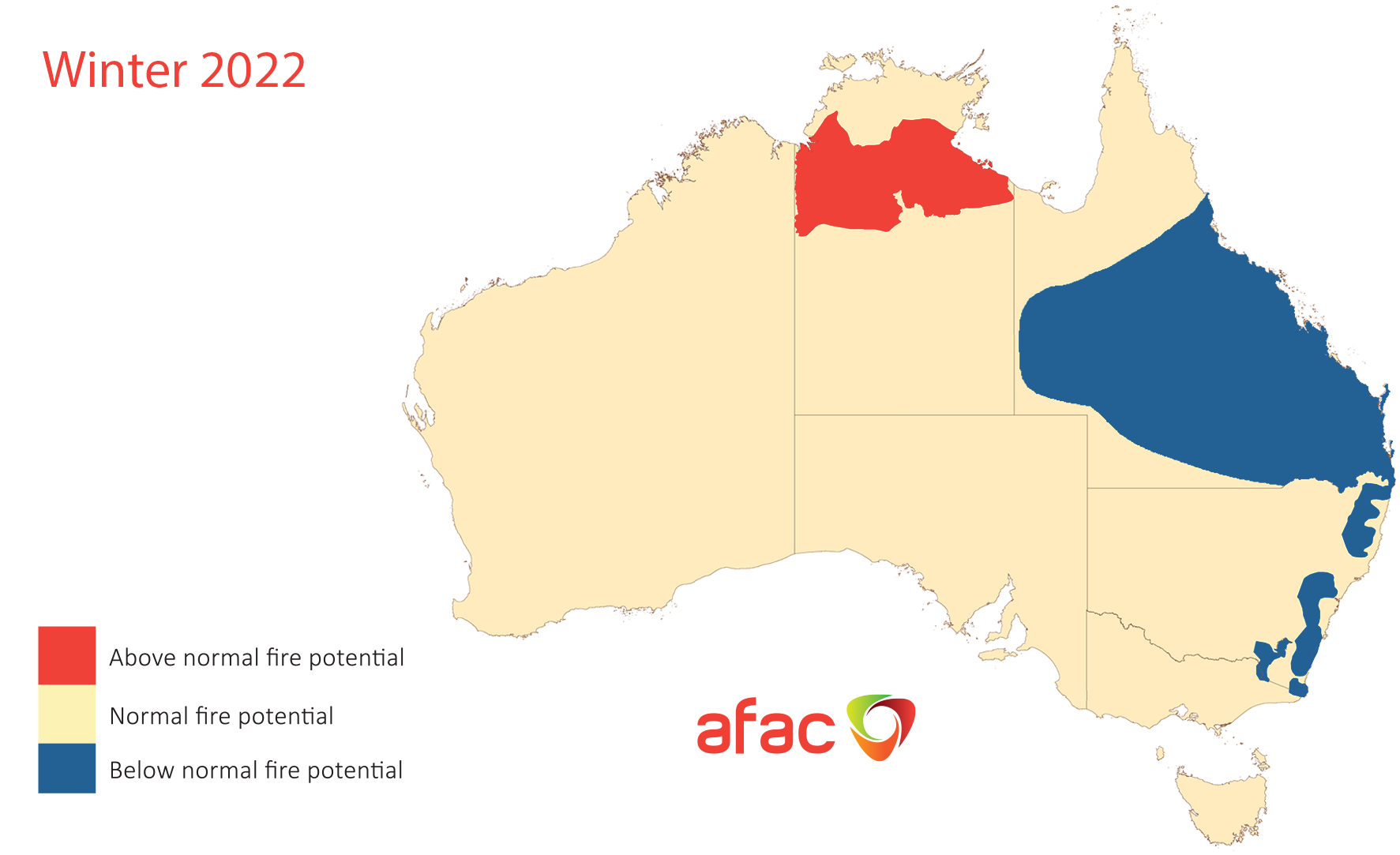
The map below shows the latest seasonal bush and grass fire outlook from the Australasian Fire and Emergency Service Authorities Council (AFAC), covering the period from June to August.

Image: Australia’s seasonal bush and grass fire outlook for winter 2022. Source: AFAC
The red area on the map above shows where bushfire potential will be above average between June and August in 2022, including large areas of the Gulf, Victoria River district and Katherine regions. Furthermore, the lack of wet season rainfall means that the June to August period will produce the type of fire conditions typically experienced later in the season for some parts of the NT.
Other areas of northern Australia that saw better wet season rainfall should have an average or below-average fire season in 2022, including the northwest Top End.
Weatherzone provide fire weather seasonal forecasts for many businesses across Australia, as well as temperature, wind and humidity forecasting out to 14 days. For more information, please contact us at apac.sales@dtn.com.


