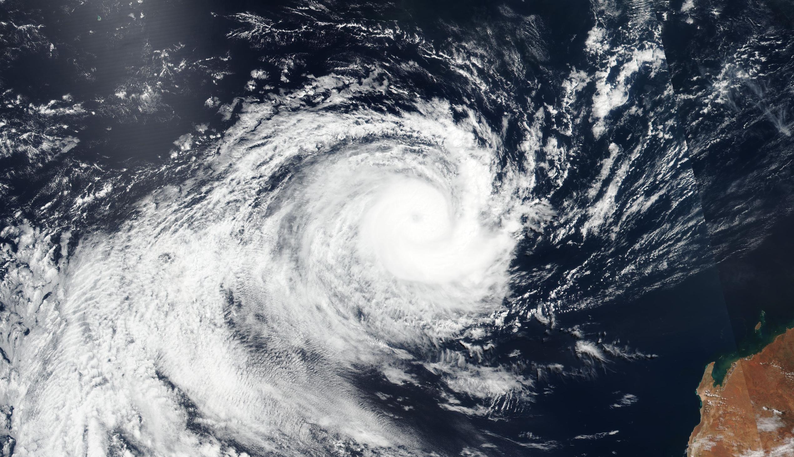
The 2023-24 Australian tropical cyclone season is almost over and while it was a quiet season based on overall numbers, some of the landfalling systems had a big impact.
The Australian tropical cyclone season officially runs from November until April. During this time, we usually see an average of about 9 to 10 tropical cyclones in Australia’s area of responsibility.
Only eight named tropical cyclones formed or moved into the Australian region during the 2023-24 season, making this a below-average season based on the overall number. However, with four tropical cyclones making landfall over Australia, this has still been an active season based on impacts, particularly for Queensland.
The eight tropical cyclones in Australia’s area of responsibility this season were:
- Severe Tropical Cyclone Jasper
- Severe Tropical Cyclone Anggrek
- Severe Tropical Cyclone Kirrily
- Tropical Cyclone Lincoln
- Severe Tropical Cyclone Neville
- Severe Tropical Cyclone Megan
- Severe Tropical Cyclone Olga
- Tropical Cyclone Paul
Of the eight tropical cyclones in the Australian region this season, Jasper, Kirrily, Lincoln and Megan made landfall on the Australian mainland.
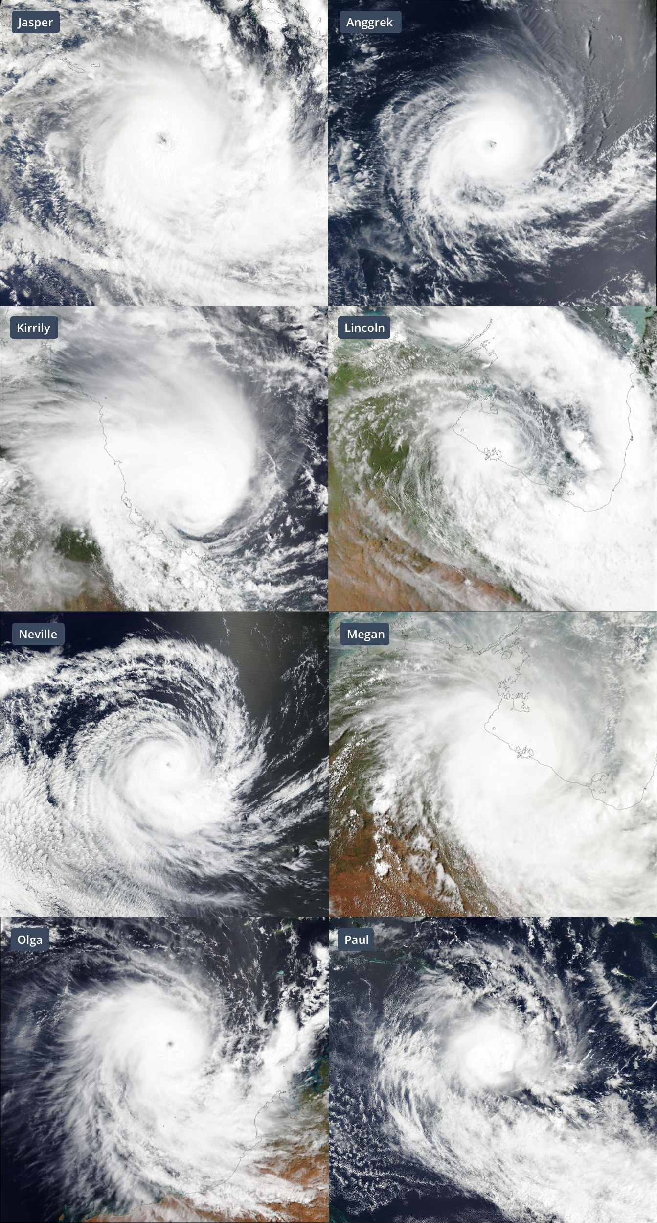
Images: The eight tropical cyclones in Australia’s area of responsibility during the 2023-24 season. Image credit: NASA Worldview
Severe Tropical Cyclone Jasper
Jasper was the first tropical cyclone of the 2023-24 season in Australia, forming over the Coral Sea in early December and becoming the earliest category four tropical cyclone in the Australian region since 2005.
Tropical Cyclone Jasper made landfall in northern Qld on Wednesday, December 13, 2023, crossing the coast between Port Douglas and Cooktown, in the vicinity of Wujal Wujal, as a category two system. Jasper was the earliest tropical cyclone in the satellite era to make landfall on Australia’s east coast.
The remnants of Tropical Cyclone Jasper lingered over northern Qld for a number of days after making landfall, producing around 2 metres of rain in five days. This deluge caused the worst flooding in more than 100 years near Cairns.
Severe Tropical Cyclone Kirrily
Kirrily was the third tropical cyclone of the season in Australia’s area of responsibility. It formed over the Coral Sea in late January 2024 and peaked at category three strength, before weakening to category two intensity as it crossed the Qld coast to the north of Townsville on January 25.
Kirrily lingered over eastern Australia into early February and caused widespread rain in Qld and NSW. The moisture associated with the former tropical cyclone eventfully drifted south and produced a huge cloud band over the Tasman Sea, which extended more than 5000 km from NSW to beyond New Zealand.
Tropical Cyclone Lincoln
While Lincoln existed only briefly as a tropical cyclone, it was a long-lasting system that delivered rain to a broad area of northern Australia in February.
Lincoln became a tropical cyclone over the southwest Gulf of Carpentaria on February 16 shortly before making landfall over the NT’s Carpentaria coast to the east of Port Arthur.
After making landfall, Lincoln’s remnant low pressure system traversed the NT and WA’s Kimberley district. This overland journey caused heavy outback rain and flooding, which cut isolated communities and cut off roads, including the Stuart and Great Northern Highways. The low pressure system then went on to bring some welcome rain to the parched Gascoyne region in WA towards the end of February.
Severe Tropical Cyclone Megan
Megan followed a similar path to Lincoln, forming over the Gulf of Carpentaria in mid-March before crossing the NT’s Carpentaria coast. However, Megan was much stronger than Lincoln at landfall, crossing the coast as a category three severe tropical cyclone.
The remnants of Tropical Cyclone Megan caused heavy rain and flooding to extend across the central inland of the NT in the days after it made landfall.
Looking ahead, there are no signs of tropical cyclone activity in the Australian region during the remainder of April. While tropical cyclone activity becomes less likely from May onwards, it is possible for systems to develop near Australia outside the official season.
As the climate delivers increasingly severe weather events, their potential to impact your business operations grows.
DTN APAC, specialises in industry-leading forecast, alerting and threat analysis of tropical cyclones, offering you expert, customised solutions when the weather turns wild.
Providing rapid-update forecast information, we alert you to any low-pressure system gaining power within your region and, unlike other providers, can track its development out to 7 days. This gives you the time to prepare and safeguard your staff, sites and assets.
You will have the most precise weather intelligence charting rainfall, wind speeds and potential storm surges to help you make critical decisions quickly. Whether it’s adjusting key work schedules, protecting your staff or securing your site, we have the alerting capability to keep you steps ahead of the storm.
We will support you, 24/7, keeping you informed and making your critical decisions easier. For more information, please contact us at apac.sales@dtn.com.


