Destructive winds, the heaviest rain in decades forced major port, rail, and mining operations to shut down in the Pilbara, though many have resumed despite ongoing major flooding and highway closures.
Severe Tropical Cyclone Zelia made landfall as a category four system near the De Grey River mouth last Friday afternoon. Despite Port Hedland missing the eye of the storm, the busy mining port observed a mean wind speed of 89km/h and a gust of 120km/h on Friday afternoon, the fastest winds in 11 years.
The powerful cyclone dumped more than half a metre of rain over parts of the Pilbara, with large daily totals which caused widespread flooding:
- Mandora, to the east of Port Hedland saw their largest February daily rainfall in 47 years, with 170.4mm falling on Thursday, February 13
- De Grey saw its wettest day in 137 years of records (some incomplete data) on Friday, with 261mm falling, and a three-day total of 580.4mm.
- Port Hedland also saw their highest daily February rain in 36 years with 93mm falling.
- Pardoo saw 228mm in 24 hours, their highest daily February rain in 12 years.
- Telfer and Yarrie saw 167mm and 166mm respectively in the 24 hours to 9am Saturday.
The intense and steady rainfall caused the De Grey River, to the east of Port Hedland, to peak at nearly nine metres on Saturday, February 15. This is above major flood levels and peaked above the March 2000 flood levels, which reached 8.86 metres. Several feeder rivers to the De Grey River also reached major flood levels over the weekend including the Shaw, Coongan, and Nullagine Rivers.
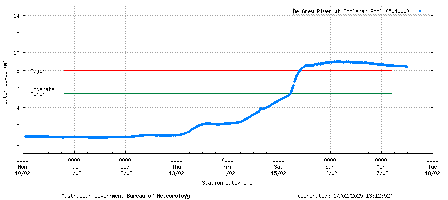
Image: River heights for the De Grey River at Coolenar Pool as of 1:12pm WST Monday, February 17. Source: BOM River Height data for De Grey River at Coolenar Pool
As you can see above the river is falling slowly, but remains at major flood levels, which is expected to continue into mid-week.
The De Grey River discharges into the Indian Ocean and when it floods, iron-rich sediment can often be seen spreading into the ocean’s turquoise water. The satellite images below, which were captured on Sunday, show this earthy discharge oozing out of the De Grey River into the Indian Ocean.
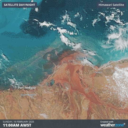
Image: Floodwaters carrying sediment out of the De Grey River into the Indian Ocean.
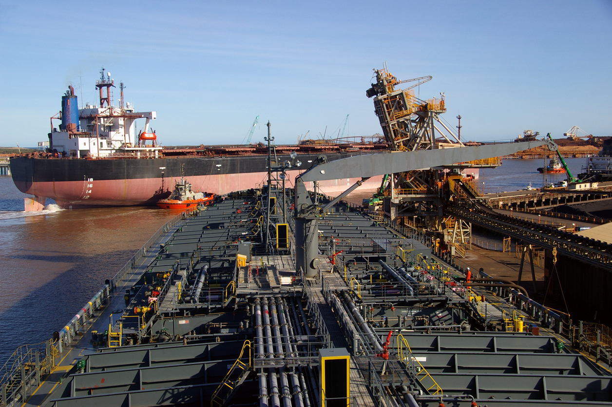
The cyclonic weather caused Port Hedland, the world’s largest bulk tonnage export to close for three days, however it has now resumed shipping. BHP, Fortescue and Roy Hill export nearly 90 per cent of Australia’s iron ore through Port Hedland, with its closure having a major impact. Several other ports nearby were closed for nearly a day from Thursday, such as Dampier and Varanus.
It has also been reported that the rail lines which transport the iron ore to the port for export between Newman and Port Hedland are now operational and at full speed after three days of closure.
The image below shows that several roads and highways remain cut off by floodwaters on Monday afternoon (red), with major freight routes blocked to Broome.

Image: Road closures (red), roads that are open but under specific conditions
(purple) and road open with caution (orange) in WA as of 1pm on Monday, February 17. Source: Mainroads
It is unknown how long these roads will be closed but it could be for several days yet, affecting transport in the region. There also could be renewed river rises along the De Grey as flood waters upstream filter into the bulging river.
During this event our risk communications meteorologists worked closely with our mining and port clients to analyse the risks associated with Zelia and minimise the ‘down time’.
Our clients were supported with precise weather intelligence on rainfall, wind speeds and potential storm surges helping our clients make critical decisions quickly. For more information, contact us at sales.apac@dtn.com
Thumbnail: Istock/Credit:Ngataringa


