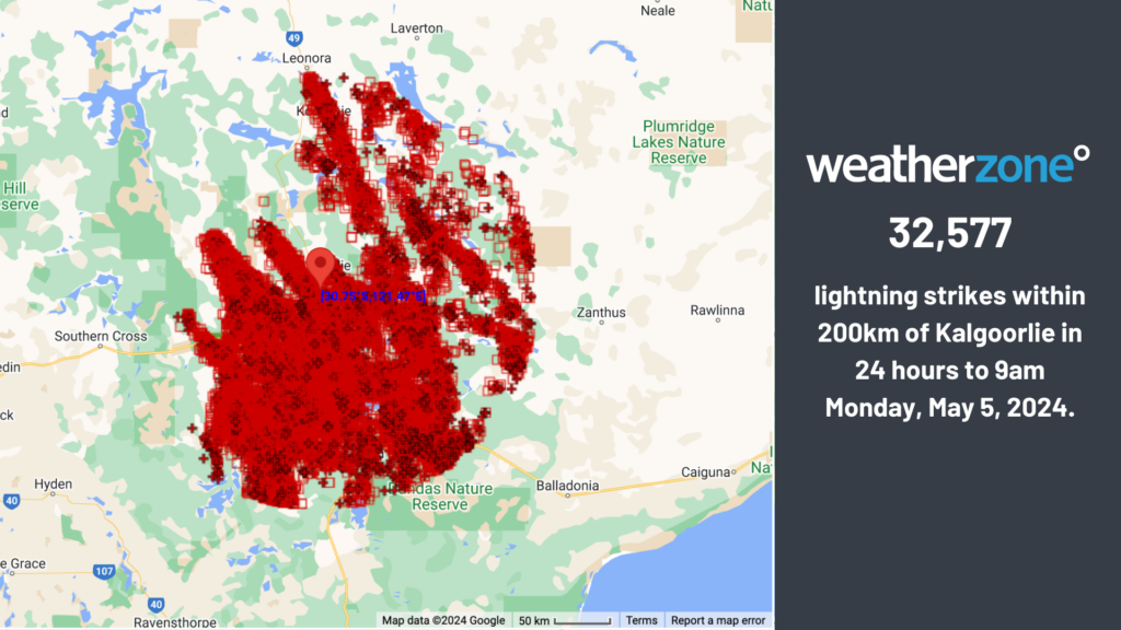
Total Lightning Network captured over 32 thousand lightning strikes in the Kalgoorlie region on Sunday and Monday, with more rainfall to come at the end of this week for the state’s southwest.
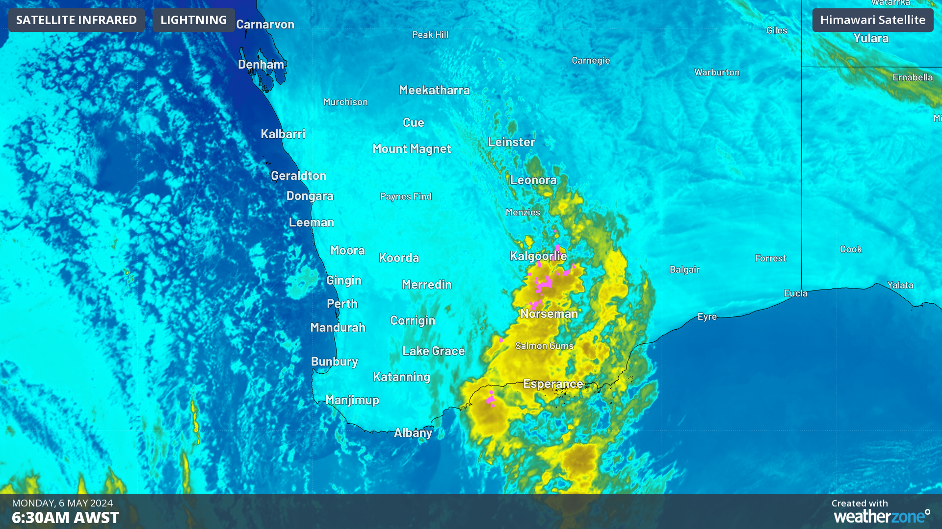
The image below shows a 500km line of thunderstorms stretching between Leinster and Salmon Gums on Monday morning as the sun rises.
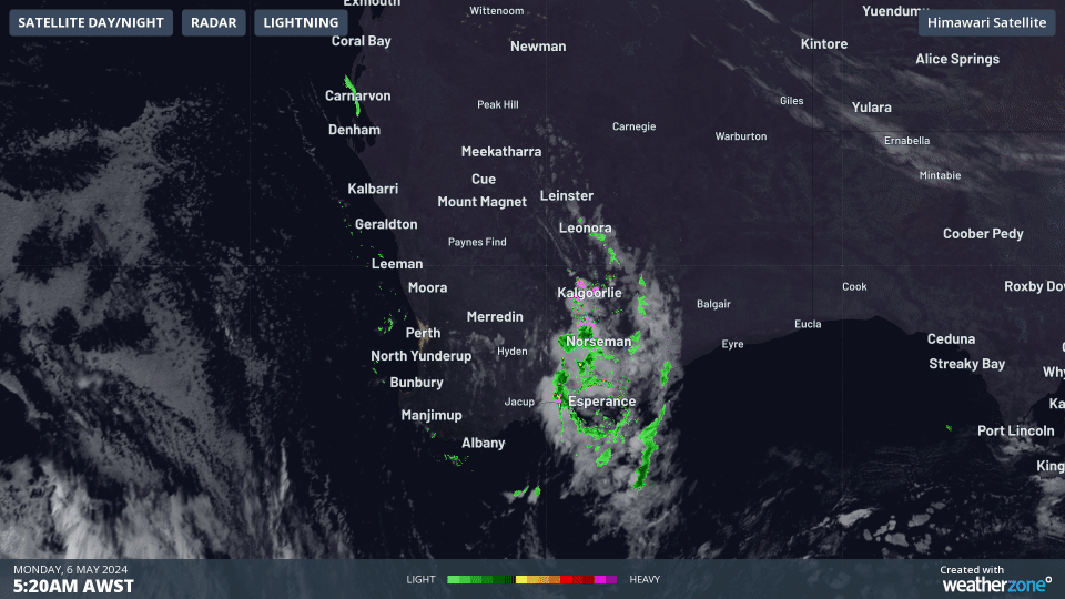
Image: Himawari-9 satellite images for the three hours leading up to 8:20am AWST on Monday, May 6.
There have not been any huge rain totals recorded in the sparse gauges in the region, despite the storm activity. Unfortunately, Kalgoorlie has not recorded any rainfall as the rainfall observations became faulty just before the storm.
While not much rain has been recorded from these storms yet, they have been particularly active with lightning.
Total Lightning Network recorded just over 32 thousand lightning strikes in a day in the Kalgoorlie region.
This rain and storm event is being caused by a low-pressure trough on the surface and an upper-level low pressure system.
The image below shows the upper low-pressure system passing through southwest WA.
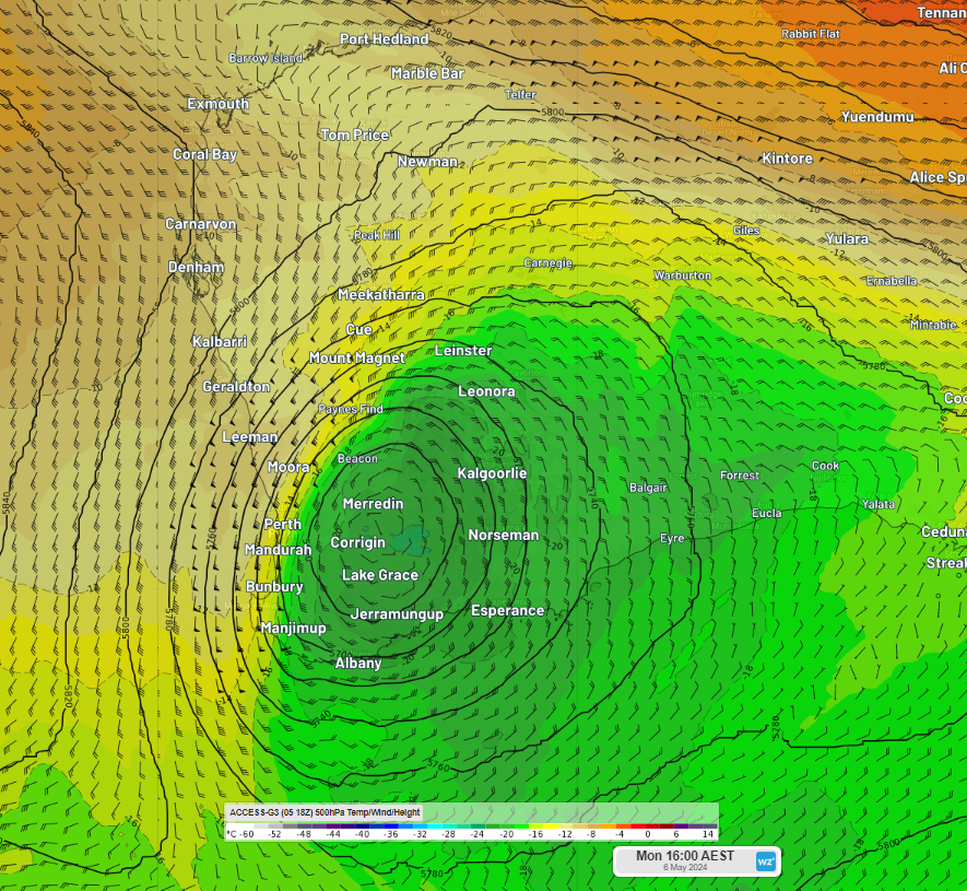
Image: 500 hPa temperature and height at 2pm AWST on Monday, May 6, according to Access-G
This low will weaken on Tuesday and continue moving east, moving into SA by mid-week, easing the rainfall and thunderstorms in the area from Tuesday.
Looking ahead, another burst of wet weather is forecast from Friday into the weekend for the states southwest as surface low pressure system sweeps across the state. The map below shows the rainfall forecast for the next week by one computer model, showing the rainfall expected in the Kalgoorlie area at the beginning of the week and the wet end to the week in the state’s southwest.
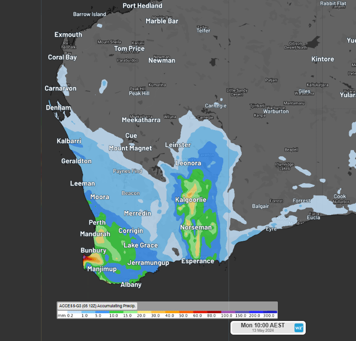
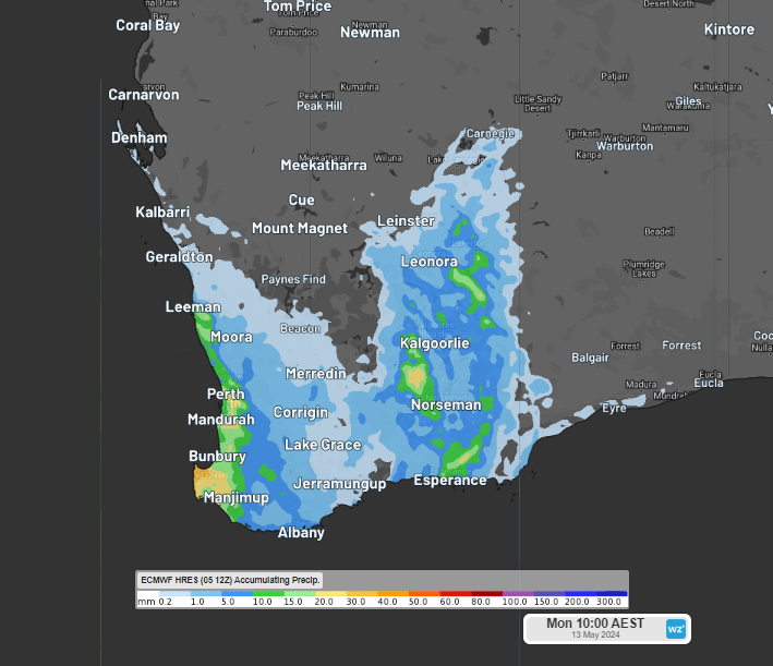
Images: Accumulated rainfall forecast for the week leading up to 8am AWST on Monday, May 13, according to Access-G (Top) and ECMWF (bottom)
You can see there is still some uncertainty regarding where and how much rain will fall in the southwest at the end of the week. We will keep you updated.


