Prosper in a dynamic world
Search

Waterspouts and 250 mm of rain in southeast Queensland

Heavy rain and thunderstorms soaked parts of southeast Qld on Monday into Tuesday morning, with the unstable weather even causing a waterspout in Moreton Bay.

Moisture-laden easterly surface winds feeding into a colder pool of air aloft caused ideal conditions for storms in southeast Qld on Monday.

While a few storms developed late on Monday morning, things really took off in the afternoon as warmer air near the ground added extra energy to the atmosphere.

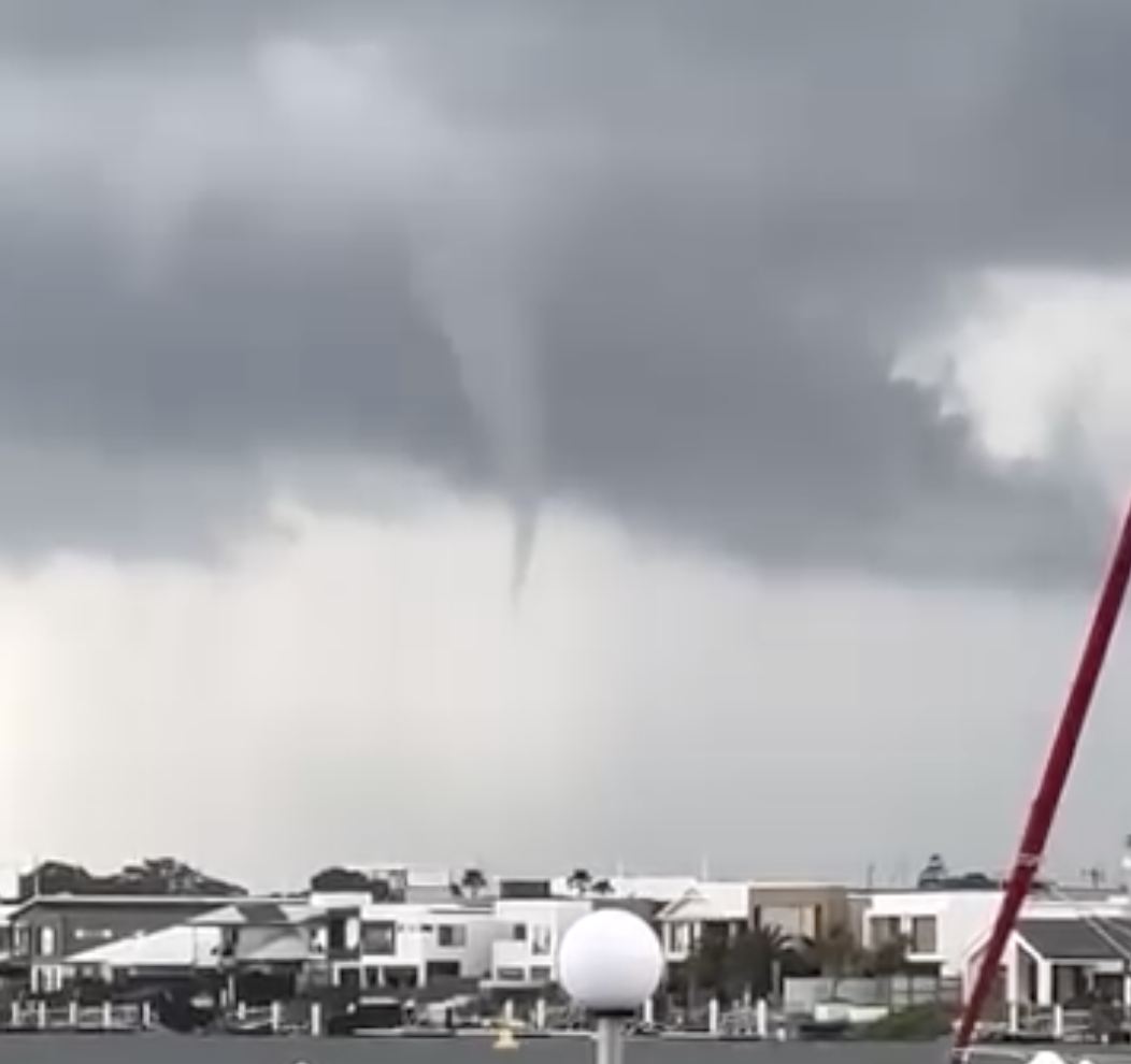
By 1pm AEST on Monday, storms were stretching around 300 km across southeast Qld. One of the early-afternoon storm cells produced an impressive waterspout over Moreton Bay to the northeast of Brisbane.

Video: Waterspout spotted over Moreton Bay on Monday, March 4, 2024. Source: @toniempringham / Instagram

The rain and storms continued into Monday afternoon and evening, with multiple slow-moving thunderstorms forming to the west of the Sunshine Coast.

This barrage of storms produced more than 200 mm of rain over parts of the Sunshine Coast Hinterland. During the 24 hours to 9am on Tuesday, 255 mm was recorded at Poona Dam, 225 mm at West Woombye and 205 mm at Eerwah Vale.

Total Lightning Network detected around 296,000 lightning strikes within 300 km of Brisbane during the 24 hours ending at 9am on Tuesday.

Waterspouts and 250 mm of rain in southeast Queensland

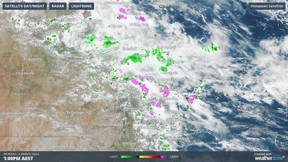
Image: Thunderstorms over southeast Qld on Monday afternoon.

There may be a few more showers and thunderstorms over northern, central and southeast Qld on Tuesday, although storms are not likely to be as intense as they were on Monday for the state’s southeast.

To find out more about our marine services, please email us at apac.sales@dtn.com.

Latest news

Satisfy your weather obsession with these news headlines from around the nation, and the world.

Rapid El Niño signal accelerating risk for Australian businesses

El Niño–favourable conditions are gathering pace across the tropical Pacific, with key ocean indicators approaching threshold levels and early atmospheric responses emerging.  While uncertainty remains around final El Niño strength, historical analogues show that even weak events can generate widespread impacts, including reduced rainfall, warmer daytime temperatures, increased frost risk, elevated fire danger, reduced tropical cyclone activity, and more. Industries including […]

Australia’s 2025–26 Cyclone Season: Slightly Above Average, Dominated by Severe Systems

Australia has just experienced a highly impactful tropical cyclone season, with more than 60% of systems reaching severe intensity, causing widespread disruption and damage to communities and multiple industries across northern Australia.  The 2025–26 Australian tropical cyclone season officially ran from 1 November 2025 to 30 April 2026. During this six-month period, Australia saw 11 tropical cyclones, with nine […]

What does a ‘super El Niño’ mean for Australia’s businesses?

There are signs that a very strong, or ‘super’ El Niño could develop in the tropical Pacific Ocean later this year. So, what does this mean for Australia’s weather during the second half of 2026? El Niño on the horizon The tropical Pacific Ocean is currently in a neutral state, meaning neither El Niño nor […]

How does DTN help businesses monitor bushfire induced pyrocumulonimbus thunderstorms that ignite more fires?

Intense heat from bushfires during elevated fire danger days can trigger fire-induced pyrocumulonimbus thunderstorms that ignite additional fires. In early January 2026, an extreme heatwave sweeping over southeastern Australia brought catastrophic fire danger to Victoria. Intensely hot bush and grass fires spread erratically and quickly in hot, dry and gusty winds, with pyrocumulonimbus generating lightning, […]