The long-awaited monsoon has arrived over northern Australia, with heavy rain set to soak part of Northern Qld, the Top End and Kimberley over the coming week.
The monsoon refers to seasonal northwesterly winds that bring widespread rain and thunderstorms to Australia’s northern tropics during the wet season. In an average season, the monsoon arrives over northern Australia during mid-to-late December, but this year it was late to arrive under the influence of El Niño.
The monsoon is now bringing some much-needed relief from oppressive heat and humidity that gripped northern Australia during the ‘build-up’. Darwin had its hottest start to a year on record due to the tardiness of the monsoon this season.
While this year’s monsoon was late, it did not beat the record set in 1973 when it didn’t arrive in Darwin until January 25.
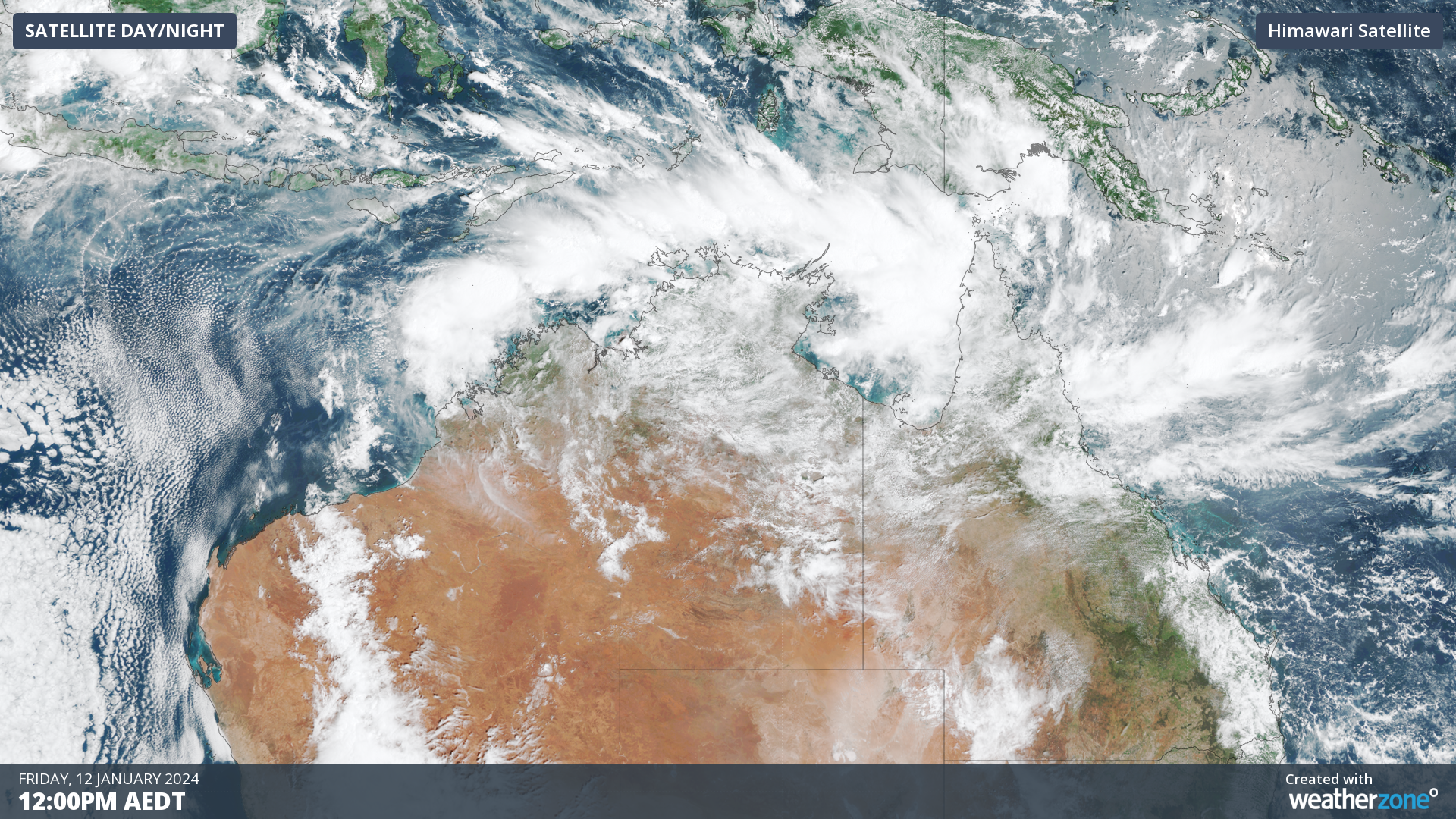
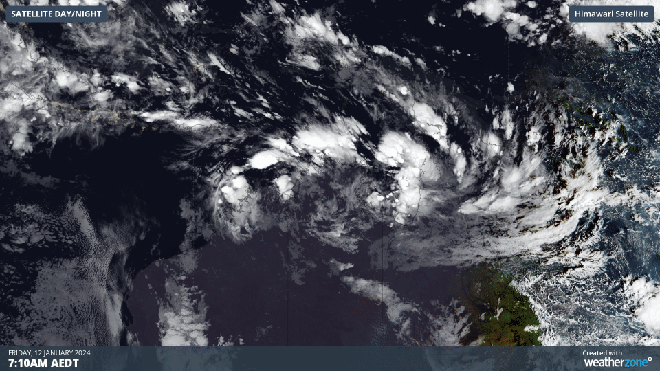
The image below shows the increased cloudiness across northern Australia on Friday morning, revealing the presence of monsoonal rain and thunderstorms in the region.
This wet phase of the monsoon will likely last around 10 to 15 days, meaning that rain and thunderstorms will be frequent across northern Australia during this period.
The map below shows that in the next 7 days, widespread falls exceeding 100 mm are forecast across the Kimberley, the Top End and Far North Qld, while some areas could surpass 300 to 500 mm in the week.
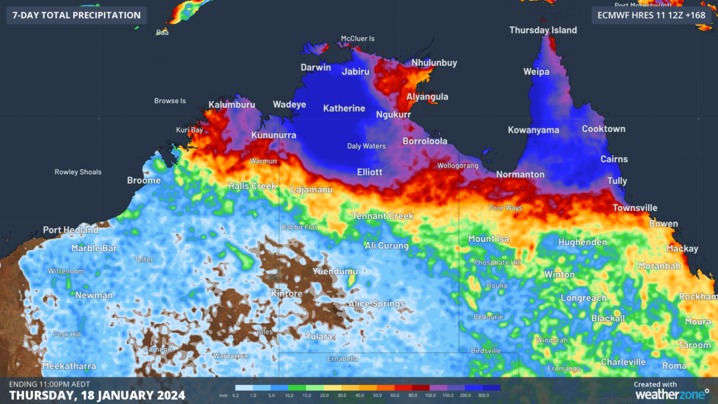
Image: 7-day accumulated rainfall forecast until 11pm AEDT on Thursday, January 18.
An area of convergence within the monsoon trough has developed along the northeast tropical coast in Qld on Friday, December 12. This prompted a severe weather warning on Friday morning for heavy rainfall, flash flooding and a minor flood warning in the Port Douglas and Daintree area.
Unfortunately, this rain is falling in the same area that received flooding rain from Tropical Cyclone Jasper and an associated monsoon burst last month.
The presence of the monsoon trough also increases the likelihood of tropical cyclones near northern Australia, particularly if embedded low-pressure systems remain over warm water for several days.
Forecast models suggest that three separate tropical lows could form in the Australian region during the coming week. However, these lows only have a low risk of becoming tropical cyclones at this stage.
The map below shows where the Bureau of Meteorology expects the three lows to be located on Sunday, January 14, with the centre of the systems expected to be located somewhere inside the orange or yellow shaded areas.
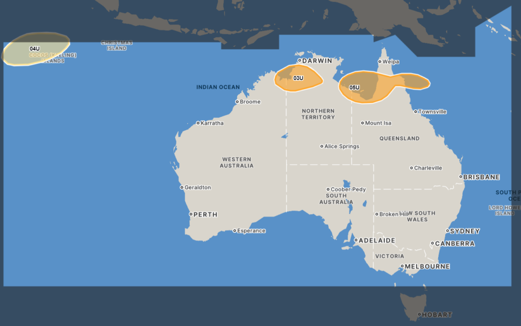
Image: The forecast location for the systems (03U, 04U and 5U) on Sunday, January 14 is expected to be located somewhere in the orange or yellow shaded areas. Source: Bureau of Meteorology.
A tropical low (designated) 03U may develop in the Joseph Bonaparte Gulf before moving south over the weekend. At this stage, there is a low chance of this system developing into a tropical cyclone as it will not have enough time over water before it crosses the NT coast by Monday.
While it is unlikely this system will develop into a tropical cyclone, it should still bring widespread rain, thunderstorms and possible gales to the Top End and Kimberley region in the coming days.
Weak tropical low 04U will also form to northwest of the Cocos (Keeling) Islands, with a low risk of becoming a cyclone.
Another tropical low, 05U, could form in the Gulf of Carpentaria and has a low chance of becoming a tropical cyclone from Sunday. Some models suggest this system could cross Cape York Peninsula and move over the Coral Sea at some stage next week. This system is likely to contribute to heavy rain and thunderstorms to Far North Qld over the coming week.
Be sure to check the latest tropical cyclone outlooks and advisories, and weather and flood warnings, for the most up-to-date information. For more information on our tropical cyclone services, please contact us at apac.sales@dtn.com.


