A tropical low, soon to be named Tropical Cyclone Kirrily, is expected to make landfall over Queensland this week as a category 3 strength system.
At 11am AEST Sunday, Tropical Low 05U was about 940 km east northeast of Townsville, with wind gusts up to 85km/h and was slow-moving. This large mass of swirling cloud can be seen in the Coral Sea
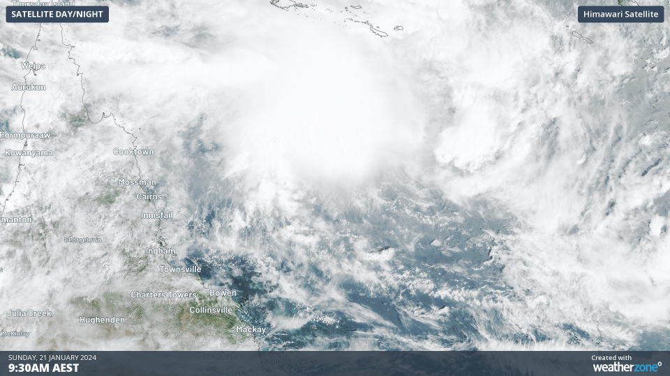
Image: Satellite loop showing the developing tropical low in the Coral Sea
On Monday evening or the early hours of Tuesday, this tropical low is likely to become Australia’s third tropical cyclone of the season and become Tropical Cyclone Kirrily.
Forecasts are expecting the developing tropical cyclone to start moving to the southwest from Monday and continue to pick up speed on its way to make landfall along the Queensland coast.
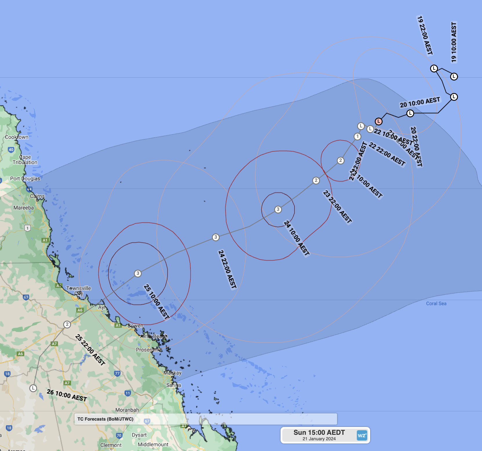
At this stage, areas between Cairns and Mackay are at risk of direct impacts, with a possible direct hit for Townsville and/or Ayr. Given its forecast speed, inland areas in the Northern Goldfields and Upper Flinders, like Charters Towers, could also see tropical cyclone strength winds before the system weakens.
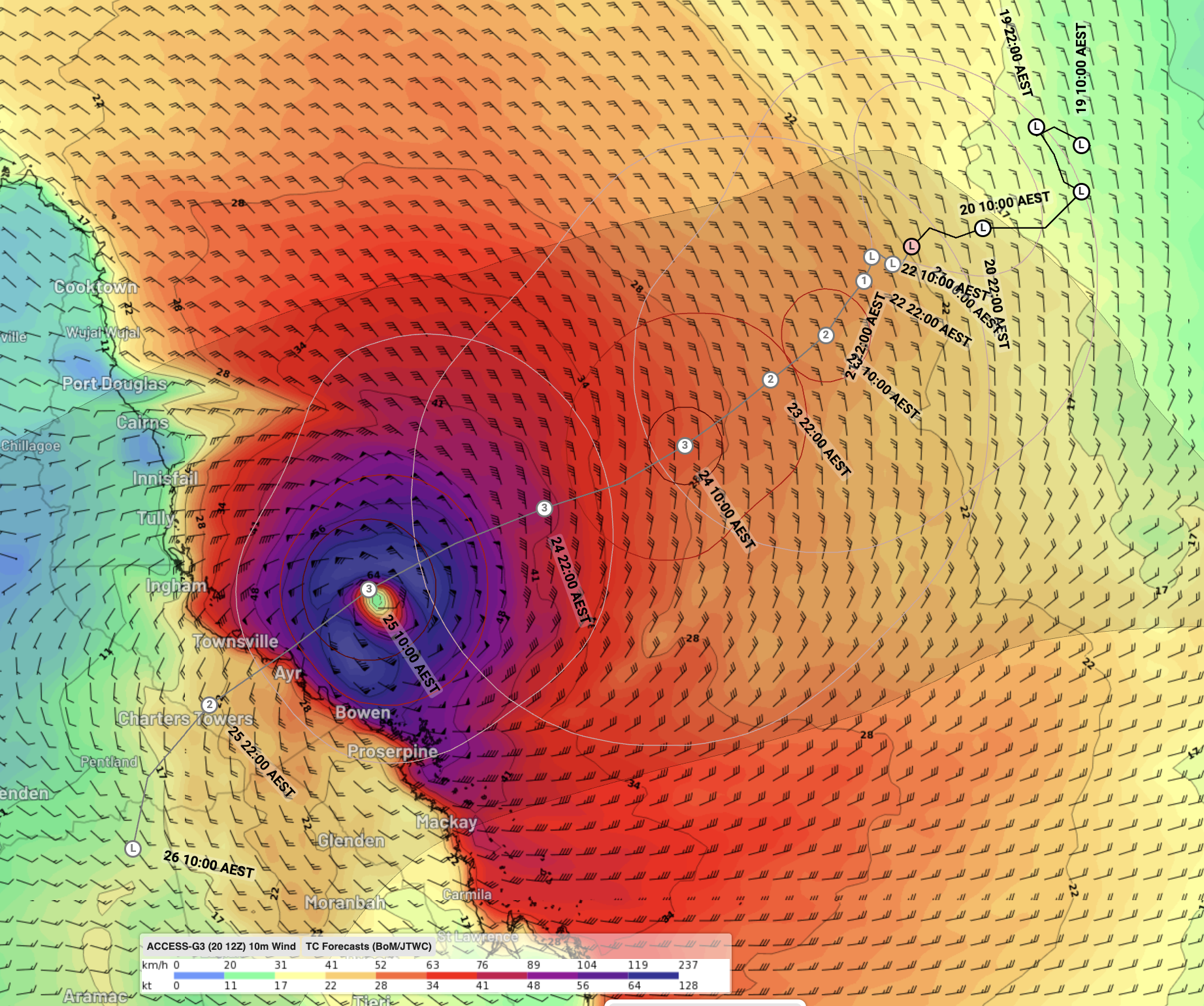
Image: The BoM forecast track issued at 11am AEST Sunday 21st showing landfall is expected between Cairns and Mackay on Thursday 25th. Access-G and other models show category 3 strength winds near the centre of the system in purple and blue.
Most models suggest this system will strengthen up to a Category 3 strength system, which would qualify it as severe tropical cyclone. A category 3 strength system has sustained winds of 118-157km/h, and typically gusts to 167-225km/h. As with most severe tropical cyclones, storm surge could become a concern along the coast, as it could lead to coastal inundation and exacerbate any flooding.
Widespread rainfall of 100-200mm, with isolated falls of over 400mm, is expected over parts of the North Tropical Coast and Tablelands, Herbert and Lower Burdekin, Central Coast and Whitsundays, Northern Goldfields and Upper Flinders, Central West and Central Highlands and Coalfields districts between Wednesday and Friday. There is also the potential for rainfall as heavy as 250-350mm falling in 6 hours for some parts, most likely on the southern flank of the system.
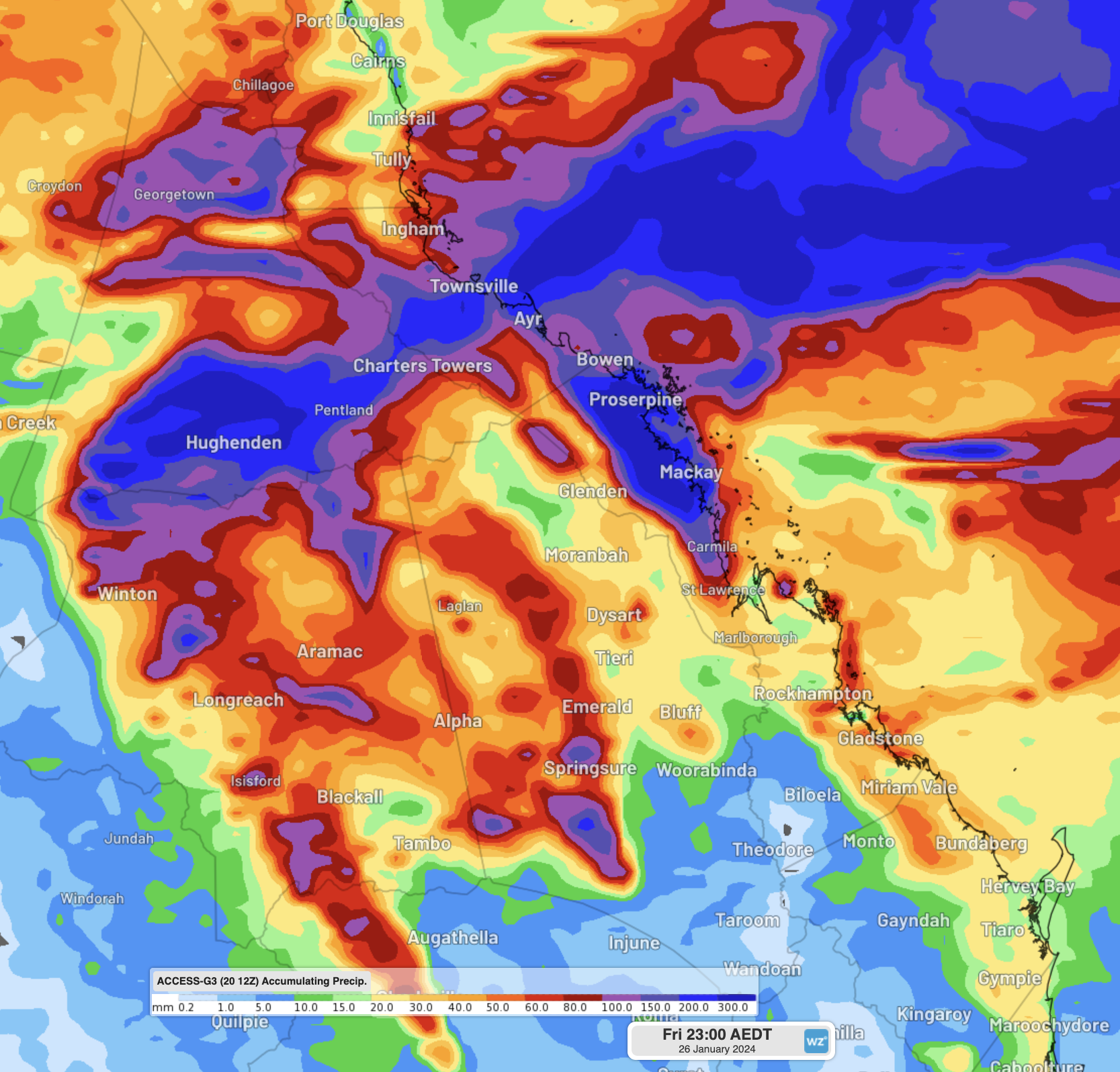
Image: Access-G showing accumulated rainfall to Friday 26th evening. Areas in dark blue indicate areas of more than 300mm.
Queenslanders in the path of this tropical cyclone are advised to keep a close eye on the warnings issued by the BoM and the Queensland Government over the coming week, as well as the Weatherzone news feed for further developments.
DTN APAC has a suite of tropical cyclones services we provide to deliver our clients with as much forewarning of tropical cyclones as we can. We have 4 levels of forecasts timeframes:
- Tropical cyclone seasonal outlooks
- Weekly tropical update
- Daily 7-day tropical cyclone forecast
- Detailed tropical cyclone impacts (issued every 1-6 hours aligning with offical advisories)
Through these products you can have as much preparation as possible for tropical cyclones and their impacts. To find out more, please visit our website or email us at apac.sales@dtn.com.


